Natural vs. Anthropogenic Drivers of Surface Water Degradation: Analysis, Impacts, and Implications for Environmental and Human Health
This article provides a comprehensive analysis of the distinct and synergistic roles of natural processes and human activities in surface water degradation.
Natural vs. Anthropogenic Drivers of Surface Water Degradation: Analysis, Impacts, and Implications for Environmental and Human Health
Abstract
This article provides a comprehensive analysis of the distinct and synergistic roles of natural processes and human activities in surface water degradation. It explores foundational concepts by detailing key natural factors (climate, geology, seasonal hydrology) and major anthropogenic sources (agricultural, industrial, urban). The review covers advanced methodological frameworks for water quality assessment, including Water Quality Index (WQI) models, Pollution Index (PI) models, and machine learning techniques for large-scale spatial and seasonal analysis. It further examines troubleshooting and optimization through the efficacy of Best Management Practices (BMPs) and conservation strategies for mitigating anthropogenic impact. Finally, the article presents validation and comparative analyses using case studies and metric-based evaluations to disentangle human amplification from natural climatic trends. This synthesis offers critical insights for researchers and scientists engaged in environmental health, risk assessment, and drug development, where water quality is a foundational component of ecosystem and public health.
Unraveling the Sources: A Deep Dive into Natural and Anthropogenic Drivers of Water Quality
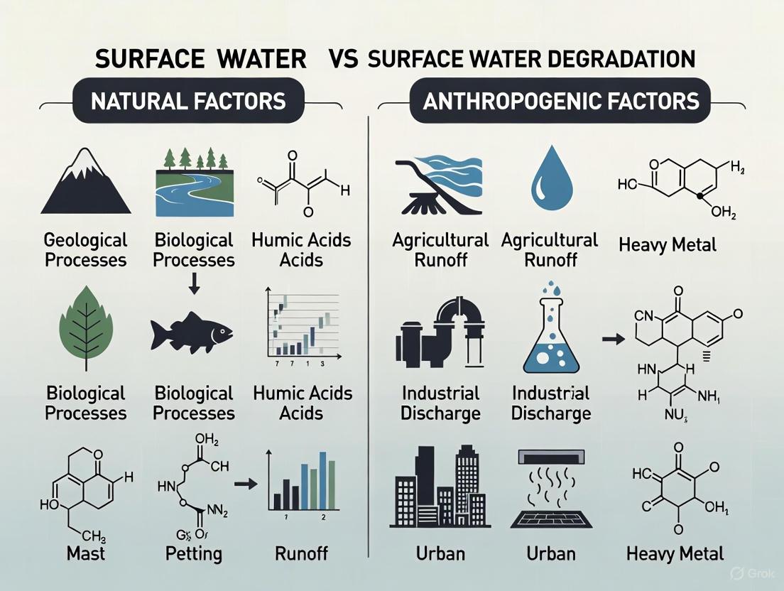
The composition of surface water is a product of a complex interplay between natural processes and anthropogenic influences. While human activities are major drivers of water quality degradation, understanding the fundamental natural factors—climate, geology, and hydrology—is essential for researchers and scientists to establish environmental baselines, identify anthropogenic contamination, and develop effective remediation strategies. This technical guide examines how these natural factors govern water composition, providing a foundational context for discerning natural versus anthropogenic signatures in surface water research. Within the broader thesis of surface water degradation studies, isolating these natural controls enables more accurate assessment of human impact and informs regulatory frameworks for water resource management.
Climate Controls on Water Composition
Climate fundamentally governs water composition through its influence on temperature, precipitation patterns, and evaporation processes. These factors collectively control the rates of chemical weathering, dilution of contaminants, and concentration of solutes in aquatic systems.
Table 1: Climate-Mediated Influences on Water Quality Parameters
| Climate Factor | Affected Water Parameter | Direction of Influence | Mechanism |
|---|---|---|---|
| Temperature | Biochemical Oxygen Demand (BOD) | Positive correlation (r=0.40) [1] | Increased microbial metabolism and organic matter decomposition |
| Chemical Oxygen Demand (COD) | Positive correlation (r=0.50) [1] | Enhanced chemical oxidation rates | |
| Total Organic Carbon (TOC) | Positive correlation (r=0.38) [1] | Accelerated organic matter breakdown | |
| Precipitation Seasonality | Nitrate-Nitrogen (NO₃-N) | Higher in wet season [2] | Increased agricultural runoff transporting fertilizers |
| Escherichia coli | Higher in dry season [2] | Reduced dilution of wastewater inputs | |
| Total Suspended Solids (TSS) | Higher in dry season [2] | Lower flows reducing sediment transport capacity | |
| Drought Conditions | Electrical Conductivity | Increase [2] | Evaporative concentration of dissolved ions |
| Heavy Metals (e.g., Cu) | Increase [2] | Reduced dilution of anthropogenic inputs |
Climate change introduces additional complexity to these relationships. Projected disruptions to the hydrological cycle include more severe wet-dry fluctuations, enhanced evapotranspiration, and reduced precipitation in many regions, leading to increased likelihood of hydrological drought and water scarcity [3]. These changes directly affect water composition by altering solute concentrations and biogeochemical processing rates.
Geological Controls on Water Composition
Bedrock geology and weathering processes fundamentally determine the natural chemical signature of surface waters through the release of elements and compounds from the lithosphere to the hydrosphere. Water-rock interactions control the baseline concentrations of major ions, trace elements, and natural contaminants in aquatic systems.
Table 2: Geogenic Factors Governing Surface Water Composition
| Geological Factor | Influence on Water Composition | Representative Parameters | Research Implications |
|---|---|---|---|
| Rock Type & Mineralogy | Determines solute availability through weathering | Ca²⁺, Mg²⁺, Na⁺, K⁺, HCO₃⁻, SO₄²⁻, SiO₂ | Establishes regional geochemical baselines |
| Soil Composition & Redox Conditions | Controls metal mobilization and speciation | Fe, Mn, As, Cr | Explains natural heavy metal occurrences |
| Geological Structure & Fractures | Creates preferential flow paths and contaminant pathways | Connectivity indices, hydraulic conductivity | Influences non-point source pollution vulnerability |
| Hyporheic Exchange | Governs biogeochemical processing at sediment-water interface | DO, NO₃⁻, NH₄⁺, DOC | Affects natural attenuation capacity |
The geological framework establishes the natural background against which anthropogenic pollution must be assessed. In China's river basins, watershed slope accounted for 17.40% of chemical oxygen demand (COD) and dissolved oxygen (DO) variations in natural watersheds, reflecting how topography and geological setting influence water quality through erosion potential and drainage characteristics [4]. Similarly, in the Arno River Basin (Italy), natural geological contributions to water chemistry must be quantified before anthropogenic impacts can be accurately assessed [5].
Geological factors also interact with anthropogenic disturbances. In the Jishan River study, while anthropogenic inputs were the primary concern, the underlying geological environment shaped how these pollutants were transported and transformed [6]. The geological template thus provides the foundational canvas upon which anthropogenic influences are superimposed.
Hydrological Controls on Water Composition
Hydrological processes integrate climate and geological influences while adding unique transport and dilution dynamics that fundamentally control water composition. Flow regime, surface water-groundwater interactions, and hydrological connectivity determine the fate and distribution of dissolved and particulate constituents in aquatic systems.
Flow velocity and discharge rates directly influence physicochemical parameters through multiple mechanisms. In the Radiowo landfill study, surface water flow showed a moderate negative correlation with pH (r = -0.44) and a moderate positive correlation with copper concentration (r = 0.47) downstream of the landfill site [1]. These relationships demonstrate how hydrological factors can either mitigate or exacerbate pollutant impacts depending on specific catchment conditions.
The hyporheic zone—where surface and groundwater mix beneath and alongside river channels—represents a critical hydrological interface governing water composition. In this zone, biogeochemical processes including nitrification, denitrification, and organic matter degradation naturally modify water chemistry through microbial activity and chemical transformations [7]. The efficiency of these natural attenuation processes is directly controlled by hydrological factors including residence time, flow paths, and exchange rates.
Climate-induced hydrological changes are altering fundamental water composition patterns globally. Multi-year hydrological droughts, characterized by prolonged reductions in river flow, are becoming more frequent and severe under anthropogenic climate change [3]. These extended low-flow conditions reduce contaminant dilution capacity and increase pollutant concentrations, potentially leading to water quality degradation even without additional pollutant loading.
Methodologies for Disentangling Natural and Anthropogenic Influences
Experimental Design and Monitoring Protocols
Comprehensive water quality assessment requires rigorous monitoring protocols capable of discriminating natural variability from anthropogenic signals. The methodology employed in the Radiowo landfill study exemplifies a robust approach, with surface water samples collected quarterly (March, June, September, November) over a twelve-year period at multiple monitoring points along a watercourse [1]. This long-term, spatially replicated design enables researchers to distinguish site-specific anthropogenic impacts from seasonal and interannual natural variability.
Essential monitoring parameters should include both conventional water quality indicators and specific tracers of human activity:
- Physicochemical parameters: pH, electrical conductivity (EC), temperature, dissolved oxygen
- Major ions: Cl⁻, NH₄⁺, SO₄²⁻, Ca²⁺, Mg²⁺, Na⁺, K⁺, HCO₃⁻
- Organic matter indicators: BOD₅, CODCr, TOC
- Nutrients: NO₃-N, NH₄-N, PO₄³⁻
- Heavy metals: Zn, Cd, Pb, Cu, Cr, Hg
- Microbiological indicators: E. coli, coliform bacteria
- Flow metrics: discharge, water level, flow velocity
Analytical and Statistical Framework
Multivariate statistical analysis provides powerful tools for identifying patterns and sources of variation in complex water quality datasets. Principal component analysis (PCA) and cluster analysis can discriminate between natural and anthropogenic influences by identifying covarying parameters and grouping sampling sites with similar characteristics [1] [8].
Water quality indices offer integrative approaches for assessing overall water quality status. The Water Quality Index (WQI) and Comprehensive Pollution Index (CPI) used in the Radiowo study transform complex multi-parameter data into simplified scores that facilitate spatial and temporal comparisons [1]. In this application, WQI values ranging from 63.06 to 96.84 and CPI values from 0.56 to 0.88 indicated generally good water quality with low pollution levels, providing quantitative support for environmental assessment.
Emerging methodologies include the T-NM index, which quantifies asymmetric human amplification and suppression effects on water quality trends [4]. This approach identified that anthropogenic drivers intensified or attenuated natural seasonal trends by 22-158% and 14-56% respectively across Chinese watersheds, with particularly strong effects during summer months.
Table 3: Essential Research Reagents and Analytical Solutions for Water Composition Studies
| Reagent/Category | Application in Water Analysis | Technical Function | Quality Control Considerations |
|---|---|---|---|
| Ion Chromatography Standards | Quantification of major anions (Cl⁻, SO₄²⁻, NO₃⁻) and cations (Na⁺, K⁺, Ca²⁺, Mg²⁺, NH₄⁺) | Calibration and quantification | Certified reference materials, multi-point calibration curves |
| Heavy Metal Standards | Analysis of trace metals (Zn, Cd, Pb, Cu, Cr, Hg) by ICP-MS/AAS | Instrument calibration and accuracy verification | Acid preservation to prevent adsorption, matrix-matched standards |
| Organic Carbon Analysis | Determination of TOC, BOD, COD | Oxidation of organic compounds, microbial respiration measurement | Blank correction, glucose-glutamic acid verification for BOD |
| Microbiological Media | Enumeration of E. coli, coliforms, heterotrophic bacteria | Microbial indicator culture and quantification | Sterilization validation, positive/negative controls |
| pH/EC Buffers & Standards | Calibration of field meters for pH, conductivity, salinity | Sensor calibration and measurement accuracy | Temperature compensation, regular calibration protocols |
| Preservation Reagents | Sample stabilization for various parameters | Prevention of biological/chemical changes between collection and analysis | Parameter-specific preservation (e.g., HNO₃ for metals, cold storage for nutrients) |
Natural factors comprising climate, geology, and hydrology establish the foundational template governing surface water composition through complex, interacting mechanisms. Climate controls temperature-dependent biogeochemical processes and precipitation-driven dilution-concentration dynamics. Geology determines the natural geochemical baseline through rock weathering and element mobilization. Hydrology integrates these influences through flow-mediated transport and transformation processes. Understanding these natural governing factors provides the essential scientific basis for discriminating anthropogenic water quality impacts—a critical requirement for effective water resource management, pollution remediation, and policy development in an era of increasing human pressure on global freshwater resources.
The degradation of surface water quality represents a critical challenge at the nexus of environmental science and public health. Within research on water quality dynamics, a fundamental dichotomy exists between natural processes and anthropogenic pressures. While climate, geology, and hydrological cycles establish baseline water conditions, human activities increasingly superimpose a distinct contamination signature upon aquatic ecosystems. This technical guide examines the anthropogenic footprint through the lens of three primary contributors: agricultural, industrial, and urban runoff. These pathways transport complex mixtures of nutrients, heavy metals, synthetic organic compounds, and particulate matter from terrestrial environments into surface waters, fundamentally altering their physicochemical and biological integrity. Understanding these mechanisms is paramount for researchers developing monitoring protocols, remediation strategies, and predictive models for aquatic system management.
Quantitative Data on Anthropogenic Contaminants
The systematic monitoring of surface waters provides critical quantitative evidence of anthropogenic impact. The following tables summarize key findings from recent global studies, highlighting contamination levels, spatial and temporal trends, and associated environmental indices.
Table 1: Heavy Metal Pollution in River Sediments and Associated Health Risks (Pearl River Delta and Huaihe River Basin Studies)
| Parameter | Pearl River Delta Findings [9] | Huaihe River Basin Findings [10] | Remarks |
|---|---|---|---|
| Overall Pollution | Most Heavy Metal (HM) contents greatly exceeded local background values; Cd had the highest pollution level. | Cr presented the highest carcinogenic risk, affecting >99.8% of adults and children at levels >1×10⁻⁶. | |
| Key Anthropogenic Sources | Electroplating industry was a common source for Cr, Cu, and Zn. | Cd, Cr, and Pb were mainly affected by industrial activities (e.g., local textile industries). As was influenced by agriculture and transportation. | Source apportionment is critical for targeted management. |
| Dominant Influencing Factor | Temperature was the dominant natural factor for HM distribution (influence degree: 0.68–0.97). | The interaction of Precipitation and Road Network Density on As was highly significant (explanatory power: 0.673). | Geodetector method reveals interaction strengths. |
| Health Risk Assessment | - | Adults had higher carcinogenic risk; children had higher non-carcinogenic risk. | Risk varies by demographic; essential for public health planning. |
Table 2: Seasonal Water Quality Trends and Organic Pollution in Managed Watersheds (China National Study) [4]
| Parameter | Long-term Trend (2006-2020) | Seasonal Anomaly (Summer) | Interpretation |
|---|---|---|---|
| COD (Chemical Oxygen Demand) | 61.1% of watersheds showed decreasing trend (35.2% significant). National avg. change: -1.57 mg/L/decade. | Only 12.3% of watersheds showed significant decrease in summer (vs. 17.9-22.5% in other seasons). 7.6% showed significant increases. | Improvement overall, but summer resilience is weaker, indicating heightened seasonal anthropogenic pressure. |
| DO (Dissolved Oxygen) | 64.7% of watersheds showed increasing trend (26.4% significant). National avg. change: +0.93 mg/L/decade. | 9.2% of watersheds showed significant DO reductions in summer. | Despite overall improvement, seasonal oxygen deficits emerge, linked to temperature and organic pollution. |
| Primary Driver Identification | - | In managed watersheds, Shannon Diversity Index (11.58%) and Largest Patch Index (10.66%) dominated COD/DO changes. | Landscape patterns (anthropogenic factors) dominate over natural factors (e.g., rainfall, slope) in managed basins. |
Table 3: Water Quality and Pollution Index Analysis near a Municipal Landfill (Radiowo Landfill Study) [1]
| Index/Parameter | Findings at Monitoring Points | Interpretation |
|---|---|---|
| Water Quality Index (WQI) | Average values ranged from 63.06 to 96.86. | Indicates "Good" to "Very Poor" water quality across the site [1]. |
| Comprehensive Pollution Index (CPI) | Average values ranged from 0.56 to 0.88. | Classified as "Low Pollution" level. |
| Key Correlated Parameters | Significant correlations observed between EC, Cl⁻, NH₄⁺, BOD₅, CODCr, and TOC. | Suggests a common origin, likely landfill leachate, influencing organic compound contamination. |
| Influence of Temperature | Temperature had greater influence on physicochemical parameters than precipitation (correlations with BOD₅, CODCr, TOC: 0.40, 0.50, 0.38). | Warming can enhance microbial activity and decomposition, exacerbating organic pollution. |
Experimental Protocols for Source Apportionment and Impact Assessment
Geodetector Statistical Method for Source Analysis
Application: This method quantitatively assesses the influence of natural and anthropogenic factors on the spatial distribution of pollutants, such as heavy metals in sediments or water [9] [10]. It is particularly valuable for identifying interactive effects between factors.
Detailed Workflow:
- Factor Selection: Define and collect spatial data for potential influencing factors (e.g., X).
- Spatial Stratification: Discretize the continuous data of each factor into appropriate layers or strata using professional knowledge or classification algorithms (e.g., natural breaks).
- q-Statistic Calculation: The Geodetector calculates a q-value to measure the explanatory power of a factor (X) for the spatial heterogeneity of the pollutant (Y).
- Formula: ( q = 1 - \frac{\sum{h=1}^{L} Nh \sigma_h^2}{N \sigma^2} )
- Where:
- ( h = 1, ..., L ) is the stratification of variable Y or factor X.
- ( Nh ) and ( N ) are the number of units in stratum h and the entire region.
- ( \sigmah^2 ) and ( \sigma^2 ) are the variances of Y in stratum h and the entire region.
- The q-value falls within [0, 1], where a larger value indicates that factor X explains more of the spatial distribution of Y [9].
- Interaction Detection: Evaluate whether two factors, X1 and X2, interact to enhance or weaken the explanation of Y. The types of interaction (e.g., nonlinear enhance, bi-enhance, independent) are determined by comparing q(X1∩X2) with q(X1) and q(X2).
- Interpretation: Identify the dominant factors and their interactions. For example, a study found that the individual explanatory powers of Precipitation and Road Network Density on Arsenic (As) were 0.362 and 0.189, respectively, but their interaction yielded a much higher explanatory power of 0.673, revealing a significant indirect anthropogenic pathway [10].
Integrated Modeling of Urban Combined Sewer Overflow (CSO) Pollution
Application: This protocol projects the spatiotemporal dynamics of anthropogenic water pollution, including conventional pollutants and pharmaceuticals, under future climate change and urbanization scenarios [11].
Detailed Workflow:
- Scenario Definition: Establish future scenarios by integrating:
- Climate Projections: From General Circulation Models (GCMs) for parameters like rainfall intensity and frequency.
- Socioeconomic Projections: Using Shared Socioeconomic Pathways (SSPs) to model urbanization, land-cover change, and population growth [11].
- Hydraulic and Water Quality Modeling:
- Utilize the Storm Water Management Model (SWMM) or an equivalent platform.
- Hydraulic Module: Simulates precipitation, runoff generation, infiltration, and one-dimensional pipe flow within the combined sewer system.
- Water Quality Module: Builds upon the hydraulic results to simulate the buildup, washoff, and transport of pollutants (e.g., suspended solids, COD, pharmaceuticals). This often involves defining exponential buildup functions and washoff equations based on runoff rate [11].
- Model Calibration and Validation: Use historical monitoring data of flow and pollutant concentrations to calibrate model parameters (e.g., roughness, accumulation rates) and validate model performance.
- Spatiotemporal Analysis and GIS Mapping:
- Run the calibrated model with future scenario data.
- Use Geographic Information Systems (GIS) to map the outputs, identifying hotspots of high-frequency CSO events (often in highly-impervious areas) and high-load discharges (often in densely-populated areas) [11].
- Analyze temporal variability, including future seasonal anomalies of discharged loads.
- Uncertainty Analysis: Employ confidence intervals (e.g., 95% CI) to quantify uncertainties in the projections, particularly for complex pollutants like pharmaceuticals [11].
Analytical Framework and Conceptual Workflow
The investigation of anthropogenic footprints in surface waters requires a structured approach that connects emission sources, transport pathways, and analytical techniques. The diagram below visualizes this comprehensive research framework.
Diagram 1: Research framework for analyzing anthropogenic footprints in surface waters. The workflow traces the path from major anthropogenic sources and their signature pollutants through transport pathways to key analytical methods and final research outputs.
The Scientist's Toolkit: Essential Reagents and Materials
The following table details key reagents, materials, and instruments essential for conducting field and laboratory research on anthropogenic water pollution.
Table 4: Essential Research Reagents and Materials for Water Pollution Studies
| Category | Item | Technical Function & Application |
|---|---|---|
| Field Sampling | High-Density Polyethylene (HDPE) Bottles | Chemically inert containers for collecting and storing water samples to prevent contamination and adsorption of pollutants [1] [10]. |
| 0.22-μm Aqueous Filter Membranes | Used for field-filtration of water samples intended for metal analysis to remove suspended particulates and bacteria [10]. | |
| Nitric Acid (HNO₃), Trace Metal Grade | Added to filtered water samples to acidify them (pH < 2), preventing adsorption of heavy metals to container walls and preserving sample integrity [10]. | |
| Portable GPS Device | Precisely records the coordinates of sampling points for spatial analysis and monitoring network design [10]. | |
| Portable pH and DO Meters | Enables on-site measurement of critical parameters (pH, Dissolved Oxygen) that can change during sample transport and storage [10]. | |
| Laboratory Analysis | Inductively Coupled Plasma Mass Spectrometry (ICP-MS) | Provides ultra-sensitive multi-element analysis for quantifying trace heavy metals (As, Cd, Cr, Pb, Hg) in water and sediment samples [9] [10]. |
| Gas Chromatography-Mass Spectrometry (GC-MS) | Identifies and quantifies specific organic pollutants, including polycyclic aromatic hydrocarbons (PAHs), pesticides, and pharmaceutical residues [1] [11]. | |
| Reagents for COD (Cr- based) | Potassium dichromate (K₂Cr₂O₇) and other reagents are used in the closed reflux method to chemically oxidize and measure the amount of organic matter in water [10]. | |
| Reagents for BOD₅ | Used for diluting samples and measuring the oxygen consumed by microorganisms over 5 days to assess the concentration of biodegradable organic wastewater [10]. | |
| Data Analysis & Modeling | Geodetector Software | A statistical tool for assessing the stratified heterogeneity of environmental data and quantitatively detecting the drivers of pollutant spatial distribution [9] [10]. |
| Storm Water Management Model (SWMM) | An open-source dynamic hydrology-hydrology water quality simulation platform used for modeling urban runoff and combined sewer overflows (CSOs) [11]. | |
| R or Python with Statistical Packages | Programming environments used for multivariate statistical analysis, trend analysis, positive matrix factorization (PMF), and creating custom data visualizations [9] [4]. |
Water pollution occurs when harmful substances contaminate a water body, degrading water quality and rendering it toxic to humans or the environment. For regulatory and scientific purposes, these pollution sources are broadly categorized into two distinct types: point sources and non-point sources [12] [13].
A point source is any single, identifiable source of pollution from which contaminants are discharged, such as a pipe, ditch, factory, or wastewater treatment plant [14] [12]. The U.S. Clean Water Act defines a point source as "any discernible, confined, and discrete conveyance, including but not limited to any pipe, ditch, channel, tunnel, conduit, well, discrete fissure, container, rolling stock, concentrated animal feeding operation, or vessel or other floating craft, from which pollutants are or may be discharged" [14]. These sources are typically regulated through permit systems.
In contrast, non-point source (NPS) pollution does not originate from a single discrete source. It is caused by rainfall or snowmelt moving over and through the ground, picking up natural and human-made pollutants along the way, and finally depositing them into lakes, rivers, wetlands, coastal waters, and groundwater [14]. Nonpoint pollution is inherently diffuse and tied to land use, making it more difficult to control than point source pollution.
Table 1: Key Characteristics of Point and Non-Point Pollution Sources
| Characteristic | Point Source Pollution | Non-Point Source Pollution |
|---|---|---|
| Origin | Single, identifiable source [12] | Multiple, diffuse sources across a landscape [14] |
| Discharge Pattern | Constant, continuous, or predictable | Intermittent, closely related to precipitation events [14] |
| Examples | Factories, sewage plants, wastewater pipes [14] [12] | Agricultural runoff, urban stormwater, forestry operations [14] |
| Primary Pollutants | Industrial chemicals, treated/untreated sewage | Excess fertilizers, pesticides, oil, grease, sediment [14] |
| Regulatory Control | Directly regulated through permit systems | Managed through land-use planning and best practices [14] |
Contaminant Pathways to Aquatic Systems
Understanding how contaminants travel from their source to aquatic receptors is critical for risk assessment and mitigation. An exposure pathway is the course a contaminant takes from a source to a receptor and must include five elements: a contaminant source, an environmental transport medium, an exposure point, an exposure route, and a receptor [15].
Site Conceptual Model for Exposure Pathways
Developing a site conceptual model is a recommended approach to visualize how contaminants move in the environment and how people or ecological receptors might come into contact with them [16]. The following diagram illustrates a generalized conceptual model for contaminant pathways from point and non-point sources to aquatic systems.
Contaminant Pathways Conceptual Model
Key Transport Mechanisms
Land Runoff and Hydrologic Modification: Precipitation moves over and through the ground, picking up and carrying away natural and human-made pollutants, finally depositing them into water bodies [14]. This is the primary mechanism for non-point source pollution.
Atmospheric Deposition: Air pollutants can be deposited into water bodies directly or through precipitation, making the atmosphere a significant transport medium for some contaminants [14].
Subsurface Flow and Hyporheic Exchange: Contaminants in groundwater can discharge into surface waters, while simultaneous exchange occurs between stream water and groundwater in the saturated sediment lateral to the stream, known as the hyporheic zone [7]. This process can facilitate the transfer of contaminants between surface and groundwater systems.
Quantitative Analysis of Key Contaminants
Advanced analytical techniques are essential for detecting and quantifying contaminants in aquatic systems. Liquid chromatography coupled with tandem mass spectrometry (LC-MS/MS) has become a cornerstone technology for this purpose, enabling the detection of contaminants at very low concentrations (nanograms to micrograms per liter) [17].
Experimental Protocol: Targeted Analysis of Contaminants of Emerging Concern (CECs)
A comprehensive study screened for 165 Contaminants of Emerging Concern (CECs) in water, sediment, and biota using the following methodology [17]:
Table 2: Experimental Protocol for CEC Analysis in Aquatic Matrices
| Protocol Step | Detailed Methodology | Purpose/Function |
|---|---|---|
| Sample Collection | Water, sediment, and fish samples collected from various sites, including areas near a Wastewater Treatment Plant (WWTP). | To obtain representative environmental matrices from potential contamination hotspots. |
| Sample Preparation | Solid-phase extraction (SPE) for water samples; pressurized liquid extraction (PLE) for sediment and biota. | To concentrate target analytes and remove matrix interferences that could affect analysis. |
| Instrumental Analysis - Screening | Liquid chromatography coupled with tandem mass spectrometry (LC-MS/MS) using multiple reaction monitoring (MRM). | Initial targeted screening for the 165 pre-defined CECs. |
| Confirmation Analysis | High-resolution mass spectrometry (HRMS) for compounds without available analytical standards. | To provide accurate mass confirmation for suspect screenings where standards are unavailable. |
| Quantitative Analysis | Use of analytical standards for detected compounds to generate concentration data. | To obtain precise quantitative data for risk assessment calculations. |
| Quality Assurance/Quality Control | Use of procedural blanks, matrix spikes, and internal standards. | To ensure analytical accuracy, precision, and account for matrix effects or recovery losses. |
Representative Quantitative Data from Environmental Monitoring
The application of such protocols yields critical quantitative data on contaminant presence and concentration, which forms the basis for risk assessment.
Table 3: Measured Concentrations of Selected CECs in Different Environmental Matrices [17]
| Contaminant | Class | Water (ng L⁻¹) | Sediment (μg kg⁻¹) | Biota (μg kg⁻¹) |
|---|---|---|---|---|
| Caffeine | Stimulant | 4.02 – 15.03 | 55.89 | Not Detected |
| Ciprofloxacin | Antibiotic | 6.05 | Not Specified | 2.94 – 4.18 |
| Clindamycin | Antibiotic | 6.04 – 7.01 | Not Specified | Not Detected |
| Diclofenac | Anti-inflammatory | 1.36 – 2.20 | Not Specified | Not Detected |
Table 4: Global Distribution and Characteristics of Microplastics in Inland Waters [18]
| Parameter | Reported Value or Prevalence | Notes |
|---|---|---|
| Abundance Range | 0.00 – 4,275,800.70 items m⁻³ | Extreme variation across global datasets. |
| Mean Abundance | 25,255.47 ± 132,808.40 items m⁻³ | High standard deviation indicates significant variability. |
| Most Common Colors | Transparent (29.27%), Black (9.21%), Blue (8.02%) | - |
| Most Common Shapes | Fibers (38.25%), Fragments (13.28%), Films (3.84%) | Fibers dominate microplastic pollution. |
| Size Distribution | ≤1 mm particles constitute 63.72% | Small particles pose greater ecological risk. |
| Primary Polymer Types | Polyester (15.90%), Polypropylene (13.90%), Polyethylene Terephthalate (5.10%) | Reflects common use in textiles and packaging. |
The Scientist's Toolkit: Essential Reagents and Materials
The analysis of aquatic contaminants requires a suite of specialized reagents, standards, and materials to ensure accurate and reproducible results.
Table 5: Key Research Reagent Solutions for Aquatic Contaminant Analysis
| Reagent/Material | Function in Analysis | Example from Literature |
|---|---|---|
| LC-MS Grade Solvents | Used as mobile phases in chromatography to separate analytes without introducing interference. | Acetonitrile (ACN), Methanol (MeOH) from JT Baker Chemical Co. [17]. |
| Acid Modifiers | Added to mobile phases to improve chromatographic separation and ionization efficiency in MS. | Formic Acid (FA), Acetic Acid (AA) provided by Tedia Co. [17]. |
| Analytical Standards | Pure reference materials used to identify and quantify target contaminants via calibration curves. | Commercially available standards for pharmaceuticals, pesticides, etc. [17]. |
| Solid-Phase Extraction (SPE) Cartridges | To concentrate trace-level contaminants from water samples and clean up complex sample matrices. | Widely used for pre-concentration of CECs in water samples prior to LC-MS/MS [17]. |
| Internal Standards | Isotope-labeled analogs of target analytes added to correct for variability in sample preparation and ionization. | Essential for achieving accurate quantification in complex environmental matrices [17]. |
The distinction between point and non-point sources is fundamental to understanding anthropogenic impacts on aquatic systems. While point sources were historically the primary regulatory focus, non-point sources like agricultural runoff and urban stormwater are now recognized as the leading causes of water quality impairments [14]. The pathways these contaminants follow—through runoff, atmospheric deposition, sediment transport, and food web accumulation—create complex exposure scenarios that challenge traditional management approaches.
Quantitative data reveals that contaminants of emerging concern, including pharmaceuticals, personal care products, and microplastics, are pervasive in global water bodies, often at levels posing ecological risks [17] [18]. The experimental methodologies outlined provide the necessary toolkit for researchers to monitor these pollutants, while conceptual models of exposure pathways offer a framework for assessing risk and targeting interventions. This scientific foundation is critical for informing the broader thesis that effective mitigation of surface water degradation requires an integrated approach addressing both natural hydrological processes and diverse anthropogenic factors, from industrial discharges to land-use practices.
Surface water quality serves as a critical indicator of environmental health, reflecting the complex interplay between natural processes and anthropogenic influences. While natural factors such as geological weathering, volcanic activity, and biological processes contribute to water composition, human activities have introduced a distinct chemical signature characterized by three prominent pollutant classes: herbicides, nutrients, and heavy metals. These contaminants represent a fundamental shift in aquatic systems, originating primarily from agricultural intensification, industrial expansion, and urbanization. This technical review examines the sources, transport mechanisms, ecological impacts, and analytical methodologies for these signature pollutants, providing researchers with a comprehensive framework for discriminating anthropogenic from natural influences in water quality degradation research.
The imperative to distinguish human-caused pollution from natural background levels has never been more pressing. Global assessments indicate that over 2 billion people live in water-stressed countries, with water quality further compromised by contamination [19]. Industrial and agricultural wastewater management remains inadequate in many regions, resulting in the release of insufficiently treated effluents containing toxic metals, pesticide residues, and nutrient loads that disrupt aquatic ecosystem function [20] [21]. This review synthesizes current research on these pollutant classes, with particular emphasis on their synergistic effects, advanced detection methods, and mechanistic pathways of toxicity.
Herbicides: Agricultural Signature with Aquatic Consequences
Silvicultural and agricultural practices constitute primary sources of herbicide introduction to aquatic systems. Modern forestry operations typically apply herbicides at lower frequencies (1-2 application events per 30-80 year rotation) compared to agricultural uses, yet concerns persist regarding non-target impacts on aquatic ecosystems [22]. Commonly used compounds include glyphosate, clopyralid, triclopyr, 2,4-D, sulfometuron methyl (SMM), and metsulfuron methyl (MSM). These herbicides enter water bodies through spray drift during application, surface runoff following precipitation events, and through groundwater infiltration, with mobilization dynamics dependent on product solubility, soil sorption potential, climatic conditions, topography, and soil properties [22].
Recent monitoring studies demonstrate that aerial application of forestry herbicides results in only trace, episodic concentrations in surface waters, with detections consistently below human health safety benchmarks. For instance, maximum SMM and MSM detections (≤0.030 μg/L) occurred during the first storm event following application at sampling locations closest to treated areas [22]. Critical abiotic factors influencing herbicide presence and concentration include proximity to treatment sites, time from application, and rainfall patterns, highlighting the importance of hydrological connectivity in pollutant transport.
Toxicity Mechanisms and Methodological Approaches
Herbicides exert toxic effects on aquatic biota through multiple mechanistic pathways, with fish serving as sensitive indicator species. The primary modes of action include:
Oxidative Stress: Herbicides induce production of reactive oxygen species (ROS) and reactive nitrogen species (RNS), causing oxidative damage to lipids, proteins, and DNA. This imbalance overwhelms antioxidant defenses, leading to lipid peroxidation, protein denaturation, and DNA fragmentation [23]. Marker compounds such as malondialdehyde (MDA) and 8-hydroxy-2'-deoxyguanosine (8-OHdG) provide quantitative measures of this damage.
Neurotoxicity: Many herbicides, particularly organophosphates and carbamates, inhibit acetylcholinesterase (AChE), an enzyme essential for neurotransmission. This inhibition results in acetylcholine accumulation, leading to neuromuscular dysfunction, convulsions, and potentially death [23] [24]. Standardized protocols for AChE activity assessment in brain and muscle tissues provide a robust biomarker for this effect.
Endocrine Disruption: Certain herbicide formulations interfere with hormonal systems, altering reproductive function and development. These effects may manifest as vitellogenin induction in male fish, altered steroid hormone levels, or impaired gonadal development [23].
Immunosuppression: Herbicide exposure can suppress both innate and adaptive immune responses in aquatic organisms, reducing resistance to pathogens through mechanisms including reduced phagocytic activity, lymphocyte proliferation, and antibody production [23].
Table 1: Experimental Biomarkers for Assessing Herbicide Toxicity in Aquatic Organisms
| Toxicity Mechanism | Biomarker | Analytical Method | Tissue Sample |
|---|---|---|---|
| Oxidative Stress | Lipid peroxidation (MDA) | TBARS assay | Liver, gills |
| Protein carbonyl content | DNPH method | Liver, muscle | |
| DNA damage (8-OHdG) | ELISA, HPLC-ECD | Whole blood, liver | |
| Antioxidant enzymes (SOD, CAT, GPx) | Spectrophotometric activity assays | Liver, gills, kidney | |
| Neurotoxicity | Acetylcholinesterase activity | Ellman method | Brain, muscle |
| Endocrine Disruption | Vitellogenin | ELISA | Blood plasma |
| Steroid hormones | Radioimmunoassay | Blood plasma, gonads | |
| Immunotoxicity | Phagocytic activity | Flow cytometry | Head kidney, blood |
| Lysozyme activity | Turbidimetric assay | Blood plasma | |
| Respiratory burst | NBT reduction test | Blood, kidney |
Research Protocols for Herbicide Monitoring
A paired watershed design provides an optimal methodological framework for monitoring silvicultural herbicide impacts. The following protocol, adapted from recent studies, enables comprehensive assessment of herbicide transport and fate [22]:
Site Selection: Identify treated and reference watersheds with similar hydrological, geological, and ecological characteristics. Treatment watersheds should drain recently harvested forest lands treated with herbicides, while reference watersheds should lack recent herbicide application.
Sampling Design: Establish sampling sites upstream (immediately downhill of treated units) and downstream (near property boundaries) in treatment streams. Include intrawatershed control streams draining untreated areas and out-of-watershed negative control streams to account for legacy herbicide residues and spatial drift extent.
Temporal Sampling Strategy: Target predicted episodic pulses with collection intervals including:
- Pre-application baseline
- During aerial application
- Immediately post-application
- First three storm events >0.5 inches rainfall within 24 hours
- Extended post-treatment period to assess persistence
Analytical Methods: Utilize liquid chromatography-tandem mass spectrometry (LC-MS/MS) for multi-residue analysis with detection limits ≤0.01 μg/L. Include both parent compounds and major transformation products.
Data Analysis: Compare detections against human health safety benchmarks (e.g., 25,000-fold below chronic exposure thresholds for SMM and MSM) and ecological effect concentrations.
Diagram 1: Mechanisms of Herbicide Toxicity in Aquatic Organisms. This pathway illustrates the primary biochemical routes through which herbicides impact fish health, from initial exposure to population-level consequences.
Nutrient Pollution: Eutrophication and Ecosystem Transformation
Anthropogenic Nutrient Enrichment Dynamics
Nutrient pollution, primarily from nitrogen and phosphorus compounds, represents one of the most widespread and challenging environmental problems affecting aquatic ecosystems globally. These nutrients enter water bodies through multiple anthropogenic pathways, including agricultural runoff from fertilized fields, animal feeding operations, discharge from municipal wastewater treatment plants, and urban stormwater runoff [25]. The dramatic increase in nitrogen flux through rivers—10 to 15-fold greater in many regions compared to several decades ago—is driven largely by agricultural intensification and population growth [26].
The ecological consequences of nutrient enrichment extend beyond simple productivity increases. Excessive nutrient loading drives eutrophication, characterized by accelerated algal and microbial growth, which directly and indirectly alters ecological community composition and food web structure [26]. These changes manifest as shifts from sensitive insect taxa (e.g., mayflies, stoneflies, and caddisflies) to pollution-tolerant organisms (e.g., worms, snails, and midges), fundamentally restructuring aquatic communities [26].
Experimental Assessment of Nutrient Impacts
Ecological Network Analysis (ENA) provides a sophisticated methodological framework for quantifying how nutrient enrichment alters food web emergent properties. The following research protocol enables comprehensive assessment of nutrient impacts on riverine ecosystems [26]:
Site Selection Along Gradient: Identify study sites across a pronounced nutrient enrichment gradient, measuring dissolved inorganic nitrogen (DIN) and dissolved reactive phosphorus (DRP) concentrations through regular monitoring (e.g., monthly samples over 7 years to establish robust baselines).
Community Characterization: Conduct comprehensive biological surveys to quantify:
- Algal and microbial biomass and composition
- Macroinvertebrate community structure using standardized sampling methods
- Fish population assessments and condition indices
Food Web Construction: Develop quantitative food webs using gut content analysis, stable isotope analysis (δ¹⁵N, δ¹³C), and literature data to establish trophic relationships and energy flows between species or trophic guilds.
Network Analysis Metrics: Calculate ENA indices including:
- Total System Throughput (TST): Sum of all energy flows in the system
- Finn's Cycling Index (FCI): Proportion of total flow that is recycled
- Average Path Length: Mean number of transfers between any two compartments
- System Omnivory Index: Degree of feeding across multiple trophic levels
Keystone Sensitivity Analysis: Develop indices that weight species' keystone properties (their influence on food web stability) by their sensitivity to specific disturbances (e.g., nutrient enrichment, floods) to predict ecosystem stability under different stressor scenarios.
Table 2: Food Web Emergent Properties Across a Nutrient Enrichment Gradient
| Network Metric | Oligotrophic Conditions | Mesotrophic Conditions | Eutrophic Conditions | Ecological Interpretation |
|---|---|---|---|---|
| Total System Throughput (TST) | Low (e.g., ~8.7M flow units) | Moderate | High (e.g., ~20.8M flow units) | Greater total energy movement through system |
| Finn's Cycling Index | Higher (>5%) | Moderate | Lower (<3%) | Reduced nutrient recycling efficiency |
| Average Path Length | Longer | Intermediate | Shorter | Simplified trophic transfer pathways |
| Community Respiration | Low | Moderate | Several times greater | Increased metabolic activity driving hypoxia risk |
| Trophic Cascade Strength | Stronger | Intermediate | Weaker | Dampened top-down control mechanisms |
| Robustness to Energy Flow Loss | Lower | Moderate | Higher | Greater resistance to random species loss |
| Vulnerability to Floods | Lower | Moderate | Higher | Structural changes increase flood sensitivity |
Nutrient Mitigation Through Microbial Processes
Emerging research highlights the potential of host-associated microbes in mitigating nutrient pollution impacts. Filter-feeding aquatic organisms such as oysters, mussels, and other bivalves support microbial communities that perform critical nutrient transformation functions [27]. Specifically, microbes in oyster guts and tissues can convert dissolved inorganic nitrogen (e.g., nitrate) into nitrogen gases through denitrification processes, effectively removing nitrogen from aquatic systems. Quantitative assessments reveal that oyster reefs represent significant denitrification hotspots, with substantial potential for reducing coastal nitrogen pollution [27].
Similar processes occur in freshwater systems, where snails, mussels, and aquatic insects host microbial communities that contribute to nitrogen transformation and emissions. These symbiotic relationships represent promising bioremediation approaches that leverage naturally occurring biological partnerships to address anthropogenic nutrient enrichment.
Heavy Metals: Persistent Metallic Legacies
Heavy metal contamination of aquatic systems has emerged as a major global environmental concern due to metals' toxicity, persistence, and bioaccumulation potential. Sources include both natural processes (volcanic eruptions, rock weathering, forest fires) and extensive anthropogenic activities [20] [21]. Industrial processes such as mining, smelting, electroplating, electronic device manufacturing, and fertilizer production release significant quantities of toxic metals including mercury, cadmium, lead, chromium, copper, and nickel into aquatic environments [21].
The chemical behavior and bioavailability of heavy metals in aquatic systems depend on their specific form and speciation. Metals can exist as free ions, complexed with organic or inorganic ligands, adsorbed onto particulate matter, or incorporated into biological tissues. Chelating agents such as ethylenediaminetetraacetic acid (EDTA), used in industrial and household detergents, can significantly enhance metal mobility and persistence in water by forming stable, soluble complexes that resist precipitation and degradation [28]. In municipal wastewater, substantial proportions of copper (approximately 60%) and nickel (>75%) exist as EDTA chelates, which are poorly removed during conventional treatment [28].
Toxicity Pathways and Health Risk Assessment
Heavy metals exert toxic effects through multiple mechanistic pathways, with impacts occurring even at low exposure concentrations due to bioaccumulation and biomagnification through food webs [20]. The primary toxicity mechanisms include:
Oxidative Stress Induction: Metals such as cadmium, chromium, and mercury catalyze production of reactive oxygen species, leading to lipid peroxidation, protein dysfunction, and DNA damage.
Enzyme Inhibition: Metals bind to protein sulfhydryl groups, disrupting enzyme function and critical biochemical pathways. For example, lead and cadmium exposure affects heme synthesis enzymes and disrupts calcium metabolism.
DNA Damage and Carcinogenicity: Several heavy metals cause genetic mutations, chromosomal abnormalities, and epigenetic changes that may initiate carcinogenic processes.
Neurotoxicity: Metals including lead, mercury, and manganese cross the blood-brain barrier, disrupting neurotransmitter function and causing neurological damage.
Endocrine Disruption: Certain metals interfere with hormonal signaling systems, altering reproductive function and development.
Human health risk assessment for heavy metals in water resources involves calculating exposure through ingestion, dermal contact, and inhalation routes. Key assessment metrics include the Hazard Quotient (HQ) for non-carcinogenic effects and Excess Cancer Risk for carcinogenic metals [20]. The Metal Index (MI) and Heavy Metal Pollution Index (HPI) provide integrated measures of overall metal contamination, incorporating multiple metals into single values to evaluate water quality status [20].
Table 3: Heavy Metal Sources, Health Effects, and Regulatory Benchmarks
| Heavy Metal | Primary Anthropogenic Sources | Major Health Effects | WHO/EPA Aquatic Life Benchmarks |
|---|---|---|---|
| Mercury (Hg) | Chlorine production, coal combustion, mining | Neurological damage, developmental defects | Varies by form (e.g., MeHg: 0.3 mg/kg in fish tissue) |
| Cadmium (Cd) | Electroplating, batteries, pigments | Kidney damage, osteoporosis, carcinogen | EPA: 1.8 μg/L (freshwater chronic) |
| Lead (Pb) | Leaded gasoline, paints, batteries | Neurological, cardiovascular, renal effects | EPA: 3.1 μg/L (saltwater chronic) |
| Copper (Cu) | Mining, electronics, antifouling paints | Liver damage, gastrointestinal distress | EPA: 3.1 μg/L (saltwater chronic) |
| Nickel (Ni) | Metal plating, alloys, batteries | Lung fibrosis, renal edema, dermatitis | EPA: 8.2 μg/L (saltwater chronic) |
| Arsenic (As) | Pesticides, wood preservatives, mining | Skin lesions, cardiovascular disease, cancer | WHO: 10 μg/L (drinking water) |
| Zinc (Zn) | Galvanization, rubber production, ointments | Anemia, pancreatic damage, infertility | EPA: 81 μg/L (freshwater chronic) |
Analytical Methods and Treatment Technologies
Advanced analytical techniques enable precise detection and quantification of heavy metals in aquatic environments. These include inductively coupled plasma mass spectrometry (ICP-MS), atomic absorption spectrometry (AAS), anodic stripping voltammetry, and X-ray fluorescence spectroscopy [20]. For metal speciation analysis, techniques such as ion chromatography coupled with ICP-MS and synchrotron-based X-ray absorption spectroscopy provide insights into chemical form and bioavailability.
Treatment technologies for heavy metal removal from wastewater include:
Physical Methods: Adsorption using biochar, activated carbon, or natural zeolites; membrane filtration (reverse osmosis, nanofiltration); ion exchange resins [21].
Chemical Methods: Chemical precipitation (hydroxide, sulfide); coagulation/flocculation; advanced oxidation processes (AOPs) for breaking metal complexes; electrochemical treatment [21] [28].
Biological Methods: Phytoremediation; bioremediation using metal-transforming bacteria and fungi; constructed wetlands [27].
Ozonation has demonstrated efficacy for treating reverse osmosis concentrates containing metal complexes and pesticides. Applied at doses of approximately 1.18 mg O₃/mg DOC, ozone achieves significant degradation of metal-EDTA complexes (e.g., Ni-EDTA, Cu-EDTA) and pesticides (e.g., fipronil, imidacloprid), while also providing 5-log inactivation of viral indicators like MS2 bacteriophage [28]. When combined with alkaline precipitation (e.g., 300 mg/L CaO at pH 11), ozone pretreatment enhances nickel removal, offering a combined approach for addressing multiple contaminants in complex wastewater matrices [28].
The Scientist's Toolkit: Research Reagent Solutions
Table 4: Essential Research Reagents for Pollutant Analysis and Assessment
| Reagent/Kit | Primary Application | Function in Research | Example Use Cases |
|---|---|---|---|
| DNPH Reagent | Protein carbonyl detection | Derivatization of oxidized amino acid residues | Quantifying herbicide-induced protein oxidation in fish tissues |
| TBARS Assay Kit | Lipid peroxidation measurement | Colorimetric detection of malondialdehyde (MDA) | Assessing oxidative stress from metal exposure in liver tissues |
| Acetylthiocholine iodide | AChE activity assay | Enzyme substrate for Ellman method | Determining neurotoxicity of pesticides in fish brain homogenates |
| GSH/GSSG Assay Kit | Oxidative stress status | Quantification of reduced and oxidized glutathione | Evaluating antioxidant capacity in gill tissues after herbicide exposure |
| Vitellogenin ELISA Kit | Endocrine disruption screening | Quantification of egg yolk precursor protein in males | Detecting estrogenic effects of pollutant mixtures in fish plasma |
| Lysozyme Assay Kit | Immunotoxicity assessment | Measurement of innate immune function | Determining immunosuppressive effects of heavy metals in aquatic organisms |
| Stable Isotopes (¹⁵N, ¹³C) | Trophic position analysis | Food web structure determination using SIA | Tracing nutrient pathways and biomagnification in polluted ecosystems |
| ICP-MS Standard Solutions | Metal quantification | Calibration for precise metal concentration measurements | Accurate determination of heavy metal levels in water and tissue samples |
Herbicides, nutrients, and heavy metals collectively represent a definitive chemical signature of human activity in aquatic ecosystems. Each pollutant class exhibits distinct transport pathways, transformation mechanisms, and ecological impacts that differentiate them from natural background constituents. The analytical frameworks, experimental protocols, and assessment methodologies presented in this review provide researchers with robust tools for quantifying these anthropogenic signatures and discriminating them from natural variability in water quality research.
Future research directions should prioritize understanding synergistic effects of multiple pollutant classes, developing advanced in situ monitoring technologies, and refining molecular indicators of sublethal stress in aquatic organisms. Additionally, exploration of nature-based solutions—including host-associated microbial communities for bioremediation and constructed wetlands for pollutant retention—offers promising approaches for mitigating the impacts of these signature pollutants. As global pressures on water resources intensify, the ability to accurately attribute degradation sources to either anthropogenic or natural factors becomes increasingly critical for effective environmental management and protection of aquatic ecosystem health.
Seasonal and Spatial Variability in Natural Water Quality Influences
The quality of surface water is not a static property but a dynamic interplay of natural processes and human activities, varying significantly across both space and time. For researchers and scientists engaged in environmental and drug development fields, understanding these patterns is crucial for risk assessment, study design, and interpreting water quality data. This guide provides an in-depth technical examination of the core principles and methodologies for analyzing seasonal and spatial variations in water quality, framed within the broader research context of distinguishing natural influences from anthropogenic degradation. Intense anthropogenic pressures, such as agricultural runoff, industrial discharge, and urban development, significantly alter land use patterns and introduce diverse pollutants into aquatic systems [29]. Simultaneously, natural factors including climate, geology, and hydrological cycles create a baseline upon which human impacts are superimposed [7]. This technical overview synthesizes current research to equip professionals with the tools to decipher these complex interactions.
Quantitative Data on Seasonal and Spatial Variations
Quantitative data reveals clear and measurable patterns in how water quality parameters change across seasons and geographical locations. The following tables consolidate findings from recent studies to facilitate easy comparison.
Table 1: Seasonal Variability of Key Water Quality Parameters
| Parameter | Observed Seasonal Pattern | Study Context | Hypothesized Primary Driver |
|---|---|---|---|
| Major Ions (Cl⁻, Na⁺, SO₄²⁻) | Higher concentrations during the Dry Season (DS) compared to the Wet Season (WS) [30]. | Loukkos Estuary, Morocco [30]. | Reduced dilution from precipitation and increased marine influence during dry periods [30]. |
| Nutrients (TN, NO₃⁻, NH₄⁺) | Substantially high concentrations in the dry season [29]. | Daliao & Shuangtaizi Rivers, China [29]. | Concentrated wastewater discharge and reduced river flow [29]. |
| Heavy Metals (e.g., Pb, Fe) | Dominance order shifts from Fe > Pb during WS to Pb > Fe during DS, with HPI values indicating higher pollution in DS [30]. | Loukkos Estuary, Morocco [30]. | Combined influence of seasonal hydrology and constant anthropogenic sources (e.g., wastewater) [30]. |
| Organic Pollution (BOD, COD, TOC) | Correlated with ambient temperature, with higher values at elevated temperatures [1]. | Radiowo Landfill, Poland [1]. | Enhanced microbial activity and decomposition rates in warmer conditions [1]. |
Table 2: Spatial Variability and Correlation with Land Use
| Spatial Pattern | Correlated Land Use / Feature | Study Context | Key Associated Parameters |
|---|---|---|---|
| Downstream degradation | Increasing urban, industrial, and agricultural areas downstream [5]. | Arno River Basin, Italy [5]. | Chloride, Sodium, Sulphate [5]. |
| Decreasing gradient from downstream to upstream | Strong marine influence downstream; marked continental influence upstream [30]. | Loukkos Estuary, Morocco [30]. | Major ions (Cl⁻, Na⁺, SO₄²⁻) [30]. |
| Correlation with built-up areas | Building areas (urban land) [29]. | Songliao River Basin, China [29]. | Nutrients (Nitrogen, Phosphorus) and Chlorophyll-a [29]. |
| Correlation with agricultural areas | Paddy fields and dryland [29]. | Songliao River Basin, China [29]. | Nutrients (Nitrogen, Phosphorus) and Chlorophyll-a [29]. |
| Correlation with natural vegetation | Woodlands and wetlands [29]. | Songliao River Basin, China [29]. | Dissolved Oxygen (DO); generally improved water quality [29]. |
Experimental Protocols for Water Quality Assessment
A robust assessment of spatiotemporal variability requires standardized protocols for field sampling, laboratory analysis, and data processing.
Field Sampling and Spatial Design
- Site Selection: Strategically select sampling sites to represent different hydrological positions (upstream, midstream, downstream) and dominant land use types within the watershed (e.g., forested, agricultural, urban) [29]. Using GIS hydrological tools to delineate drainage areas for each site is recommended [29].
- Temporal Frequency: Conduct sampling campaigns to capture key seasonal hydrological conditions, typically including wet (high flow), dry (low flow), and if relevant, an agricultural season [30] [29]. Sampling over multiple years strengthens trend analysis [1].
- In-Situ Measurements: At each site, measure physicochemical parameters directly in the field using calibrated portable meters. Core parameters include pH, Electrical Conductivity (EC), Dissolved Oxygen (DO), and water temperature [1].
- Sample Collection and Preservation: Collect water samples in appropriate containers following standard protocols (e.g., PN-ISO 5667-6:2016-12) [1]. Preserve samples on ice or with chemical preservatives (e.g., acidification for metal analysis) as required for subsequent laboratory analysis to prevent alteration of constituents [1].
Laboratory Analysis of Key Parameters
- Major Ions and Nutrients: Analyze concentrations of major anions (Cl⁻, SO₄²⁻, HCO₃⁻) and cations (Na⁺, Ca²⁺, Mg²⁺, K⁺) using ion chromatography or other standard methods. Key nutrients include Ammonium (NH₄⁺), Nitrate (NO₃⁻), Nitrite (NO₂⁻), and Phosphate (PO₄³⁻), typically analyzed via colorimetric methods [30] [29].
- Heavy Metals: Determine concentrations of metals like Lead (Pb), Cadmium (Cd), Chromium (Cr), Copper (Cu), Zinc (Zn), and Iron (Fe) using inductively coupled plasma mass spectrometry (ICP-MS) or atomic absorption spectroscopy (AAS) [30] [29].
- Organic Pollution Indicators: Quantify the organic load through Biochemical Oxygen Demand (BOD₅), Chemical Oxygen Demand (COD Cr), and Total Organic Carbon (TOC) using standardized laboratory procedures [1].
Data Processing and Index Calculation
Systematic analysis of the collected data is critical for interpretation. The workflow below outlines the key steps from raw data to actionable insights.
Diagram 1: Data Analysis Workflow
- Descriptive Statistics: Calculate measures of central tendency (mean, median) and dispersion (standard deviation, range) for all parameters to understand data distribution and identify potential outliers [31] [32].
- Pollution Indices: Synthesize multiple parameters into simplified indices for holistic assessment.
- Water Quality Index (WQI): Aggregates various parameters into a single score by assigning relative weights and quality rating scales, often classified as Excellent, Good, Poor, etc [1].
- Heavy Metal Pollution Index (HPI): Evaluates the combined effect of individual heavy metals relative to their permissible limits [30].
- Comprehensive Pollution Index (CPI): Another integrated measure used to classify pollution levels (e.g., low, moderate, high) [1].
- Multivariate Statistical Analysis: Employ techniques to uncover hidden patterns and relationships.
- Principal Component Analysis (PCA): Reduces data dimensionality to identify the key factors (components) responsible for most of the variance in the dataset, often distinguishing seasonal or spatial patterns [29].
- Redundancy Analysis (RDA): A canonical ordination technique used to directly relate water quality parameters to environmental variables (e.g., land use percentages, temperature), revealing the driving factors behind spatial patterns [29].
Visualizing Influences and Pathways
Understanding the complex interplay of factors affecting water quality is essential. The following diagram synthesizes the core relationships and pathways leading to spatiotemporal variability.
Diagram 2: Water Quality Variability Pathways
The Scientist's Toolkit: Research Reagent Solutions
This section details essential materials, reagents, and tools required for conducting comprehensive water quality variability studies.
Table 3: Essential Research Reagents and Materials
| Item / Reagent | Function / Application |
|---|---|
| Pre-Sterilized Sample Bottles | Collection and transport of water samples for microbial (e.g., E. coli) and organic analysis. Prevents cross-contamination [1]. |
| Acid-Washed HDPE Bottles | Collection and storage of samples for trace metal analysis. Acid-washing minimizes adsorptive losses and contamination [29]. |
| Chemical Preservatives | Added immediately after collection to stabilize specific analytes (e.g., HNO₃ for metals, ZnSO₄ for nutrients) [1]. |
| Certified Reference Materials (CRMs) | Used during laboratory analysis to ensure accuracy, precision, and quality control of the generated data [1]. |
| Multi-Parameter Portable Meter | For in-situ measurement of core physicochemical parameters: pH, Electrical Conductivity (EC), Dissolved Oxygen (DO), temperature [1]. |
| Unmanned Aerial Vehicle (UAV) with Multispectral Camera | Remote sensing of spatial patterns in water quality parameters like turbidity and photosynthetic pigments (e.g., MicaSense RedEdge camera) [33]. |
| Ion Chromatography (IC) System | Laboratory analysis of major anion and cation concentrations (Cl⁻, SO₄²⁻, Na⁺, Ca²⁺, etc.) [30]. |
| ICP-MS or AAS | Highly sensitive laboratory analysis of heavy metal concentrations at trace levels (Pb, Cd, Cr, Cu, etc.) [30] [29]. |
| GIS Software (e.g., ArcGIS) | Used for spatial analysis, including mapping sampling sites, delineating watersheds, and correlating water quality with land use data [29]. |
| Statistical Software (e.g., R, Python, SPSS) | For performing descriptive statistics, calculating pollution indices, and running multivariate analyses (PCA, RDA) [31] [34] [29]. |
Measuring the Impact: Advanced Frameworks for Water Quality Assessment and Profiling
Water Quality Indices (WQIs) and Pollution Indices (PIs) are essential mathematical tools that transform complex water quality data into simple numerical values for comprehensive water quality assessment and communication. These indices help in strengthening water resource management and ensuring safe drinking water by providing a scientifically robust assessment framework [35]. The degradation of water resources, influenced by both natural processes (climate change, water-rock interactions, geological factors) and anthropogenic activities (industrialization, urbanization, agricultural practices), necessitates such comprehensive assessment tools [7]. While WQI models provide a holistic measure of overall water quality status, PI methods specifically quantify the extent of pollution deviation from established standards, serving complementary roles in water quality evaluation.
The fundamental purpose of these indices is to address the critical need for standardized water quality assessment amid growing threats to water security. With over five billion inhabitants globally dependent on groundwater and surface water systems for potable water, crop production, and manufacturing applications, the degradation of these resources poses significant threats to ecosystem stability and human health [7]. The application of WQI has increased significantly worldwide, though these models face persistent challenges related to parameter weighting, aggregation functions, and transparency that require ongoing methodological refinements [35].
Core Components of Water Quality Indices
Fundamental Structural Elements
All Water Quality Index models comprise five essential components that work in sequence to transform raw water quality measurements into meaningful index values:
- Indicator Selection: Identification of key water quality parameters that accurately reflect water condition
- Sub-index Transformation: Conversion of each parameter concentration into a standardized quality value (typically 0-100 scale)
- Parameter Weighting: Assignment of relative importance values to each parameter based on health and environmental significance
- Aggregation Function: Mathematical integration of weighted sub-indices into a single composite score
- Classification Scheme: Categorization of final index values into qualitative water quality classes [35]
The structural integrity of each component significantly influences the reliability and accuracy of the final water quality assessment. Uncertainties in WQI models primarily arise from parameter selection validity, weighting distribution, and aggregation function choice [35].
Comparison of Index Types and Their Applications
Table 1: Water Quality Index Types and Their Characteristics
| Index Type | Primary Function | Output Range | Key Applications |
|---|---|---|---|
| Overall WQI | Holistic water quality assessment | 0-100 (typically) | General water quality status evaluation [35] |
| Pollution Index (PI) | Quantify pollution level relative to standards | Variable by method | Identify pollution severity [36] |
| Said-WQI | Simplified water quality categorization | 0.67-2.34 (categorical) | Rapid water quality screening [36] |
| Overall Index of Pollution (OIP) | Comprehensive pollution assessment | 3.71-11.20 (classified) | Multi-parameter pollution evaluation [36] |
Methodological Approaches and Experimental Protocols
Standard WQI Development Workflow
The development and application of Water Quality Indices follow systematic experimental protocols that ensure scientific rigor and reproducibility. The following diagram illustrates the standard workflow for WQI development and application:
Parameter Selection and Weighting Methodologies
Parameter selection represents a critical first step in WQI development, with advanced statistical and machine learning approaches increasingly supplementing traditional expert judgment:
Feature Selection using Machine Learning: The XGBoost (Extreme Gradient Boosting) algorithm combined with Recursive Feature Elimination (RFE) has demonstrated superior performance in identifying critical water quality indicators. This method involves (1) initial training of the XGBoost model on the complete dataset to rank features by importance, (2) iterative elimination of unimportant features through recursion, and (3) retraining the model with filtered features to finalize parameter selection [35]. This approach achieved 97% accuracy for river sites with a logarithmic loss of only 0.12 in Danjiangkou Reservoir case studies [35].
Weighting Techniques: The Relative Weighting Method and Rank Order Centroid (ROC) approach represent two prominent weighting strategies. Research indicates that coupling the Bhattacharyya mean WQI model (BMWQI) with the ROC weighting method significantly outperforms other WQI models in reducing uncertainty, showing eclipsing rates for rivers and reservoirs at 17.62% and 4.35%, respectively [35].
Index Aggregation and Calculation Methods
Standard WQI Calculation: Traditional WQI models employ linear aggregation functions to combine weighted sub-indices. The general formula follows:
[ WQI = \sum{i=1}^{n} (wi \times q_i) ]
Where ( wi ) represents the weight of parameter i, ( qi ) represents the quality rating of parameter i, and n represents the number of parameters [35] [37].
Pollution Index (PI) Method: The PI approach uses a different mathematical foundation, typically employing the worst-case assessment principle:
[ PI = \sqrt{\frac{(Ci/Li)^2{max} + (Ci/Li)^2{avg}}{2}} ]
Where ( Ci ) represents measured concentration of parameter i, and ( Li ) represents permissible limit for parameter i [36].
Comparative Performance of Aggregation Functions: Research has identified eight distinct aggregation functions with varying performance characteristics. A comparative optimization framework evaluating these functions demonstrated that the newly proposed Bhattacharyya mean WQI model (BMWQI) coupled with ROC weighting significantly reduced model uncertainty compared to conventional approaches [35].
Advanced Modeling Techniques and Machine Learning Applications
Machine Learning Optimization of WQI Models
Recent advances have integrated machine learning algorithms to enhance WQI accuracy and efficiency while reducing operational costs and complexity:
Algorithm Performance Comparison: Research comparing Gaussian Process Regression (GPR), Ensemble Regression (ER), Support Vector Machine (SVM), Regression Tree (RT), and Kernel Approximation Regression (KAR) demonstrated that GPR, ER, SVM, and RT models achieved over 96% prediction accuracy for AQI (a parallel air quality index), while KAR showed lower accuracy at 82.36% [38]. The GPR model particularly excelled with minimum Root Mean Square Error (RMSE) of 0.87 and 1.219 during training and testing phases respectively [38].
Hybrid Optimization Approaches: The integration of Genetic Algorithm Particle Swarm Optimization (GAPSO) with WQI has emerged as an effective method for assessing contributions from potential pollution sources. This approach combines the global search capability of genetic algorithms with the local search efficiency of particle swarm optimization, demonstrating feasibility and reliability for pollution source attribution in river systems [37].
Table 2: Machine Learning Applications in Environmental Index Modeling
| Algorithm | Application | Performance Metrics | Advantages |
|---|---|---|---|
| XGBoost with RFE | Feature selection for WQI | 97% accuracy, log loss: 0.12 [35] | Superior prediction performance, lower error |
| Gaussian Process Regression | AQI prediction | RMSE: 1.219, R²: >0.96 [38] | Probabilistic outputs, robustness to noise |
| GAPSO-WQI | Pollution source attribution | WQI range: 15-256 [37] | Global and local search optimization |
| Random Forest | Feature importance evaluation | Identified PM2.5, PM10, CO as critical [38] | Captures nonlinear relationships |
Comparative Analysis of Index Performance
Case Study: Upper Citarum River Assessment: A comprehensive comparison of OIP, Said-WQI, and PI methods in Indonesia's Upper Citarum River revealed significant methodological differences in pollution classification. The OIP and Said-WQI methods categorized the river's status as ranging from 'good' to 'poor', while the PI method classified it from 'mildly polluted' to 'severely polluted' [36]. Seasonal analysis showed OIP values from 3.71 to 11.20 ("poor" to "moderate"), Said-WQI between 0.67 and 2.34 ("poor" to "good"), and PI values from 4.15 to 8.13 ("moderately polluted" to "heavily polluted") [36].
Urban Landfill Impact Assessment: Research around an urban landfill in Dhaka, Bangladesh, employing 19 physicochemical parameters demonstrated WQI's effectiveness in identifying pollution gradients. The study classified three samples as "very bad" (WQI < 31) and seven as "bad" (WQI between 31 and 51.9), with the lowest value of 1.85 recorded from a sewer [39]. Principal Component Analysis identified five principal components accounting for 92.16% of WQI variation, with PC1, PC2, and PC3 explaining 38.5%, 21.38%, and 16.35% of total variance respectively [39].
Natural Versus Anthropogenic Influence Discrimination
Analytical Framework for Source Attribution
Distinguishing between natural and anthropogenic influences represents a critical research frontier in water quality assessment. A novel trend-based metric, the T-NM index, has been developed to isolate asymmetric human amplification and suppression effects across watershed systems [4]. This approach analyzed 195 natural and 1540 managed watersheds in China (2006-2020), revealing that consistent trends in 52-89% of watersheds suggest climatic dominance, while anthropogenic drivers intensified or attenuated trends by 22-158% and 14-56% respectively, with particularly pronounced effects during summer months [4].
Attribution Analysis Findings: Multivariable modeling demonstrated that seasonal factors explained 47.08% of water quality variation, with rainfall (25.37%) and slope (17.40%) accounting for COD and DO changes in natural watersheds. Conversely, anthropogenic landscape metrics including Shannon Diversity Index (11.58%) and Largest Patch Index (10.66%) dominated in managed watersheds [4]. This establishes a generalizable framework for distinguishing natural and anthropogenic influences, offering key insights for adaptive water quality management under climatic and socio-economic transitions.
Watershed Trajectory Classification
Research classifying combined COD and DO concentration trajectories identified four distinct categories of watershed behavior:
- Q1: Synchronous increases in both COD and DO (288 watersheds, 62 significant)
- Q2: COD reduction coupled with DO increase (687 watersheds, 202 significant) - Dominant pattern
- Q3: Synchronous decreases in both COD and DO (319 watersheds, 26 significant)
- Q4: COD increase accompanied by DO decrease (167 watersheds, 10 significant) [4]
Spatial analysis revealed that quadrant Q2, characterized by improving water quality (COD reduction with DO increase), dominated all trajectories (69.1% ± 8.8%), peaking at 87.5% in the Yellow River Basin, indicating successful pollution control interventions [4].
Research Reagents and Computational Tools
Essential Analytical Framework Components
Table 3: Research Reagent Solutions for Water Quality Assessment
| Reagent/Tool | Function | Application Context |
|---|---|---|
| XGBoost with RFE | Machine learning feature selection | Identifies critical water quality parameters [35] |
| GAPSO Algorithm | Hybrid optimization for WQI | Reduces model uncertainty, optimizes weights [37] |
| Principal Component Analysis | Dimensionality reduction | Identifies key variance components in water quality [39] |
| Random Forest | Feature importance evaluation | Ranks pollutant contribution to index [38] |
| Seasonal Index Decomposition | Temporal pattern analysis | Separates seasonal from trend components [40] |
| T-NM Index | Natural-anthropogenic discrimination | Quantifies human vs. natural influences [4] |
Water Quality Index and Pollution Index models have evolved substantially from simple aggregative approaches to sophisticated computational frameworks integrating machine learning and advanced statistical techniques. The discrimination between natural and anthropogenic influences represents a critical advancement, enabling targeted management interventions based on pollution source attribution.
Future research directions should focus on enhancing model transparency, developing standardized validation protocols across diverse aquatic systems, and improving real-time monitoring capabilities through IoT integration. The integration of hybrid machine learning approaches with traditional index methods shows particular promise for balancing accuracy with interpretability, ultimately supporting more effective water resource management policies and environmental protection strategies globally.
The continued refinement of these indices will play a crucial role in addressing the interconnected challenges of water quality degradation, climate change impacts, and sustainable development goals, providing the scientific foundation for evidence-based decision-making in water resource management.
The degradation of surface water quality stems from complex interactions between natural processes and anthropogenic activities. Multivariate statistical analysis (MSA) has emerged as a critical tool for researchers to interpret complex water quality datasets, identify pollution sources, and disentangle these contributing factors. This technical guide provides an in-depth examination of MSA methodologies, including principal component analysis (PCA), cluster analysis (CA), and discriminant analysis (DA), and their application in environmental forensics. Supported by detailed protocols, data visualizations, and reagent specifications, this whitepaper serves as a comprehensive resource for environmental scientists and researchers conducting source apportionment in water quality studies.
Water quality assessment is inherently multidimensional, involving numerous physical, chemical, and biological parameters that vary spatially and temporally [41]. The challenge for researchers lies in interpreting these complex datasets to identify specific pollution sources and their contributions, particularly within the overarching research context of distinguishing natural versus anthropogenic influences on water degradation [7]. Multivariate statistical techniques (MSTs) facilitate this process by reducing data dimensionality, identifying hidden patterns, and quantifying the relationships between multiple variables simultaneously [42] [41]. Their application has grown substantially in environmental chemistry, with a significant increase in publications utilizing MSA for water quality research between 2001 and 2020 [41]. This guide details the core methodologies, experimental protocols, and analytical frameworks essential for implementing MSA in pollution source identification.
Core Multivariate Statistical Techniques
Fundamental Concepts and Applications
Multivariate statistical techniques are broadly categorized into dependence methods (which examine cause-and-effect relationships between independent and dependent variables) and interdependence methods (which explore the underlying structure and patterns within a dataset without distinguishing between variable types) [43]. In environmental analysis, these techniques help answer critical questions about pollution origin, transport, and impact.
Table 1: Key Multivariate Statistical Techniques for Pollution Source Identification
| Technique | Type | Primary Function | Common Applications in Water Quality |
|---|---|---|---|
| Principal Component Analysis (PCA) | Interdependence | Reduces data dimensionality by transforming correlated variables into uncorrelated principal components | Identifying latent pollution factors [42] [44] |
| Factor Analysis (FA) | Interdependence | Reveals underlying relationships by grouping correlated variables into factors | Source apportionment for industrial, agricultural, or natural sources [44] |
| Cluster Analysis (CA) | Interdependence | Groups similar objects (sampling sites) based on variable similarity | Classifying river regions (e.g., clean, moderately polluted, highly polluted) [42] |
| Discriminant Analysis (DA) | Dependence | Classifies variables into predefined groups and identifies discriminating parameters | Determining spatial/temporal variations and key distinguishing parameters [42] |
| Multiple Linear Regression | Dependence | Models relationship between multiple independent variables and a dependent variable | Predicting contaminant concentrations based on source characteristics [43] |
Advanced Modeling Approaches
For quantitative source apportionment, researchers often employ advanced modeling techniques such as Absolute Principal Component Score-Multiple Linear Regression (APCS-MLR). This method quantitatively estimates the contribution of each identified pollution source to overall water quality degradation [44]. In one study, APCS-MLR revealed that industrial wastewater and rural wastewater contributed 35.68% and 25.08% of pollution, respectively, followed by municipal sewage (18.73%) and phytoplankton pollution (15.13%) [44]. This approach provides actionable data for policymakers to prioritize intervention strategies.
Experimental Design and Methodological Protocols
Comprehensive Sampling Strategy
Robust MSA requires careful experimental design and data collection. A systematic approach ensures data quality and analytical reliability:
Site Selection: Implement strategic sampling along hydrological gradients, including upstream (background) sites, potential impact zones (e.g., downstream from industrial discharges or agricultural areas), and downstream locations to assess cumulative effects [42] [1]. Spatial considerations should account for point sources (e.g., fish farm effluents, untreated sewage outfalls) and non-point sources (e.g., agricultural runoff) [42] [7].
Temporal Frequency: Conduct monthly sampling over at least one hydrological year to capture seasonal variations [42]. Parameters like water temperature and flow show high seasonality, significantly influencing contaminant concentrations and dilution capacity [42].
Parameter Selection: Measure a comprehensive suite of physicochemical parameters. Core indicators include pH, electrical conductivity (EC), dissolved oxygen (DO), chemical oxygen demand (COD), total suspended solids (TSS), nutrients (total nitrogen, ammonium-N, total phosphorus), major ions (chloride, sulfate, calcium), and heavy metals (zinc, cadmium, lead, etc.) [42] [1].
Integrating Socioeconomic Data
Recent research demonstrates that combining hydrochemistry parameters (HPs) with socioeconomic parameters (SPs) in multivariate statistics significantly improves the accuracy and certainty of pollution source identification and apportionment [44]. Regression analyses can establish correlations between specific contaminants and anthropogenic activities, such as linking ammonium nitrogen and total nitrogen to industrial and population growth, while associating total phosphorus with domestic discharge and poultry breeding [44].
Statistical Analysis Workflow
The following diagram illustrates the integrated experimental and analytical workflow for pollution source identification:
Essential Research Reagents and Materials
Table 2: Key Research Reagent Solutions for Water Quality Analysis
| Reagent/Material | Technical Function | Application Context |
|---|---|---|
| Sample Preservation Reagents (e.g., H₂SO₄ for pH stabilization, ZnAc for NH₄⁺ preservation) | Inhibits biological degradation and chemical transformations between sampling and analysis | Field sampling and transport for accurate laboratory measurements [42] [1] |
| Indicator Solutions for Titration (e.g., Ferroin, Starch, Eriochrome Black T) | Visual endpoint detection in volumetric analysis for parameters like COD, hardness, chlorides | Wet chemistry analysis following standardized methods (e.g., APHA) [1] |
| Ion Chromatography Eluents (e.g., Carbonate/Bicarbonate solutions, Methanesulfonic acid) | Mobile phase for separation and quantification of major anions (Cl⁻, SO₄²⁻) and cations (Na⁺, Ca²⁺) | Instrumental analysis for major ion composition [42] |
| Spectrophotometry Reagents (e.g., Nessler's reagent for NH₄⁺, Cd reduction for NO₃⁻, Ascorbic acid for PO₄³⁻) | Forms colored complexes with target analytes for concentration determination via Beer-Lambert law | Nutrient analysis using colorimetric methods [42] [1] |
| Atomic Spectroscopy Standards (Single-element and multi-element calibration standards) | Quantitative calibration for trace metal analysis (Zn, Cd, Pb, Cu, Cr, Hg) via AAS/ICP | Heavy metal contamination assessment [1] |
| Solid-Phase Extraction Cartridges (C18, polymeric sorbents) | Pre-concentration of trace organic contaminants and clean-up of sample matrix | Analysis of pesticides, pharmaceuticals, and PAHs [45] |
| Quality Control Materials (Certified Reference Materials, Laboratory Fortified Blanks) | Verification of method accuracy, precision, and absence of contamination throughout analytical process | Data quality assurance/quality control (QA/QC) protocols [1] |
Data Interpretation and Integration with Environmental Context
Distinguishing Natural and Anthropogenic Factors
Effective interpretation of MSA results requires contextualizing statistical outputs within environmental frameworks:
Natural Factors: PCA and FA often reveal factors associated with soluble salts (e.g., EC, Ca²⁺, Cl⁻, SO₄²⁻) and suspended solids from natural erosion, influenced by seasonal variations in water temperature and flow [42]. Geological factors like water-rock interactions can release fluoride, arsenic, and heavy metals into aquifers [7].
Anthropogenic Factors: Statistical factors with high loadings of nutrients (NH₄⁺, TN, TP), organic matter (BOD, COD, TOC), and specific heavy metals typically indicate contamination from municipal sewage, industrial effluents, agricultural runoff, or fish farm discharges [42] [7]. Spatial discriminant analysis can identify parameters like DO, EC, NH₄-N, TN, and TSS as key discriminators between regions with varying anthropogenic pressure [42].
Complementary Assessment Tools
Integrating MSA with other assessment methods strengthens overall conclusions:
Water Quality Indices (WQI): Convert complex water quality data into a single numerical value for overall status assessment and communication with stakeholders [42] [1]. WQI values from 87.6 to 95.3 indicate "good" to "excellent" water quality [42].
Geostatistical Analysis: Techniques like kriging and cokriging incorporate spatial autocorrelation to predict water quality parameters at unmeasured locations and create contamination hotspot maps [46]. This is particularly valuable for designing monitoring networks and targeting intervention measures.
Multivariate statistical analysis provides powerful methodological frameworks for deciphering complex water quality datasets and attributing pollution to specific sources. The integration of physicochemical parameters with socioeconomic data, coupled with advanced techniques like APCS-MLR, enhances the accuracy and practical utility of source apportionment studies. When properly implemented within a rigorous experimental design that accounts for both natural and anthropogenic influences, MSA delivers critical evidence to support evidence-based water resource management, targeted pollution control strategies, and the protection of aquatic ecosystem health. As environmental challenges grow in complexity, these analytical approaches will remain indispensable tools in the researcher's toolkit for diagnosing and addressing water quality degradation.
Machine Learning and Random Forest Techniques for Large-Scale Water Quality Modeling
The escalating challenge of surface water degradation, driven by the complex interplay of natural processes and anthropogenic activities, necessitates advanced analytical approaches for effective water quality management. This technical guide explores the application of machine learning (ML), with a focused examination of Random Forest (RF) techniques, for large-scale water quality modeling. The synthesis of current research reveals that ensemble machine learning methods, particularly RF, Gradient Boosting, and their derivatives, consistently achieve superior performance (R² values of 0.62-0.89) in predicting critical water quality parameters across diverse aquatic systems. These data-driven models effectively capture non-linear relationships between water quality indicators and their drivers, including land use patterns, hydrological factors, and anthropogenic pressures. The operationalization of these models, from data acquisition through the Water Quality Portal to the implementation of ensemble frameworks, provides researchers and water management professionals with powerful tools to support decision-making, optimize monitoring resources, and ultimately contribute to more sustainable water resource management.
Surface water quality worldwide faces unprecedented pressures from both natural and anthropogenic sources. The degradation of aquatic systems stems from a complex nexus of factors including agricultural runoff, industrial discharge, urban development, and climate change, creating a pressing need for sophisticated modeling approaches that can inform protection and remediation strategies [1] [29]. Traditional methods for water quality assessment, which often rely on manual sampling, laboratory analysis, and conventional statistical models, are increasingly inadequate for capturing the dynamic, multi-scale, and non-linear nature of water quality processes [47].
The emergence of machine learning, particularly ensemble methods like Random Forest, represents a paradigm shift in water quality modeling capabilities. Unlike traditional models that require pre-specified relationships and extensive pre-processing, ML algorithms can learn complex patterns directly from data, handling both quantitative and qualitative variables without strict distributional assumptions [47]. This capability is particularly valuable for disentangling the compounded effects of natural variability and human impact on water systems—a central challenge in contemporary hydrogeochemical research.
This technical guide provides an in-depth examination of ML and RF techniques for large-scale water quality modeling. It addresses the complete modeling workflow, from data acquisition and preprocessing to model development, interpretation, and deployment, with particular emphasis on how these approaches enhance our understanding of natural versus anthropogenic influences on water quality dynamics.
Theoretical Foundations: Machine Learning in Water Contexts
The Machine Learning Paradigm in Water Science
Machine learning represents a fundamental shift from process-based modeling to data-driven discovery in water quality science. Where traditional hydrological models attempt to mathematically represent physical, chemical, and biological processes, ML algorithms identify patterns and relationships directly from observational data without requiring explicit mechanistic understanding [48]. This capability is particularly advantageous for modeling water quality parameters that result from complex, non-linear interactions between multiple environmental variables.
The application of ML in water quality evaluation has expanded rapidly with the growing availability of high-frequency sensor data and computational resources. ML models have demonstrated exceptional utility across diverse water environments including surface waters [49] [29], groundwater [48], drinking water treatment systems [50], and aquaculture operations [51]. This versatility stems from ML's ability to adapt to different data structures and capture system-specific relationships without structural modifications.
Random Forest: Core Architecture and Advantages
Random Forest is an ensemble learning method that operates by constructing multiple decision trees during training and outputting the mean prediction (regression) or mode of classes (classification) of the individual trees [47]. The key innovations in RF include:
- Bootstrap Aggregating (Bagging): Each tree is trained on a random subset of the original data, introducing diversity into the ensemble and reducing variance.
- Feature Randomness: When splitting nodes, the algorithm considers only a random subset of features, ensuring trees are decorrelated and more robust.
For water quality applications, RF offers several distinct advantages over other ML approaches [47]:
- Handles both quantitative and qualitative data without requiring pre-processing
- Resistant to overfitting through the ensemble mechanism
- Captures non-linear dependencies between predictor and target variables
- Provides intrinsic feature importance metrics for interpretation
- Functions effectively with high-dimensional data without dimensional reduction
These characteristics make RF particularly suitable for water quality modeling where datasets often contain mixed data types, complex interactions, and missing values.
Data Acquisition and Preprocessing Frameworks
Large-scale water quality modeling depends on comprehensive, reliable data infrastructure. In the United States, the Water Quality Portal (WQP) serves as the primary repository, integrating publicly available data from the United States Geological Survey (USGS), Environmental Protection Agency (EPA), and over 400 state, federal, tribal, and local agencies [52] [53]. This collaborative service provides access to more than 430 million water quality records, representing an invaluable resource for developing large-scale models.
For international applications, similar monitoring networks exist, though data accessibility varies. The comprehensive study by Chen et al. (2025) on urbanized coastal watersheds assembled 105,368 weekly measurements from 432 monitoring sites, demonstrating the scale of data required for robust regional models [49]. Additionally, hydrometeorological data from sources like the North America Land Data Assimilation System (NLDAS) and land cover information from the National Land Cover Database (NLCD) provide critical contextual variables for water quality prediction [47].
Feature Selection and Engineering for Water Quality
Effective feature selection is crucial for developing interpretable and generalizable water quality models. Based on the literature, predictive features can be categorized into several domains:
Table 1: Feature Categories for Water Quality Modeling
| Category | Key Parameters | Modeling Relevance |
|---|---|---|
| Physical Water Parameters | Temperature, Turbidity, Total Dissolved Solids | Direct indicators of water state; often easily measured in real-time |
| Chemical Constituents | pH, NH₄⁺, SO₄²⁻, BOD₅, CODCr, TOC | Determine suitability for various uses and ecological health |
| Nutrient Loadings | Total Nitrogen (TN), Total Phosphorus (TP), NO₃⁻, NH₄⁺ | Critical for eutrophication potential; strongly linked to agricultural land use |
| Heavy Metals | Zn, Cd, Pb, Cu, Cr, Hg, As | Anthropogenic pollution indicators; pose human health risks |
| Hydrometeorological Factors | Precipitation, River Flow, Ambient Temperature | Drive transport and transformation processes |
| Land Use/Watershed Characteristics | Urban/Agricultural/Forest Cover, Watershed Size, Soil Type | Represent anthropogenic pressure and natural resilience capacity |
Feature engineering often involves calculating landscape metrics within delineated drainage areas, as demonstrated in the Songliao River Basin study where land use composition was quantified for each sampling site's contributing area [29]. Temporal features such as seasonal indicators, antecedent conditions, and lagged hydrological variables further enhance model performance by capturing dynamic responses.
Data Preprocessing Methodologies
Data preprocessing for water quality modeling typically addresses several common challenges:
- Handling Missing Values: Techniques range from simple interpolation to more sophisticated ML-based imputation, with the appropriate method depending on the missing data mechanism and proportion.
- Addressing Class Imbalance: For classification tasks (e.g., predicting water quality status), techniques like SMOTETomek—which combines oversampling and undersampling—can balance class distributions, as demonstrated in tilapia aquaculture management research [51].
- Feature Scaling: Normalization or standardization is often applied, especially for distance-based algorithms or neural networks, though tree-based methods like RF are generally scale-invariant.
- Temporal Alignment: Integrating data from different sampling frequencies (e.g., continuous sensor measurements with discrete lab analyses) requires careful temporal aggregation or disaggregation.
Experimental Protocols and Modeling Frameworks
Random Forest Implementation for Water Quality Prediction
The RF implementation for water quality modeling follows a structured protocol, as exemplified by Zavareh et al.'s (2024) assessment across 11 watersheds in Virginia, District of Columbia, and Maryland [47]:
Data Preparation Protocol:
- Watershed Delineation: Define spatial boundaries using GIS hydrological tools based on digital elevation models
- Parameter Selection: Identify target water quality indicators (e.g., Dissolved Oxygen, Specific Conductivity, Turbidity) and predictor variables from available datasets
- Temporal Alignment: Aggregate data to consistent time steps (e.g., daily values) matching the modeling objective
- Train-Test Splitting: Implement temporal or spatial cross-validation strategies to assess model generalizability
Model Development Framework:
- Scenario-Based Approach: Develop multiple modeling scenarios with increasing predictor complexity:
- Scenario 1: Basic water quality parameters only
- Scenario 2: Add hydrometeorological data
- Scenario 3: Incorporate watershed physiology
- Scenario 4: Include land cover information
- Scenario 5: Additional environmental variables
- Scenario 6: Comprehensive variable set
- Hyperparameter Tuning: Optimize critical RF parameters including number of trees, maximum depth, minimum samples per leaf, and feature subset size via grid or random search with cross-validation
- Model Validation: Employ k-fold cross-validation (typically k=5 or 10) with strict separation of training and validation sets
Performance Evaluation Metrics:
- Relative Root Mean Square Error (RRMSE): Normalized error metric for comparing across parameters
- Correlation Coefficient (r): Measures linear relationship between predicted and observed values
- Variance Explained (R²): Indicates proportion of variance captured by the model
- Feature Importance Rankings: Derived from mean decrease in impurity or permutation importance
Ensemble Modeling Approaches Across Watersheds
For large-scale applications spanning multiple watersheds, advanced ensemble approaches demonstrate superior performance. Chen et al. (2025) proposed an Ensemble Across-watersheds Model (EAM) that integrates data from multiple basins through model stacking [49]:
EAM Implementation Workflow:
- Base Model Development: Train multiple individual models (e.g., RF, XGBoost, Neural Networks) on data from each watershed
- Meta-Learner Training: Use predictions from base models as features for a stacking meta-learner that captures shared patterns across watersheds
- Cross-Watershed Validation: Assess model transferability by testing performance on watersheds not included in training
This approach achieved test set R² values of 0.62 for dissolved oxygen, 0.74 for ammonia nitrogen, and 0.65 for total phosphorus, outperforming single-watershed models by leveraging shared information across basins while accommodating watershed-specific characteristics [49].
From Prediction to Decision Support: Actionable Output Frameworks
Advanced applications extend beyond parameter prediction to direct decision support, as demonstrated by research optimizing water quality management in tilapia aquaculture [51]:
Decision Support Protocol:
- Scenario Definition: Identify critical water quality scenarios (e.g., ammonia spikes, low dissolved oxygen) and corresponding management actions based on expert knowledge
- Multi-Model Comparison: Evaluate multiple ML algorithms (Random Forest, Gradient Boosting, XGBoost, SVM, Logistic Regression, Neural Networks) for action classification
- Ensemble Refinement: Implement Voting Classifier ensembles to leverage strengths of individual models
- Performance Validation: Assess using accuracy, precision, recall, and F1-score with cross-validation
This approach achieved remarkable accuracy, with multiple models including the ensemble Voting Classifier, Random Forest, Gradient Boosting, XGBoost, and Neural Network all achieving perfect accuracy on test sets, demonstrating the potential for automated, data-driven decision support systems [51].
Performance Benchmarking and Comparative Analysis
Algorithm Performance Across Aquatic Systems
Comparative studies reveal distinct performance patterns among ML algorithms for different water quality modeling tasks. In tilapia aquaculture management, multiple ensemble methods including Voting Classifier, Random Forest, Gradient Boosting, XGBoost, and Neural Networks achieved perfect accuracy (100%) on test sets for predicting optimal management actions, with Neural Networks attaining the highest cross-validation accuracy (98.99% ± 1.64%) [51]. For drinking water treatment plant applications, ensemble methods demonstrated exceptional performance in predicting raw water turbidity (R²: 0.80-0.87) and UV254 absorbance (R²: 0.85-0.89) using rainfall and river flow predictors [50].
Table 2: Performance Comparison of Machine Learning Algorithms in Water Quality Applications
| Application Domain | Best Performing Algorithms | Key Performance Metrics | Data Characteristics |
|---|---|---|---|
| Aquaculture Management | Neural Network, Voting Ensemble, Random Forest | Accuracy: 98.99-100%, F1-score: 0.989-1.0 | Synthetic dataset of 20 scenarios, 150 samples, 21 parameters [51] |
| Drinking Water Treatment | Random Forest, XGBoost, Gradient Boosting | Turbidity R²: 0.80-0.87, UV254 R²: 0.85-0.89 | Hydrometeorological time series data [50] |
| Multi-Watershed Assessment | Ensemble Across-watershed Model (EAM) | DO R²: 0.62, NH₄⁺ R²: 0.74, TP R²: 0.65 | 105,368 weekly measurements from 432 sites [49] |
| Regional Watershed Analysis | Random Forest Regression | Variable performance by scenario and parameter | 10 years of daily data from 11 watersheds [47] |
Factor Importance: Natural vs. Anthropogenic Influences
Interpretable ML techniques, particularly SHAP (SHapley Additive exPlanations) analysis, provide quantitative insights into the relative importance of natural versus anthropogenic factors driving water quality variations:
Anthropogenic Dominance:
- Land use characteristics (urban development, agricultural intensity) consistently emerge as primary drivers of nutrient loading and heavy metal contamination [49] [29]
- Specific thresholds have been identified, such as water quality significantly deteriorating when arid farmland exceeds 54% of watershed area [29]
- Industrial and municipal point sources dominate specific pollutant patterns, particularly downstream of urban centers [1] [5]
Natural Modulators:
- Temperature exhibits stronger influence on organic compound parameters (BOD₅, CODCr, TOC) than precipitation in some systems [1]
- Watershed physiology (size, slope, soil type) regulates transport and transformation processes
- Seasonal flow variations substantially impact contaminant dilution and concentration
The spatial distribution of influential factors follows predictable patterns, with anthropogenic factors dominating in downstream and urbanized areas, while natural characteristics maintain greater influence in headwater and minimally disturbed systems [29].
Essential Research Reagent Solutions
Table 3: Essential Monitoring Parameters and Analytical Methods for Water Quality Modeling
| Parameter Category | Specific Metrics | Measurement Methods | Modeling Relevance |
|---|---|---|---|
| Physical Indicators | Turbidity, Temperature, Conductivity, Total Dissolved Solids | In-situ sensors, laboratory analysis | Fundamental water state variables; often used as direct model inputs [47] |
| Oxygen Regime | Dissolved Oxygen (DO), Biochemical Oxygen Demand (BOD₅), Chemical Oxygen Demand (CODCr) | Sensor measurements, wet chemistry, titration | Ecosystem health indicator; critical for aquatic life support [51] [1] |
| Nutrient Load | Total Nitrogen (TN), Total Phosphorus (TP), NH₄⁺, NO₃⁻, PO₄³⁻ | Spectrophotometry, chromatography, automated analyzers | Eutrophication potential; strongly linked to land use [49] [29] |
| Major Ions | pH, Cl⁻, SO₄²⁻, Na⁺, Ca²⁺, Alkalinity | Electrochemical methods, ion chromatography, titration | Chemical stability; influence metal bioavailability and toxicity [1] [5] |
| Heavy Metals | Zn, Cd, Pb, Cu, Cr, Hg, As | ICP-MS, AAS, spectrophotometry | Anthropogenic pollution tracers; human health risk assessment [1] [29] |
| Biological Indicators | Chlorophyll-a, TOC, Microbial Parameters | Fluorometry, combustion, culturing, molecular methods | Productivity and organic load indicators [51] [29] |
Computational Framework and Software Ecosystem
Implementing RF and ensemble ML approaches for water quality modeling requires both specialized software and computational resources:
Core Analytical Platforms:
- Python/R: Primary programming languages with extensive ML libraries (scikit-learn, XGBoost, TensorFlow, caret, randomForest)
- GIS Software: ArcGIS, QGIS for watershed delineation and spatial analysis
- Statistical Packages: Specialized utilities for time series analysis and geostatistics
Critical Computational Considerations:
- Data Storage: Large-scale models may require 10GB-1TB+ storage depending on spatial/temporal resolution
- Processing Power: Ensemble methods and neural networks benefit from GPU acceleration for training
- Memory Requirements: Watershed-scale models with high-resolution data may need 16-128GB RAM
Discussion: Interpretation and Implementation Pathways
Disentangling Natural and Anthropogenic Signals
A primary advantage of ML approaches in water quality research is their capacity to separate confounding natural and anthropogenic influences. Through feature importance metrics and partial dependence plots, models can quantify the relative contribution of different driver categories. For example, studies consistently identify land use as a dominant factor for nutrient parameters, while natural factors like temperature and flow regime exert stronger influence on physical parameters like dissolved oxygen [49] [47] [29].
The non-linear relationships revealed by ML models provide particularly valuable insights for management. Research in coastal urbanized watersheds identified specific thresholds, including tree cover (55%) and distance from the sea (10 km), where factor impacts on water quality change substantially [49]. Similarly, temperature (17-25°C) and daily rainfall (10 mm) represent critical thresholds beyond which water quality responses accelerate. These non-linearities explain why simple correlation analyses often fail to capture complex ecosystem responses.
Operational Deployment and Decision Support
The transition from research models to operational decision support systems represents the frontier of ML applications in water quality management. Several implementation frameworks show particular promise:
Early Warning Systems for Treatment Plants: EML models predicting raw water turbidity and UV254 using rainfall and river flow data (R²: 0.80-0.89) provide 1-3 day advance warning of quality changes, enabling proactive treatment adjustments [50].
Precision Aquaculture Management: ML systems that recommend specific management actions (e.g., adjust aeration, reduce feeding, partial water exchange) based on real-time water quality parameters demonstrate how predictive modeling translates directly to operational decisions [51].
Monitoring Network Optimization: SHAP analysis identifying 20-40% of samples with above-average impact on spatiotemporal water quality variations enables targeted monitoring strategies that maximize information gain while reducing resource requirements [49].
Limitations and Research Frontiers
Despite significant advances, important challenges remain in ML applications for water quality modeling:
Data Quality and Availability:
- Irregular sampling frequencies and missing data complicate temporal modeling
- Spatial mismatches between monitoring sites and influencing factors
- Standardization challenges across different monitoring programs and agencies
Model Interpretation Complexities:
- While feature importance metrics identify influential variables, they don't establish causal mechanisms
- Interaction effects among predictors can be difficult to isolate and interpret
- Transferability across geographically distinct regions remains challenging
Emerging Frontiers:
- Integration with Process-Based Models: Hybrid approaches that combine ML pattern recognition with physical process understanding
- Real-Time Assimilation Systems: Dynamic models that continuously update with sensor data streams
- Multi-Objective Optimization: Frameworks that balance water quality, ecological, and economic considerations
- Climate Resilience Planning: Models that project water quality responses under climate change scenarios
Machine learning, particularly Random Forest and ensemble techniques, has fundamentally transformed large-scale water quality modeling capabilities. These approaches consistently demonstrate superior performance in predicting critical parameters across diverse aquatic systems, with R² values commonly exceeding 0.75 for carefully constructed models. More importantly, ML models provide unprecedented insights into the complex interplay between natural and anthropogenic factors driving water quality degradation.
The operationalization of these models—from early warning systems for treatment plants to decision support for aquaculture management—marks a significant advancement toward data-driven water resource management. As monitoring networks expand and computational resources grow, the integration of ML into routine water quality assessment and management will undoubtedly accelerate, providing more nuanced, predictive, and actionable insights for protecting vulnerable water resources in an era of increasing human pressure and climate uncertainty.
For researchers and practitioners, the implementation framework presented in this guide provides a structured pathway for developing, validating, and interpreting ML models for water quality applications. By following rigorous protocols for data preprocessing, model selection, validation, and interpretation, the water management community can leverage these advanced analytical tools to address the pressing challenge of surface water degradation in the Anthropocene.
Integrating Landscape Variables and Hydrological Data in Predictive Models
The degradation of surface water quality stems from a complex interplay of natural processes and anthropogenic activities [7]. Traditional hydrological models often prioritize climatic and topographic data, overlooking the critical role of landscape composition and configuration—the spatial arrangement of different land uses—in governing hydrological pathways and responses [54] [55]. This gap limits the ability to predict water quality outcomes resulting from human-driven land use change. The integration of quantitative landscape metrics into hydrological modeling offers a transformative approach for creating more accurate and spatially explicit predictive tools. This guide details the methodologies and protocols for effectively merging these data types, providing researchers with a structured framework to enhance models aimed at disentangling natural and anthropogenic influences on freshwater ecosystems.
Key Landscape Metrics for Hydrological Prediction
Landscape metrics are quantitative indices that measure the spatial pattern of a landscape, encompassing both its composition (the variety and abundance of patch types) and its configuration (the spatial arrangement, shape, and connectivity of those patches) [54]. The table below summarizes the most influential categories of metrics for hydrological modeling.
Table 1: Key Landscape Metrics for Hydrological Predictive Modeling
| Metric Category | Specific Metrics | Hydrological Interpretation | Impact on Water-Related Ecosystem Services |
|---|---|---|---|
| Aggregation & Connectivity | Aggregation Index, Cohesion Index, Contagion | Measures the extent to which similar land uses are clustered or dispersed. | Higher forest aggregation (>75 index) reduces runoff variability; lower cohesion (<80 index) increases it [54]. |
| Shape Complexity | Perimeter-Area Ratio (PAR), Mean Shape Index | Quantifies the complexity of patch boundaries. | Higher PAR in agricultural land (>1) increases groundwater recharge variability; complex forest shapes influence runoff and water yield [54] [55]. |
| Core Area | Core Area Index | Measures the interior area of a patch, buffered from edge effects. | A higher core area index for forests and agriculture (e.g., >8) stabilizes groundwater recharge and reduces hydrological variation [54]. |
| Patch Density & Size | Patch Density (PD), Mean Patch Size, Splitting Index (SPLIT) | Reflects the fragmentation of the landscape. | High forest fragmentation (>1000 patches) minimizes runoff variation; urban patch size and agricultural dispersion (SPLIT) strongly correlate with peak flows and baseflow [54] [55]. |
Data Integration Methodologies and Experimental Protocols
Integrating landscape metrics with hydrological data requires a structured workflow, from data collection to model application. The following protocol outlines the critical steps.
Data Acquisition and Preprocessing
- Land Use/Land Cover (LULC) Data: Obtain high-resolution LULC maps (e.g., from Landsat imagery) classified into major categories (urban, agriculture, forest, etc.) [55]. Preprocessing involves reclassifying categories for consistency and masking irrelevant areas.
- Hydrological Data: Collect time-series data on key hydrological variables such as daily streamflow, water yield, groundwater recharge, and surface runoff [54] [56]. For water quality studies, parameters like BOD5, CODCr, TOC, and heavy metal concentrations are essential [6] [1].
- Climate and Topographic Data: Acquire catchment-aggregated data on precipitation, temperature, and potential evapotranspiration, as these often dominate hydrological predictions [54] [57]. Topographic wetness index and drainage density are also critical covariates [58].
Calculation of Landscape Metrics
Using GIS software (e.g., FRAGSTATS), calculate a broad suite of class-level metrics (metrics calculated for each land use class) for each catchment or study unit. It is crucial to focus on metrics with demonstrated hydrological relevance, such as those in Table 1, to avoid model overfitting [55].
Variable Selection and Model Integration
Given the high dimensionality of landscape metric data, employ robust variable selection techniques:
- LASSO (Least Absolute Shrinkage and Selection Operator) Regression: This method is highly effective for variable selection in high-dimensional datasets. It introduces a penalty that shrinks the coefficients of less important variables to zero, effectively selecting only the most influential predictors [55]. The model helps in selecting key metrics like urban patch size (
SHAPE_MN) and agricultural dispersion (SPLIT) that explain a high percentage of deviation in hydrological signatures [55]. - Random Forest Algorithm: A machine learning technique that can handle non-linear relationships. It can be used to rank the importance of all predictor variables (including landscape metrics, climate, and topography), providing insight into which metrics are the most significant predictors [54]. Studies have shown that the average importance of landscape metrics can be as high as 43.5% for temporal predictions of water yield [54].
Graphviz diagram illustrating the core data integration workflow:
Table 2: Essential Research Reagents and Computational Tools
| Tool/Resource | Function/Brief Explanation | Relevant Context of Use |
|---|---|---|
| FRAGSTATS | The standard software for computing a wide array of landscape metrics from spatial pattern analysis. | Calculating core area index, perimeter-area ratio, and aggregation indices from LULC maps [54]. |
| SWAT (Soil & Water Assessment Tool) | A physically-based, semi-distributed hydrological model used to simulate water quality and predict the impact of land management practices. | Generating simulated data for water yield, surface runoff, and groundwater recharge when observed data is scarce [54] [57]. |
| LASSO Regression | A regression method that performs both variable selection and regularization to enhance prediction accuracy and interpretability. | Identifying the most influential landscape metrics from a large candidate set to prevent overfitting [55]. |
| EStreams Dataset | An integrated, pan-European dataset of streamflow indices, hydro-climatic signatures, and landscape descriptors for over 17,000 catchments. | Providing a ready-made, large-sample dataset for model training, testing, and benchmarking across diverse regions [56]. |
| Python (with scikit-learn, pandas) | A programming language with powerful libraries for data manipulation, machine learning, and statistical analysis. | Implementing Random Forest models, LASSO regression, and data preprocessing pipelines [57] [56]. |
| R (with sp, raster packages) | A statistical computing environment with extensive packages for spatial data analysis and modeling. | Conducting spatial statistics, calculating metrics, and integrating with hydrological data [58]. |
Advanced Integration: Hybrid Modeling Approaches
A promising frontier is the development of hybrid models that integrate physical-based hydrological models with data-driven machine learning (ML) techniques. This approach leverages the strengths of both paradigms: the process-based understanding of physical models and the pattern-recognition power of ML [57] [59].
One advanced method involves using a physical model like SWAT to generate simulated hydrological variables (e.g., evapotranspiration, snowmelt). These outputs are then decomposed using a time-series model like Prophet to extract trend and seasonal components. These decomposed, structured features subsequently serve as enhanced inputs for a machine learning model (e.g., multi-output regression) to predict final hydrological responses like surface runoff and water yield [57]. This sequential approach balances physical realism with forecast stability and generalization.
Graphviz diagram of the hybrid model architecture:
The integration of landscape variables into hydrological models represents a critical advancement in the quest to delineate anthropogenic from natural drivers of surface water degradation. By moving beyond simple land use composition to incorporate quantitative measures of spatial configuration, researchers can develop more powerful diagnostic and predictive tools. The methodologies outlined—from foundational metric selection and LASSO-driven variable identification to advanced hybrid modeling—provide a robust technical framework. The application of these integrated models is indispensable for informing targeted land-use policies, such as strategic afforestation, the design of green infrastructure, and sustainable agricultural planning, ultimately contributing to the preservation and restoration of vital water resources.
The degradation of surface water quality presents a critical global challenge, driven by a complex interplay of natural processes and anthropogenic activities [7]. Effective water resource management requires a clear understanding of pollution sources, pathways, and the specific parameters that must be monitored to assess environmental health. Anthropogenic factors—including industrial discharge, agricultural runoff, and urban development—introduce pollutants such as heavy metals, nutrients, and synthetic chemicals into aquatic systems [7]. Concurrently, natural processes, including climate change, geological weathering, and hydrological dynamics, contribute to the background levels of substances and can exacerbate pollution from human activities [60] [7]. This technical guide provides an in-depth examination of established and emerging analytical protocols for monitoring key physicochemical parameters, framing them within the context of distinguishing natural from human-induced water quality degradation. The aim is to equip researchers and environmental professionals with the knowledge to accurately track, assess, and diagnose the factors responsible for the deterioration of surface water resources.
Established Physicochemical Parameters and Assessment Frameworks
Traditional water quality assessment relies on a suite of core parameters that indicate the organic and nutrient load in water bodies, directly relating to the oxygen balance and ecological health.
Conventional Organic Pollution Indicators
Table 1: Conventional Parameters for Organic and Nutrient Pollution Assessment
| Parameter | Description & Methodology | Environmental Significance | Standard Classification (Example from China) [60] |
|---|---|---|---|
| BOD₅ | Biochemical Oxygen Demand over 5 days. Measures oxygen consumed by microorganisms decomposing organic matter in a dark, 20°C incubator. | Indicates biodegradable organic load. High levels deplete dissolved oxygen, harming aquatic life. | Class I: ≤3 mg/L; Class III: ≤4 mg/L; Class V: ≤10 mg/L |
| COD({}_{\text{Cr}}) | Chemical Oxygen Demand using Potassium Dichromate (Cr) oxidation. Measures oxygen equivalent of organic matter oxidizable by a strong chemical oxidant. | Represents the total oxidizable organic load, including non-biodegradable substances. | Class I: ≤15 mg/L; Class III: ≤20 mg/L; Class V: ≤40 mg/L |
| TN | Total Nitrogen. Sum of all organic and inorganic nitrogen forms (e.g., NO₃⁻, NO₂⁻, NH₃, organic N). | Key indicator of nutrient enrichment; a primary driver of eutrophication. | Class I: ≤0.2 mg/L; Class III: ≤1.0 mg/L; Class V: ≤2.0 mg/L |
| TP | Total Phosphorus. Measures all forms of phosphorus, often converted to orthophosphate for analysis. | Often the limiting nutrient for algal growth in freshwater ecosystems. | Class I: ≤0.01 mg/L; Class III: ≤0.05 mg/L; Class V: ≤0.2 mg/L |
| NH₃-N | Ammonia Nitrogen. Specifically measures the concentration of nitrogen in the form of ammonia (NH₃) and ammonium ion (NH₄⁺). | Indicates recent pollution from sewage or agricultural runoff; toxic to fish at low levels. | Class I: ≤0.15 mg/L; Class III: ≤1.0 mg/L; Class V: ≤2.0 mg/L |
Comprehensive Assessment Using Water Quality Indices (WQIs)
To simplify complex datasets, Water Quality Indices (WQIs) aggregate multiple parameter results into a single score. The development of a WQI typically involves four phases [61]:
- Parameter Selection: Choosing relevant physical, chemical, and biological variables (e.g., DO, BOD, TN, TP, heavy metals).
- Data Transformation: Converting raw data into sub-index scores using rating curves or common scales.
- Weight Assignment: Assigning relative importance (weights) to each parameter based on its impact on overall water quality.
- Aggregation: Mathematically combining the sub-indices and weights into a final index value, often using geometric or additive means.
Notable WQIs include the National Sanitation Foundation WQI (NSF-WQI) and the Canadian Council of Ministers of the Environment WQI (CCME WQI) [61]. These tools are vital for tracking trends and communicating overall water quality status to stakeholders.
Heavy Metal Pollution: Assessment Protocols and Indices
Heavy metals are persistent, toxic, and prone to bioaccumulation, making them a primary concern. Their sources can be natural (geogenic), such as rock weathering, or anthropogenic, including industrial effluents, mining, and urban runoff [62] [7].
Analytical Methodology: ICP-OES
A standard method for determining heavy metal concentrations in water is Inductively Coupled Plasma Optical Emission Spectrometry (ICP-OES) [62].
- Workflow: Water samples are collected in clean polyethylene bottles, acidified to pH 1-2 with HNO₃ to prevent metal adsorption, and transported to the lab. The sample is then nebulized and introduced into a high-temperature argon plasma (~10,000 K), where atoms are excited. As they return to ground state, they emit element-specific light, which is separated by a spectrometer and quantified.
- Application: This technique allows for the simultaneous, accurate measurement of multiple metals, including Zn, Cd, Pb, Cu, Ni, Mn, As, and Cr, at trace levels (µg/L) [62].
Pollution Assessment Indices
To evaluate the cumulative risk of multiple metals, several indices are used. The following protocols are based on a study of the Styr River [62].
Table 2: Heavy Metal Pollution Assessment Indices and Calculation Methods
| Index Name | Purpose | Calculation Protocol & Formulas | ||
|---|---|---|---|---|
| Heavy Metal Pollution Index (HPI) | Evaluates the composite influence of heavy metals relative to permissible standards. | 1. Calculate the sub-index (Qᵢ) for each metal: ( Q_i = \frac{ | Mi - Ii | }{(Si - Ii)} \times 100 ) 2. Assign a weight (Wᵢ) inversely proportional to the standard: ( Wi = \frac{1}{Si} ) 3. Aggregate the HPI: ( HPI = \frac{\sum (Wi \times Qi)}{\sum Wi} ) _Mᵢ: Monitored value; Iᵢ: Ideal value; Sᵢ: Standard value [62]. |
| Degree of Contamination (DC) | Provides a simple sum of the individual contamination factors. | Calculate the contamination factor for each metal: ( Cf = \frac{Mi}{Ii} ) Sum the factors: ( DC = \sum Cf ) A higher DC indicates a greater overall contamination level [62]. | ||
| Heavy Metal Evaluation Index (HEI) | Similar to DC, it assesses the overall quality with respect to heavy metals. | ( HEI = \sum \frac{Mi}{Ii} ) This uses a similar contamination factor approach as the DC [62]. |
The Frontier: Contaminants of Emerging Concern (CECs)
CECs are substances not commonly monitored but which pose a potential threat to environmental health and ecosystems. A major category of CECs is Pharmaceuticals and Personal Care Products (PPCPs) [63].
Characteristics and Challenges
Many CECs, including PPCPs, are endocrine-disrupting chemicals (EDCs). They can alter hormonal functions in aquatic organisms, leading to reproductive effects at very low concentrations (ng/L to µg/L) [63]. Traditional toxicity testing endpoints may not be sufficient, as effects can be latent (not observed until adulthood) and specific to certain modes of action [63]. The table below lists some of the most pressing CECs.
Table 3: Key Emerging Contaminants in Water Systems
| Contaminant | Primary Sources | Key Health & Environmental Concerns | Regulatory Status (as of 2025) |
|---|---|---|---|
| PFAS ("Forever Chemicals") | Industrial production, fire-fighting foams, consumer products. | Kidney/testicular cancer, thyroid disease, high cholesterol, weakened immune system, adverse pregnancy outcomes [64]. | EPA has set a legally enforceable standard of 4 ppt for PFOA and PFOS in drinking water [64]. |
| Microplastics | Breakdown of plastic waste, synthetic fibers from washing. | Act as vectors for harmful bacteria and chemical additives; can cross biological barriers; linked to cardiovascular risks [64]. | No federal regulations in the U.S.; some states implementing own testing [64]. |
| HAA5 & TTHMs | Disinfection byproducts (DBPs) from water treatment. | Linked to bladder cancer; harmful to fetal growth and development; potential liver/kidney damage [64]. | EPA limits: HAA5 at 60 ppb, TTHMs at 80 ppb (health guidelines are much stricter) [64]. |
| Tricloroethylene (TCE) | Industrial solvent. | Known human carcinogen; harmful to developing fetus, brain, nervous, and immune systems [64]. | EPA legally allows 5 ppb in drinking water, but prohibited all uses in Dec 2024 [64]. |
The Scientist's Toolkit: Essential Reagents and Materials
Table 4: Key Research Reagent Solutions and Materials for Water Quality Analysis
| Item | Function & Application |
|---|---|
| Clean High-Density Polyethylene (HDPE) Bottles | Standard for sample collection and storage to prevent contamination and adsorption of analytes onto container walls [62]. |
| Nitric Acid (HNO₃), 65% TraceMetal Grade | Used for acidification of water samples intended for metal analysis. Preserves sample by preventing precipitation and adsorption of metals, ensuring accurate ICP-OES results [62]. |
| Potassium Dichromate (K₂Cr₂O₇) | The strong oxidizing agent used in the standard COD({}_{\text{Cr}}) test method to chemically oxidize organic matter in the water sample [60]. |
| Calibration Standard Solutions | Certified reference materials containing known concentrations of target analytes (e.g., heavy metals, nutrients). Essential for calibrating instruments like ICP-OES and ensuring analytical accuracy [62]. |
| Chemical Reagents for BOD₅ | Includes nutrients (N, P), buffer (phosphate), and allylthiourea (nitrification inhibitor) to prepare dilution water for the standard BOD₅ test [60]. |
Integrating Monitoring Data: Distinguishing Natural and Anthropogenic Factors
Effective diagnosis of pollution sources requires integrating data from all monitored parameters. Land use is a powerful indicator of anthropogenic pressure. For instance, a study in Hangzhou City found that set density and green space ratio in residential areas were core factors affecting surface water concentrations of NH₃-N and TP [65]. Furthermore, different residential types (multi-story vs. high-rise) exhibited distinct control thresholds for these land-use metrics to achieve water quality objectives, highlighting the need for tailored management policies [65].
Statistical analysis, such as Pearson correlation, can reveal significant associations between specific heavy metals and pollution indices, helping to track trends and identify co-occurring contaminants [62]. Advanced isotopic techniques, like measuring stable carbon (δC-13) and nitrogen (δN-15) isotopic ratios, are emerging as powerful tools to indicate eutrophication and shifts in nutrient limitation [60].
The task of monitoring surface water quality demands a multi-faceted approach that spans traditional parameters like BOD₅ and COD({}_{\text{Cr}}) to the complex realm of heavy metals and CECs. Robust, standardized protocols for measuring these indicators form the bedrock of environmental assessment. However, accurate diagnosis of degradation sources—crucial for implementing effective remediation strategies—requires going beyond simple concentration measurements. It necessitates the integrated use of pollution indices, statistical tools, land-use analysis, and advanced isotopic techniques to disentangle the complex web of natural and anthropogenic influences. As new contaminants continue to emerge and land-use pressures intensify, the scientific and regulatory communities must rely on this comprehensive and evolving toolkit to safeguard water resources for ecosystem integrity and public health.
Solutions in Practice: Mitigating Anthropogenic Impact through Management and Remediation
Effectiveness of Best Management Practices (BMPs) in Agricultural Watersheds
The degradation of surface water quality presents a complex global challenge, driven by an interplay of natural processes and anthropogenic activities. Within this context, agricultural non-point source pollution is a predominant anthropogenic factor, contributing significantly to excess nutrient and sediment loadings in water bodies worldwide [66]. Best Management Practices (BMPs) represent a suite of conservation measures designed to mitigate these agricultural impacts. This technical guide provides an in-depth analysis of the effectiveness of BMPs in agricultural watersheds, synthesizing current research, monitoring data, and modeling approaches to offer a scientific resource for researchers and environmental professionals. The content is framed within the broader research on surface water degradation, distinguishing the addressable, human-influenced factors from background natural processes to clarify the targeted role of BMPs.
Quantitative Assessment of BMP Effectiveness
Evaluations of BMP effectiveness employ a combination of field monitoring, watershed-scale studies, and hydrological modeling. The following sections and tables summarize key quantitative findings from recent scientific literature.
Implementation and Effectiveness Ratings from National Monitoring
A large-scale monitoring program conducted by the USDA Forest Service for fiscal years 2015-2018 provides a snapshot of BMP performance across diverse management activities on national forests and grasslands. The results, encompassing 998 monitored sites, are summarized in Table 1.
Table 1: National BMP Monitoring Results (FY 2015-2018) for Various Resource Areas [67]
| Resource Area | Number of Monitored Sites | Sites with Full BMP Implementation | Sites with Full BMP Effectiveness | Sites with Best Composite Rating |
|---|---|---|---|---|
| Wildland Fire Management | 221 | 32% (Overall) | 46% (Overall) | 33% (Overall) |
| Recreation Management | 615 | 32% (Overall) | 46% (Overall) | 33% (Overall) |
| Water Uses Management | 162 | 32% (Overall) | 46% (Overall) | 33% (Overall) |
| Total / Overall | 998 | 32% | 46% | 33% |
This data indicates that while BMPs were fully effective at protecting water resources at nearly half of the sites, there is substantial room for improvement in both implementation and the resulting composite outcomes. These results provide a baseline for adaptive management aimed at improving water quality and aquatic health [67].
Effectiveness of Specific BMPs on Sediment and Nutrient Loads
A targeted case study from the Tarquinia plain in Italy utilized the Soil and Water Assessment Tool (SWAT) to model the efficacy of individual and combined BMPs in a vulnerable agricultural region. The findings offer a quantitative comparison of different intervention strategies, as detailed in Table 2.
Table 2: Effectiveness of BMP Scenarios on Pollutant Load Reductions in the Tarquinia Plain [68]
| BMP Scenario | Sediment Load Reduction (%) | Total Nitrogen (TN) Load Reduction (%) | Total Phosphorus (TP) Load Reduction (%) |
|---|---|---|---|
| Terracing (Individual) | 22.0% | 26.2% | 22.7% |
| Combined BMPs | 33.9% | 27.0% | 27.5% |
| Baseline Loads | 2,627.05 t y⁻¹ | 14,018.01 kg y⁻¹ | 108,464.81 kg y⁻¹ |
The study concluded that combined BMPs were the most effective strategy, highlighting the importance of integrated approaches over single-practice implementations. Terracing alone also demonstrated significant effectiveness, particularly in reducing sediment loss [68].
BMP Performance in Tile-Drained Landscapes
In specific agricultural systems, such as the tile-drained watersheds of the Laurentian Great Lakes Basin (GLB), BMP effectiveness must be evaluated against particular challenges. A 2025 literature review synthesized findings on nutrient load reductions, revealing that performance is highly dependent on site-specific factors like climate, soil type, and drainage design [69]. Key findings include:
- Individual BMPs like cover cropping, nutrient management, controlled drainage, and constructed wetlands can substantially reduce nutrient loadings.
- Integrated approaches that combine multiple BMPs across field, edge-of-field, and watershed scales provide enhanced nutrient reduction benefits, which are necessary to meet regional water quality targets.
- Climate change poses a significant challenge, potentially undermining BMP performance by altering precipitation patterns and increasing extreme weather events [69].
Detailed Methodologies for BMP Evaluation
Robust assessment of BMP effectiveness relies on standardized monitoring and sophisticated modeling protocols. Below are detailed methodologies for the key approaches cited in this guide.
National BMP Monitoring Protocol
The USDA Forest Service's national BMP program employs a consistent protocol to evaluate implementation and effectiveness across land-disturbing activities [67]:
- Site Selection: Projects and sites are selected based on a national framework to ensure coverage across different resource areas (e.g., wildland fire, recreation, water uses) and geographic regions.
- Implementation Assessment: Evaluators assess BMP implementation using standardized forms and checklists. This assessment covers three components:
- Planning: Review of project plans to ensure BMPs are appropriately incorporated.
- On-the-Ground Execution: Field verification that BMPs were installed and constructed correctly.
- Project Oversight: Evaluation of maintenance and ongoing management of BMPs.
- Effectiveness Assessment: Evaluators determine how well the implemented BMPs protect water, aquatic, and riparian resources during and after project activities. This involves measuring or observing indicators of soil erosion, sediment discharge, and water quality degradation.
- Rating System: Both implementation and effectiveness are assigned categorical ratings (e.g., full, partial, not implemented). A composite rating is then determined by combining these two scores.
- Data Analysis and Reporting: Data are aggregated and analyzed by protocol within a resource area. Statistical comparisons are made between monitoring periods, and key findings with management implications are reported to facilitate adaptive management.
Hydrological Modeling with the Soil and Water Assessment Tool (SWAT)
The SWAT model is a widely used, public-domain tool for simulating the effects of land management practices on water, sediment, and agricultural chemical yields in large, complex watersheds. The workflow, as applied in the Tarquinia plain study [68], is as follows:
- Model Setup:
- Watershed Delineation: The watershed is divided into sub-basins based on a digital elevation model (DEM).
- Hydrologic Response Units (HRUs): Each sub-basin is subdivided into HRUs, which are unique combinations of land use, soil type, and slope.
- Model Calibration and Validation:
- The model is parameterized with historical weather, soil, land use, and management data.
- It is calibrated using observed streamflow, sediment, and nutrient data at a monitored outlet to ensure it accurately represents the watershed's hydrology and water quality.
- The calibrated model is validated against an independent set of observed data to confirm its predictive capability.
- Scenario Analysis (BMP Simulation):
- Baseline Simulation: The calibrated model is run for a historical period to establish baseline sediment and nutrient loads.
- BMP Scenarios: Model parameters are modified to represent various BMPs. For example:
- Terracing: Adjusts the slope length and steepness (LS) factor in the Universal Soil Loss Equation (USLE).
- Contour Farming: Modifies the USLE support practice (P) factor.
- No-Tillage and Residue Management: Alters soil properties, surface runoff, and evaporation parameters.
- The model is run for each BMP scenario, and the outputs are compared against the baseline to quantify percent reductions in pollutant loads.
Conceptual Frameworks and Workflows
The following diagrams, generated using Graphviz DOT language, illustrate the logical relationships and workflows central to BMP planning and evaluation.
BMP Planning and Adoption Decision Framework
This diagram visualizes the conceptual framework for farmer and land manager decision-making regarding BMP adoption, synthesized from the reviewed literature [66].
Diagram 1: BMP Adoption Decision Framework
SWAT Model Workflow for BMP Assessment
This diagram outlines the experimental workflow for using the SWAT hydrological model to assess the effectiveness of Best Management Practices, as applied in recent research [68] [69].
Diagram 2: SWAT Model BMP Assessment Workflow
The Scientist's Toolkit: Key Research Reagents and Solutions
This section details essential tools, models, and data sources critical for conducting rigorous research on BMP effectiveness in agricultural watersheds.
Table 3: Key Research Reagents and Solutions for BMP Effectiveness Studies
| Tool/Model/Data Source | Type | Primary Function in BMP Research |
|---|---|---|
| Soil and Water Assessment Tool (SWAT) | Hydrological Model | Simulates long-term impacts of land management practices (BMPs) on water, sediment, and nutrient yields in watersheds; used for scenario analysis [68] [69]. |
| National BMP Monitoring Protocols (USDA) | Standardized Methodology | Provides consistent forms and instructions for field evaluation of BMP implementation and effectiveness across diverse activities and terrains [67]. |
| Digital Elevation Model (DEM) | Geospatial Data | Serves as fundamental input for watershed delineation and topographic analysis in hydrological models like SWAT [68]. |
| Land Use/Land Cover (LULC) Data | Geospatial Data | Critical for characterizing the landscape and assigning management parameters to different areas within a model simulation [68]. |
| Soil Survey Data (e.g., SSURGO) | Geospatial & Attribute Data | Provides soil classification and physical properties necessary for modeling hydrological processes and erosion [68]. |
| Long-term Climate Records | Time-Series Data | Used for model calibration, validation, and for running future climate scenarios to assess BMP resilience [69]. |
| Water Quality Monitoring Equipment | Field Instrumentation | Measures in-situ parameters and collects grab samples for laboratory analysis of nutrients and sediments, essential for model calibration and direct BMP effectiveness verification [67] [69]. |
Water resources are fundamental for ecosystem function, human health, and economic development, yet they face increasing threats from both natural processes and human activities [7]. The degradation of surface water quality represents a critical global challenge that requires an integrated approach to management and conservation. This whitepaper examines the complex interplay between natural heterogeneities and anthropogenic factors in surface water degradation, focusing specifically on the role of land use planning as a strategic conservation tool [7].
Land use planning and water management have traditionally operated as siloed disciplines, despite their obvious interconnections [70]. The integration of water resources management strategies into land use planning processes enables more sustainable community growth by addressing water scarcity and quality issues proactively, rather than reactively through conservation programs implemented during drought emergencies [70]. Within the context of surface water degradation research, it is essential to recognize that anthropogenic activities—including industrial applications, urban development, and agricultural practices—interact with natural factors such as climate change, geological conditions, and hydrological processes to create complex water quality challenges [7].
Theoretical Framework: Natural Versus Anthropogenic Factors in Surface Water Degradation
Classification of Contributing Factors
Surface water degradation arises from multiple sources that can be categorized based on their origin. Understanding these classifications is essential for developing targeted conservation strategies.
Table 1: Classification of Water Quality Degradation Factors
| Category | Subcategory | Specific Examples | Primary Impacts |
|---|---|---|---|
| Natural Factors | Climate Change | Altered precipitation patterns, increased temperature | Changes in flow regimes, thermal pollution |
| Geological Factors | Water-rock interactions, mineral composition | Natural leaching of heavy metals, salinity | |
| Hydrological Processes | Hyporheic exchange, soil erosion | Sediment transport, nutrient cycling | |
| Natural Disasters | Floods, droughts | Contaminant mobilization, habitat destruction | |
| Anthropogenic Factors | Industrial Activities | Solid/liquid wastes, chemical spills, mining | Heavy metal contamination, acid mine drainage |
| Agricultural Practices | Fertilizers, pesticides, livestock waste | Nutrient loading (nitrogen, phosphorus), pathogen introduction | |
| Urban Development | Municipal waste, stormwater runoff, impervious surfaces | Chemical contaminants, altered hydrology, thermal pollution | |
| Land Use Changes | Deforestation, urbanization, wetland destruction | Increased runoff, reduced infiltration, habitat loss |
Interactive Effects and Cumulative Impacts
The relationship between natural and anthropogenic factors is rarely additive; rather, these factors interact in complex ways that can amplify their individual impacts [7]. For instance, natural geological formations containing heavy metals may pose minimal risk until mining activities or acid rain from industrial emissions mobilizes these metals into surface water systems [7]. Similarly, climate change-induced precipitation changes can exacerbate the runoff of fertilizers from agricultural lands, creating more severe nutrient pollution problems than either factor would produce alone [71].
Research indicates that anthropogenic activities have dramatically altered the natural cycling of water and contaminants, with land use changes representing one of the most significant drivers of surface water degradation [71]. A systematic review of hydrological modeling studies confirmed that urban expansion, deforestation, and vegetation loss consistently intensify surface runoff, peak flow, and flood frequency, all of which transport pollutants into water bodies [71].
Land Use Planning as a Strategic Framework for Water Conservation
The Integration Imperative
Land use decisions directly influence both the availability and quality of water resources, while water availability simultaneously constrains land use options [72]. This interconnection creates both challenges and opportunities for sustainable resource management. Integrated planning approaches allow communities to address water quality issues at their source, often more effectively and at lower cost than end-of-pipe treatment solutions [70] [72].
The comprehensive plan—which articulates a community's vision for its future development—provides an ideal platform for incorporating water conservation strategies [70]. When water management agencies collaborate with land use planners, they gain access to additional policy tools and enforcement mechanisms [72]. For example, while water management organizations may struggle to implement mandatory irrigation restrictions during droughts, land use authorities can codify such restrictions into law, significantly enhancing their effectiveness [72].
Key Components of Conservation Land Use Planning
Effective conservation land use planning incorporates several essential elements that collectively protect water resources:
Assessment of Natural Resources: Comprehensive evaluation of ecological values, including biodiversity, water resources, and soil health, provides the foundational data for informed decision-making [73]. Advanced surveying technologies, including Geographic Information Systems (GIS) and remote sensing, enable precise mapping of terrain features, drainage patterns, and critical habitats [73].
Setting Conservation Goals: Establishing clear, measurable objectives for land use that align with both environmental protection and community needs ensures that development does not compromise ecological integrity [73]. These goals should address specific water quality targets, habitat protection thresholds, and sustainable yield limits for water extraction.
Policy Development: Crafting regulations and guidelines that govern land use practices is essential for minimizing environmental impact [73]. Effective policies may include zoning regulations, protected area designations, stormwater management requirements, and conservation incentives.
Stakeholder Engagement: Successful implementation requires collaboration among diverse stakeholders, including government agencies, property owners, and community members [73]. Participatory processes build support for conservation measures and incorporate local knowledge into planning decisions.
Methodologies for Assessing Water Quality and Land Use Impacts
Water Quality Indices (WQIs) as Assessment Tools
Water Quality Indices (WQIs) represent valuable tools for converting complex water quality data into simple numerical values that facilitate communication with diverse audiences, including researchers, policymakers, and the public [61]. These indices typically integrate physical, chemical, and biological parameters into a single value ranging from 0 to 100, with higher values indicating better water quality [61] [74].
Table 2: Comparison of Prominent Water Quality Index Models
| Index Name | Key Parameters | Aggregation Method | Application Context | Strengths and Limitations |
|---|---|---|---|---|
| National Sanitation Foundation WQI (NSFWQI) | Dissolved oxygen, coliforms, pH, BOD, nitrates, phosphates, temperature, turbidity | Multiplicative | Rivers and lakes | Widely recognized; sensitive to parameter outliers |
| Canadian Council of Ministers of the Environment WQI (CCME WQI) | Variable selection based on local priorities | Vector-based calculation | Compliance with water quality objectives | Flexible; assesses frequency of guideline exceedance |
| Malaysian WQI (MWQI) | DO, BOD, COD, ammonia nitrogen, suspended solids, pH | Additive | River classification | Nationally standardized; limited parameter set |
| West Java WQI (WJWQI) | Temperature, suspended solids, COD, DO, nitrite, total phosphate, detergent, phenol, chloride | Multiplicative | Coastal and inland waters | Statistical parameter reduction; addresses uncertainty |
The development of a WQI typically involves four key stages: (1) selection of appropriate water quality parameters, (2) transformation of raw data into common sub-indices, (3) calculation of parameter weighting values based on relative importance, and (4) aggregation of sub-indices to compute the overall index value [74]. Different aggregation functions (additive, multiplicative, logarithmic) introduce varying sensitivities to parameter outliers, with multiplicative approaches being more sensitive when any single parameter exceeds acceptable norms [61].
Discriminant Analysis for Spatial Pattern Recognition
Multivariate statistical techniques, particularly discriminant analysis (DA), provide powerful methodological approaches for identifying the parameters that most significantly contribute to spatial variations in water quality [75]. This method helps researchers and land use planners prioritize monitoring efforts and target intervention strategies.
In a recent study assessing surface water quality in Algeria, discriminant analysis identified pH, potassium, chloride, sulfate, and bicarbonate as the most significant parameters discriminating between different monitoring stations [75]. The discriminant function was calculated as:
Figure 1: Discriminant Analysis Workflow for Water Quality Assessment
The DA approach enables researchers to reduce multidimensional data sets while retaining the parameters that contribute most significantly to spatial differentiation, creating more efficient and cost-effective monitoring programs [75].
Hydrological Modeling of Land Use Impacts
Hydrological models represent essential tools for quantifying the relationships between land use changes and water resource impacts. A systematic review of 78 studies (2005-2025) revealed that models can be categorized by spatial scale, process representation, and sensitivity to land use and land cover (LULC) dynamics [71].
Advanced modeling platforms increasingly incorporate remote sensing (RS), Geographic Information Systems (GIS), and machine learning techniques, often within cloud-based platforms like Google Earth Engine (GEE), to enhance LULC detection accuracy and flood prediction capability [71]. These tools enable researchers to simulate scenarios and predict the potential water quality impacts of proposed land use changes before implementation.
Experimental Protocols for Key Assessments
Surface Water Quality Monitoring Protocol
Comprehensive surface water quality assessment requires standardized methodologies to ensure data comparability and scientific rigor. The following protocol outlines key procedures:
Sample Collection:
- Select monitoring stations based on suspected pollution gradients and representative land use types [75]
- Collect samples in pre-cleaned polyethylene bottles at consistent depths and locations
- Preserve samples appropriately (e.g., addition of HNO₃ for cation analysis to achieve pH < 2)
- Transport samples in coolers at 4°C to analytical laboratories
- Maintain chain-of-custody documentation throughout the process
Parameter Analysis:
- Measure field parameters (temperature, pH, dissolved oxygen, electrical conductivity) in situ using calibrated multiparameter probes
- Analyze major cations (Ca²⁺, Mg²⁺, Na⁺, K⁺) using inductively coupled plasma optical emission spectrometry (ICP-OES) or atomic absorption spectroscopy (AAS)
- Determine major anions (Cl⁻, SO₄²⁻, NO₃⁻) via ion chromatography
- Quantify nutrient concentrations (nitrogen, phosphorus species) using colorimetric methods
- Assess biological parameters (fecal coliforms, benthic macroinvertebrates) following standardized biological assessment protocols
Quality Assurance/Quality Control:
- Implement blank, duplicate, and spiked samples with each batch (minimum frequency 1 per 20 samples)
- Calibrate instruments with certified standard solutions before each analysis
- Participate in inter-laboratory comparison programs to ensure data quality
- Calculate ion balance errors with acceptance criteria of ±10%
Land Use Change Detection and Impact Assessment
Monitoring land use changes and their hydrological consequences requires integrated spatial and temporal analysis:
LULC Classification:
- Acquire multi-temporal satellite imagery (e.g., Landsat, Sentinel) for the study period
- Perform radiometric and atmospheric correction to normalize images
- Classify land use categories using supervised classification algorithms (e.g., maximum likelihood, support vector machines)
- Validate classification accuracy with ground-truthed reference data (minimum 85% accuracy)
Hydrological Impact Assessment:
- Delineate watershed boundaries using digital elevation models (DEMs)
- Calculate landscape metrics (e.g., impervious surface percentage, fragmentation indices) for each time period
- Correlate land use changes with water quality parameters using statistical methods (regression analysis, principal component analysis)
- Model hydrological processes using validated models (e.g., SWAT, HEC-HMS) to simulate runoff and contaminant transport
The Scientist's Toolkit: Essential Research Reagents and Materials
Table 3: Essential Research Materials for Water Quality and Land Use Studies
| Category | Item | Technical Specification | Primary Function |
|---|---|---|---|
| Field Equipment | Multiparameter Water Quality Probe | Measures pH, EC, DO, temperature, turbidity | In-situ parameter assessment |
| Automatic Water Sampler | Programmable volume and timing | Representative sample collection | |
| GPS Receiver | Sub-meter accuracy | Precise location mapping | |
| Digital Flow Meter | Ultrasonic or electromagnetic sensing | Discharge measurement | |
| Laboratory Analysis | ICP-MS/MS System | Detection limits to ng/L | Trace metal quantification |
| Ion Chromatograph | Anion/cation exchange columns | Major ion analysis | |
| UV-Vis Spectrophotometer | Wavelength range 190-1100 nm | Nutrient concentration determination | |
| Microscopy Setup | 100-1000x magnification | Biological specimen identification | |
| Spatial Analysis | GIS Software | Spatial analyst tools | Land use change detection |
| Remote Sensing Imagery | Multi-spectral, appropriate resolution | Land cover classification | |
| Hydrological Modeling Software | SWAT, HEC-HMS, MIKE SHE | Runoff and contaminant transport simulation | |
| Digital Elevation Model | Appropriate resolution (e.g., 10-30m) | Watershed delineation |
Integrated Implementation Framework
Successful implementation of conservation land use planning requires a systematic, phased approach that integrates scientific assessment with stakeholder engagement and adaptive management:
Figure 2: Conservation Land Use Planning Implementation Cycle
Define Objectives: Establish measurable conservation goals aligned with ecological priorities and community needs, incorporating specific water quality targets and habitat protection thresholds [73]
Conduct Assessments: Collect comprehensive data on land resources, ecological conditions, and stakeholder perspectives using the methodologies outlined in Section 5 [73]
Develop Plan: Create detailed conservation plans that specify strategies, actions, and timelines, integrating best practices from environmental science and land use planning [70] [73]
Engage Stakeholders: Implement participatory processes that include all affected parties—local communities, government agencies, environmental organizations—through workshops, public meetings, and collaborative decision-making [73]
Implement Actions: Execute the strategies outlined in the plan, ensuring alignment with established conservation goals and utilizing appropriate regulatory tools and incentive structures [73]
Monitor Outcomes: Establish robust systems to track the effectiveness of conservation strategies using Water Quality Indices, hydrological models, and ecological indicators [61] [74]
Adaptive Management: Utilize monitoring data and stakeholder feedback to make informed adjustments to management strategies, creating a continuous improvement cycle [72] [73]
The integration of water resources management strategies into land use planning provides a powerful approach for addressing the complex challenges of surface water degradation. By understanding the interactions between natural processes and anthropogenic activities, researchers and planners can develop more effective conservation strategies that address water quality issues at their source. The methodologies and tools outlined in this whitepaper—including Water Quality Indices, discriminant analysis, hydrological modeling, and stakeholder engagement processes—provide a scientific foundation for making informed land use decisions that protect water resources while supporting sustainable development.
Future research should focus on enhancing the integration of socio-economic variables into hydrological models, improving the handling of uncertainty in water quality assessments, and developing more sophisticated approaches for quantifying the cumulative impacts of multiple stressors on aquatic ecosystems. As climate change and population growth continue to intensify pressures on water resources, the strategic integration of land use planning and water conservation will become increasingly essential for maintaining ecosystem health and human well-being.
The remediation of legacy municipal landfill sites represents a critical intersection of environmental management, historical policy, and modern engineering. These sites, often established before stringent environmental regulations, pose a continuing threat to surface water quality through leachate migration. This technical guide examines the remediation process within the broader research context of distinguishing natural versus anthropogenic factors in surface water degradation [1]. The complex nature of Municipal Solid Waste (MSW) landfills makes understanding the dynamics and factors affecting water quality essential for effective water protection and management, directly supporting the achievement of Sustainable Development Goals (SDGs) [1]. The following sections provide a detailed analysis of remediation methodologies, monitoring protocols, and performance assessment based on contemporary case studies.
Case Study Analysis: Engineered Containment and Treatment
Pointe-Saint-Charles Industrial Park, Montreal
The rehabilitation of the 123-hectare Pointe-Saint-Charles industrial park, a former landfill on the banks of the Saint Lawrence River, demonstrates a comprehensive approach to addressing severe contamination from a century of waste disposal [76].
Project Overview: Contamination migrating from the site into the Saint Lawrence River necessitated immediate intervention. Initial temporary containment and pumping measures were implemented until a permanent, sustainable solution could be deployed [76].
Core Remediation Technology: The solution featured a multi-faceted engineered system:
- Impermeable Barrier Wall: A cement-bentonite wall was constructed to permanently block groundwater flow and associated contaminants, including hydrocarbons, toward the river [76].
- Pump-and-Treat System: Contaminated groundwater is extracted through a network of wells and directed to treatment processes tailored to specific contaminant profiles [76].
Innovative Treatment Process: The project encountered a significant challenge with ammoniacal nitrogen, which is toxic to aquatic life and contributes to waterway deterioration. The team implemented an innovative struvite precipitation treatment that is less sensitive to operational changes (temperature, pH, effluent composition) than conventional methods. A key advantage is the production of struvite, a salt composed of nitrogen, phosphorus, and magnesium that can be repurposed as fertilizer, creating a circular waste-to-resource model [76].
Technical Challenges and Solutions: Construction of the barrier wall among historic waste materials in an urban environment required extensive investigative work and detailed planning to mitigate risks to sensitive underground infrastructure, such as fibre optic cables [76].
Radiowo Landfill Monitoring Study, Poland
A twelve-year monitoring study of the Radiowo landfill in Poland provides critical data on the long-term surface water quality impacts of a legacy site and the effectiveness of its remediation [1].
Site History and Context: The Radiowo landfill operated from 1962 for unsorted municipal waste until 1991, later transitioning to accept waste from a composting plant [1]. This case focuses on monitoring and assessment as a cornerstone of understanding remediation efficacy.
Methodological Framework: The study employed a rigorous monitoring protocol:
- Monitoring Points: Surface water samples were collected at three points along the Zaborowski Canal: upstream (background), below a former composting facility discharge point, and downstream toward the Kampinos National Park [1].
- Temporal Scope: Sampling occurred quarterly over twelve years, with 28-35 measurements per point for each parameter [1].
- Analytical Parameters: Fifteen physicochemical parameters were analyzed, including pH, EC, Cl−, NH4+, SO42−, BOD5, CODCr, TOC, Zn, Cd, Pb, Cu, Cr, Hg, and PAH [1].
Table 1: Key Surface Water Quality Parameters from Radiowo Landfill Study
| Parameter | Significance | Measurement |
|---|---|---|
| BOD5, CODCr, TOC | Indicators of organic compound contamination | Showed significant correlation with temperature [1] |
| NH4+ | Ammoniacal nitrogen, toxic to aquatic life | Key parameter in leachate contamination [1] |
| Heavy Metals (Zn, Cd, Pb, Cu, Cr, Hg) | Persistent toxic elements | Monitored for long-term environmental impact [1] |
| Electrical Conductivity (EC) | Indicator of total dissolved ions | Correlated with Cl−, NH4, BOD5, CODCr, and TOC [1] |
Water Quality Assessment Methodologies
Index-Based Analysis for Surface Water Assessment
The Radiowo study utilized two primary index-based methodologies to evaluate surface water quality quantitatively [1]:
Water Quality Index (WQI): This index provides a standardized measure of overall water quality by aggregating multiple parameters. The calculation involves:
- Assigning a relative weight (Wᵣ) to each parameter based on its environmental significance [1].
- Calculating a quality rating scale (Qᵢ) for each parameter by comparing measured values (Cᵢ) to regulatory standards (Sᵢ) [1].
- Determining sub-indices and summing them for the final WQI value [1].
At the Radiowo site, average WQI values ranged from 63.06 to 96.86, indicating "Good" to "Very Good" water quality according to the Ramakrishnaiah classification system [1].
Comprehensive Pollution Index (CPI): This index specifically quantifies the degree of pollution. The average CPI values at the Radiowo site ranged from 0.56 to 0.88, consistently indicating "Low Pollution" across monitoring points [1].
Chemical Water Quality Index (CWQI) Framework
A broader methodological perspective is provided by the Chemical Water Quality Index (CWQI), designed as a simple, flexible tool for quantifying water quality in river basins [5]. Applied to the Arno River Basin in Italy, the CWQI demonstrated capabilities for:
- Tracking evolution of water chemistry along a river course [5].
- Identifying contamination hotspots (e.g., downstream of urban areas) [5].
- Exploring long-term trends in relation to environmental policies [5].
The CWQI application revealed that despite increasing anthropogenic pressures, water chemistry remained relatively stable over three decades, suggesting regulatory measures helped prevent further degradation [5].
Experimental Protocols and Monitoring Systems
Surface Water Monitoring Protocol
Based on the methodologies applied in the case studies, the following protocol provides a framework for monitoring surface water quality at legacy landfill sites:
Sampling Standards:
- Adhere to established sampling standards (e.g., PN-ISO 5667-6:2016-12) [1].
- Determine sampling frequency based on regulatory guidelines, typically quarterly to capture seasonal variations [1].
Parameter Selection: Monitor a comprehensive suite of parameters including:
- Basic indicators: pH, Electrical Conductivity (EC) [1]
- Nutrient parameters: Chlorides (Cl−), Ammonium (NH4+), Sulfates (SO42−) [1]
- Organic content indicators: BOD5, CODCr, TOC [1]
- Heavy metals: Zn, Cd, Pb, Cu, Cr, Hg [1]
- Organic contaminants: PAH [1]
Flow and Environmental Correlation:
- Measure surface water flow rates at sampling points [1].
- Record ambient temperature and precipitation data to correlate with water quality parameters [1].
Table 2: Essential Research Reagents and Materials for Water Quality Analysis
| Reagent/Material | Function | Application Context |
|---|---|---|
| Struvite Precipitation Reagents | Forms precipitates with ammonium nitrogen | Removes toxic ammoniacal nitrogen from leachate [76] |
| Bentonite-Cement Mix | Creates low-permeability barrier | Constructs subsurface containment walls [76] |
| Chemical Oxygen Demand (COD) Reagents | Oxidizes organic matter | Measures organic pollution in water samples [1] |
| Heavy Metal Standards | Calibration reference | Quantifies metal concentrations via ICP-MS/AAS [1] |
| pH/EC Buffers and Standards | Instrument calibration | Ensures accuracy of pH and conductivity measurements [1] |
Data Analysis and Statistical Assessment
Multivariate Statistical Analysis: Identify factors determining surface water composition using multivariate statistical approaches [1]. This helps distinguish anthropogenic influences from natural background variation.
Correlation Analysis: Examine relationships between parameters such as EC, Cl−, NH4, BOD5, CODCr, and TOC, which often show significant correlations in the outflow direction of landfills [1].
Trend Analysis: Assess long-term temporal trends to evaluate remediation effectiveness and identify emerging issues [5].
Visualizing Remediation Strategies and Impact Assessment
The following diagram illustrates the integrated monitoring and remediation workflow for assessing surface water impacts from legacy landfill sites.
Discussion: Natural vs. Anthropogenic Factors in Surface Water Degradation
The case studies demonstrate the critical importance of distinguishing between natural and anthropogenic factors when assessing surface water degradation near legacy landfills.
Anthropogenic Signature: Contamination from landfills typically shows distinct anthropogenic patterns, including elevated levels of ammonium, specific heavy metals, and organic compounds correlated with waste composition [1]. The Montreal case showed clear anthropogenic impacts requiring engineered intervention [76].
Natural Influences: The Radiowo study found temperature had a greater influence on certain physicochemical parameters than precipitation, particularly on organic compound contamination parameters (correlations between temperature and BOD5, CODCr, and TOC were 0.40, 0.50, and 0.38, respectively) [1]. This highlights the importance of accounting for natural seasonal variations in monitoring programs.
Remediation Effectiveness: Successful remediation is demonstrated when water quality indices show improvement or maintenance of acceptable levels despite the presence of legacy contamination [1]. The index-based approach provides a quantitative method for tracking remediation performance over time and distinguishing anthropogenic improvements from natural variations.
The remediation of legacy municipal landfill sites requires a multidisciplinary approach combining engineered containment solutions, innovative treatment technologies, and rigorous long-term monitoring. The case studies presented demonstrate that through appropriate intervention, even historically contaminated sites can be managed to protect surface water resources effectively. The use of standardized water quality indices provides a valuable methodology for quantifying remediation success and distinguishing anthropogenic impacts from natural variations in water quality. As research advances, the integration of biological indicators with chemical parameters and the utilization of longer, high-resolution datasets will further enhance our ability to manage these legacy sites sustainably.
Addressing Seasonal Challenges in Non-Point Source Pollution Control
Non-point source (NPS) pollution, originating from diffuse sources such as agricultural fields, urban runoff, and forestry operations, presents a formidable challenge for water quality management worldwide. Unlike point source pollution, which emerges from identifiable discharge points, NPS pollution enters water bodies through stormwater runoff, snowmelt, and precipitation, carrying natural and anthropogenic pollutants from the landscape [77] [78]. The dynamic nature of NPS pollution is profoundly influenced by seasonal variations in climate, hydrological cycles, and human activities, which alter the generation, transport, and transformation of pollutants [4] [29].
Framed within the broader research context of natural versus anthropogenic factors in surface water degradation, this guide addresses the critical intersection where human activities amplify or suppress naturally occurring seasonal patterns. Climate change and human activities have redefined seasonal river water quality patterns, with anthropogenic drivers intensifying or attenuating natural trends by 22–158% and 14–56%, respectively, according to recent studies [4]. Effectively managing these seasonal flux variations requires a sophisticated understanding of the complex interplay between natural biogeochemical cycles and anthropogenic interventions across different temporal scales.
Seasonal Dynamics of NPS Pollution
Climatic and Hydrological Influences
Seasonal variations in temperature, precipitation patterns, and runoff dynamics fundamentally control the mobilization and transport of NPS pollutants. The amplification of pollution pathways during specific seasons creates predictable yet challenging patterns for water resource managers.
- Summer Challenges: Summer typically exhibits the most pronounced anthropogenic influence on water quality trends. Research across 1,540 managed watersheds in China demonstrated that human activities intensified or attenuated natural summer trends by 22–158% [4]. Elevated temperatures accelerate biochemical reaction rates, while increased rainfall intensity generates substantial runoff, transporting higher pollutant loads to water bodies.
- Winter and Dry Season Patterns: During colder months, reduced biological activity can lead to the accumulation of pollutants in soils and surfaces. The first flush of spring runoff then mobilizes these accumulated contaminants, creating a sharp pulse of pollution into water systems. In many northern rivers, the dry season shows substantially high concentrations of Total Nitrogen (TN), Nitrate (NO₃⁻), and Ammonium (NH₄⁺) due to reduced dilution capacity [29].
- Seasonal Flow Regimes: Dissolved Oxygen (DO) concentrations demonstrate strong seasonal dependence, with prediction accuracy significantly higher under low-flow conditions (R² = 0.88) compared to high-flow periods [79]. This occurs because lower temperatures and reduced suspended solids under low-flow conditions increase DO concentrations, whereas higher suspended solid concentrations during high-flow conditions likely reduce light penetration and photosynthetic activity [79].
Anthropogenic Activity Cycles
Human land-use practices and economic activities follow distinct seasonal rhythms that directly correlate with pollutant discharge patterns, creating anthropogenic signatures in water quality data.
- Agricultural Calendar: Nutrient application schedules aligned with growing seasons create predictable spikes in fertilizer constituents in downstream water bodies. The timing of fertilizer and pesticide applications, coupled with irrigation practices and harvest cycles, creates a "agricultural signature" in water quality data that varies by region and crop type [4] [7].
- Urban Source Variations: In urban environments, seasonal variations manifest through road salt application in winter, increased pesticide and fertilizer use on landscapes in spring and summer, and altered flow regimes due to outdoor water use [77] [78]. Temperature has been shown to have a greater influence on physicochemical parameters than precipitation, especially on contamination by organic compounds, with correlations between temperature and BOD₅, COD₆, and TOC of 0.40, 0.50, and 0.38, respectively [1].
- Industrial and Municipal Patterns: Industrial water use and wastewater discharge vary according to market demand by season [4], while municipal systems face challenges with increased runoff volume during rainy seasons that can overwhelm treatment infrastructure.
Table 1: Seasonal Pollution Patterns and Primary Contributing Factors
| Season | Dominant Pollution Patterns | Primary Contributing Factors |
|---|---|---|
| Spring | Nutrient pulses, sediment loading | Snowmelt, fertilizer application, soil disturbance |
| Summer | Low DO, elevated pathogens, algal blooms | High temperatures, agricultural runoff, urban stormwater |
| Fall | Nutrient retention, variable metal concentrations | Crop harvest, soil exposure to rainfall, leaf litter decomposition |
| Winter | Salt contamination, accumulated pollutants | Road de-icing, reduced biological activity, dormant vegetation |
Monitoring and Assessment Strategies
Advanced Temporal Analysis
Conventional fixed-interval sampling strategies often fail to capture the intrinsic temporal variability of NPS pollution, leading to critical data gaps during pollution-critical events [80]. Autocorrelation analysis has emerged as a powerful tool for identifying seasonal periodicity and optimizing monitoring frequency.
Temporal autocorrelation analysis using a 12-month lag can reveal strong annual periodicities for parameters including nitrate nitrogen (NO₃⁻-N), water temperature (WT), chloride (Cl⁻), and sulfate (SO₄²⁻) [80]. Parameters exhibiting strong seasonal autocorrelation (coefficients >0.6) serve as reliable indicators for long-term trend detection and require less frequent monitoring, while those with weak periodicity may need more intensive sampling, especially during critical seasons.
Spatial Assessment Techniques
The spatial clustering of pollutants provides essential information for targeting intervention strategies. Local Moran's I spatial analysis has proven effective in identifying significant clusters of NO₃⁻-N, SO₄²⁻, fluoride (F⁻), and ammonia nitrogen (NH₃-N), reflecting pollution hotspots tied to anthropogenic land use [80].
Integrating spatial and temporal analyses enables researchers to distinguish between chronic pollution issues and seasonal episodic events, each requiring different management approaches. Stations can be strategically classified into "Add," "Keep," and "Merge" categories using K-means clustering to optimize monitoring networks by reducing redundancy while retaining representativeness [80].
Remote Sensing and Machine Learning
Remote sensing technologies provide unprecedented capabilities for monitoring NPS pollution across large spatial scales and frequent temporal intervals. Sentinel-2 Multispectral Instrument (MSI) satellite data, with its fine spatial resolution (10–20 m) and frequent revisit time (every 5 days), enables monitoring of both optically active parameters (chlorophyll-a, suspended solids) and non-optically active parameters (dissolved oxygen, electrical conductivity) when combined with machine learning models [79].
Random Forest models have demonstrated particularly strong performance in predicting water quality parameters, with one study achieving an R² of 0.88 and RMSE of 1.37 for DO under low-flow conditions using a model incorporating spectral bands and indices [79]. These advanced predictive models facilitate near real-time water quality assessments and enable the identification of temporal trends and spatial hotspots without the logistical and financial constraints of traditional monitoring.
Table 2: Monitoring Techniques for Seasonal NPS Pollution Assessment
| Technique | Application | Data Requirements | Limitations |
|---|---|---|---|
| Temporal Autocorrelation | Identify seasonal periodicity, optimize sampling frequency | Long-term monthly water quality data | Requires consistent multi-year data series |
| Local Moran's I | Detect spatial clusters and pollution hotspots | Georeferenced sampling locations with synchronized data collection | May miss diffuse pollution in heterogeneous landscapes |
| Random Forest Regression | Predict non-optically active parameters from satellite data | Sentinel-2 imagery with coinciding in-situ measurements | Model accuracy varies with flow conditions and parameter type |
| K-means Clustering | Classify monitoring stations for network optimization | Multiple water quality parameters across monitoring stations | Requires expert validation of automated classification |
Control Strategies and Best Management Practices
Agricultural Management
Agricultural operations represent a dominant source of seasonal NPS pollution, particularly through nutrient and sediment runoff during planting, irrigation, and harvest seasons. Implementing conservation tillage practices, which involve leaving crop residue from previous harvests while planting new crops, significantly reduces erosion because the field is not plowed, helping nutrients and pesticides stay where applied [77].
The timing of nutrient application represents another critical control point. Crop nutrient management involves applying fertilizers sparingly and only as needed, guided by pre-growing season field testing to prevent excess nutrient runoff [77]. Introducing beneficial insects including ladybugs, praying mantises, and spiders as natural predators to control agricultural pests reduces the need for pesticides, particularly during vulnerable growth stages [77].
Urban Runoff Control
Urban and suburban areas generate diverse NPS pollutants, including sediments, nutrients, toxins, and pathogens, with concentrations and loads varying seasonally [78]. Structural controls play a vital role in mitigating these seasonal fluxes.
- Buffer Strips: Grassy areas located between impervious surfaces and water bodies effectively absorb soil, fertilizers, pesticides, and other pollutants before they reach the water, with efficiency varying seasonally based on vegetation density and growth stage [77].
- Retention Ponds and Constructed Wetlands: These systems capture runoff and stormwater, allowing sediments and contaminants to settle out before reaching downstream waters [77]. Constructed wetlands additionally provide habitat for wildlife and can be designed to accommodate seasonal flow variations.
- Porous Pavement Materials: Used in parking lots and highways, porous pavement allows rainwater and stormwater to drain into the ground beneath it, reducing runoff volume. A stone reservoir underneath the pavement often provides additional filtration before water reaches groundwater [77].
Forestry Operations
Forestry activities can significantly increase sediment and nutrient loads to water bodies, particularly when operations coincide with wet seasons. Carefully planning the location and design of roads and skid trails to follow the contour of the land substantially reduces erosion potential [77]. Maintaining buffer strips between logging operations and nearby streams, lakes, or rivers protects water quality by filtering runoff, with optimal widths varying seasonally based on hydrologic connectivity [77]. Promptly replanting trees after logging operations minimizes soil exposure to erosive forces, with timing considerations critical to maximize survival rates and quickest regrowth [77].
Experimental Framework for Seasonal NPS Research
Watershed-Scale Monitoring Protocol
A comprehensive understanding of seasonal NPS pollution requires standardized methodologies that enable cross-site comparisons and meta-analyses. The following protocol outlines a robust approach for investigating seasonal NPS dynamics:
- Site Selection: Stratify sampling sites across upstream, middle, and downstream reaches to capture spatial variability in land use [29]. Include both natural reference watersheds and managed watersheds with similar climates to disentangle climatic and anthropogenic influences [4].
- Sampling Frequency: Conduct monthly sampling at minimum, with intensified sampling (bi-weekly or event-based) during critical seasons such as spring thaw, summer storms, and autumn leaf fall. Temporal autocorrelation analysis can help optimize this frequency after initial data collection [80].
- Core Parameters: Measure a comprehensive suite of parameters including:
- Ancillary Data Collection: Simultaneously record discharge, precipitation, air temperature, and land use data to contextualize water quality measurements.
Data Analysis Framework
Once collected, data should be analyzed using a multi-faceted statistical approach:
- Trend Analysis: Apply seasonal Kendall tests or similar non-parametric methods to identify significant seasonal trends in water quality parameters over multi-year periods [4].
- Attribution Analysis: Use multivariable models to quantify the relative contributions of seasonal factors, meteorological conditions, watershed attributes, and land use patterns to water quality variation [4].
- Index Development: Calculate integrative metrics such as the T-NM index to isolate asymmetric human amplification and suppression effects [4], or Water Quality Index (WQI) and Comprehensive Pollution Index (CPI) to summarize overall conditions [1].
- Spatial-Temporal Modeling: Employ machine learning algorithms such as Random Forest to predict water quality parameters across unsampled locations and times, leveraging both in-situ measurements and remote sensing data [80] [79].
The Scientist's Toolkit
Research Reagent Solutions
Table 3: Essential Research Reagents and Materials for Seasonal NPS Pollution Studies
| Reagent/Material | Function | Application Context |
|---|---|---|
| Spectrophotometric Kits | Colorimetric determination of nutrient concentrations (NO₃⁻, NH₄⁺, PO₄³⁻) | Field and laboratory quantification of agricultural nutrient runoff |
| Multi-parameter Sondes | Simultaneous in-situ measurement of temperature, pH, DO, EC, turbidity | Continuous seasonal monitoring at fixed stations in rivers and streams |
| Solid-Phase Extraction Cartridges | Concentration and purification of pesticide and organic contaminant samples | Trace-level analysis of agricultural and urban organic pollutants |
| ICP-MS Standards | Calibration and quantification of heavy metal concentrations | Assessment of industrial and urban metal contamination across seasons |
| Chlorophyll Extraction Solvents | Extraction and quantification of algal pigment concentrations | Monitoring seasonal algal dynamics and eutrophication status |
| DNA Extraction Kits | Isolation of genetic material from water samples | Seasonal tracking of microbial source tracking and pathogen detection |
| Stable Isotope Tracers (¹⁵N, ¹³C) | Elucidating nutrient pathways and transformation processes | Identifying seasonal nutrient sources and biogeochemical processes |
Field and Laboratory Equipment
Effective seasonal NPS pollution research requires specialized equipment for both field deployment and laboratory analysis:
- Automated Water Samplers: Programmable units capable of collecting time- or flow-integrated samples during storm events and seasonal transitions, essential for capturing episodic pollution pulses [29].
- In-Situ Sensor Networks: Multi-parameter sondes deployed at fixed stations providing continuous, high-frequency data on core parameters (temperature, pH, DO, EC, turbidity), enabling detection of diel and event-scale variations that discrete sampling would miss [80].
- Field Fluorometers: Portable instruments for measuring chlorophyll-a and other fluorescent parameters in real-time, facilitating rapid assessment of algal biomass dynamics across seasons [79].
- GPS Equipment: High-precision global positioning systems for accurate spatial referencing of sampling locations, essential for spatial autocorrelation analysis and hotspot identification [80].
- Laboratory Analytical Instruments: Including ICP-MS for metal analysis, GC-MS for organic contaminants, TOC analyzers for organic matter quantification, and nutrient autoanalyzers for high-throughput nutrient determination [29] [1].
Addressing seasonal challenges in non-point source pollution control requires an integrated approach that recognizes the dynamic interplay between natural cycles and human activities. As research demonstrates, anthropogenic drivers can intensify or suppress natural seasonal trends by substantial margins—up to 158% amplification in some watersheds [4]. This profound human influence on natural patterns necessitates management strategies that are equally adaptive and temporally targeted.
Successful seasonal NPS pollution control hinges on several key principles: implementing adaptive management strategies with temporal targeting to address specific seasonal threats, employing advanced monitoring frameworks that integrate temporal autocorrelation, spatial clustering, and machine learning to optimize limited resources [80], designing multi-scale intervention systems that function across watershed, reach, and site scales to address pollution at its origin, during transport, and before water body entry, and embracing technological integration through remote sensing, continuous sensors, and predictive modeling to provide comprehensive, near real-time assessment capabilities [79].
As climate change alters precipitation patterns and seasonal hydrology, the challenges of managing NPS pollution will likely intensify. Future research should focus on developing more sophisticated seasonal forecasting models, refining adaptive management frameworks that can respond to shifting conditions, and creating decision support tools that help managers optimize the timing and placement of control measures. By embracing the complex seasonal dynamics of NPS pollution and employing the advanced strategies outlined in this guide, researchers and practitioners can make significant progress toward achieving sustainable water quality goals in the face of both natural variability and anthropogenic pressure.
Optimizing Wastewater Treatment and Industrial Discharge Regulations
The management of industrial wastewater stands at the intersection of anthropogenic environmental impact and regulatory response. As industrial activities continue to generate complex waste streams, understanding the interplay between anthropogenic factors like industrial discharges and natural processes in surface water systems becomes crucial for developing effective treatment regulations [1] [7]. The degradation of water resources represents a significantly studied phenomenon influenced by both human activities and natural processes including climate change, water-rock interactions, and geological factors [7]. Modern regulatory frameworks have evolved from simple contamination control to comprehensive strategies that address emerging contaminants, promote water reuse, and recognize wastewater as a potential resource rather than merely a disposal challenge [81]. This whitepaper examines current regulatory trends, advanced treatment methodologies, and monitoring protocols essential for researchers and professionals navigating the complex landscape of industrial wastewater management in 2025 and beyond.
Current Regulatory Framework for 2025
Evolving Compliance Requirements
The regulatory landscape for industrial wastewater management is undergoing significant transformation, moving beyond conventional contamination control toward integrated water stewardship. Key regulatory drivers for 2025 include:
Clean Water Act and NPDES Permits: The National Pollutant Discharge Elimination System (NPDES) permits remain foundational, with August 2025 bringing minor corrections to NPDES regulations and ongoing development of the 2026 Multi-Sector General Permit (MSGP). Industries should anticipate transitions from 'report-only' monitoring to benchmark monitoring for parameters including pH, Total Suspended Solids (TSS), and Chemical Oxygen Demand (COD) [82].
PFAS Monitoring Requirements: Facilities across multiple sectors must implement 'report-only' analytical monitoring for per- and polyfluoroalkyl substances (PFAS). Affected sectors include chemical manufacturing, solid waste landfills, textile manufacturing, foam product manufacturing, airports, paper and food packaging, electroplating, and semiconductor manufacturing [82].
Nutrient Management: Enhanced focus on nutrient control requires fertilizer manufacturing facilities (Subsector I1) to conduct benchmark monitoring for ammonia, nitrate, and nitrite [82].
Water Reuse Integration: Regulatory frameworks increasingly recognize and incentivize water reuse, with California, Florida, and Texas establishing comprehensive regulations. The trend favors expanded water reuse, though regulatory approaches vary significantly by jurisdiction [83].
Industry-Specific Effluent Guidelines
The EPA's Effluent Limitation Guidelines (ELGs) establish technology-based standards for 59 industrial categories. Recent developments include new ELGs limiting PFAS in wastewater from organic chemical, plastics, and synthetic fiber manufacturers [82]. The following table summarizes key industry-specific requirements:
Table 1: Industry-Specific Effluent Guidelines and Monitoring Requirements
| Industry Category | Key Regulated Pollutants | 2025 Monitoring Emphasis |
|---|---|---|
| Chemical Manufacturing | PFAS, BOD₅, TSS, pH | PFAS reporting, enhanced inspection triggers |
| Meat & Poultry Processing | Nitrogen, Phosphorus, Oil & Grease, TSS, BOD₅ | Nutrient monitoring, flow management |
| Pulp, Paper & Paperboard | BOD₅, TSS, Dioxin, Pentachlorophenol | Process water reuse, zero discharge applications |
| Metal Finishing | Cadmium, Chromium, Copper, Lead, Nickel, Zinc, Cyanide | Heavy metals recovery, concentrate management |
| Gum & Wood Chemicals | BOD₅, TSS | Zero discharge requirements for specific subcategories |
Advanced Wastewater Treatment Technologies
Technology Selection Framework
Selecting appropriate treatment technologies requires matching solutions to specific wastewater characteristics and reuse objectives. The following experimental protocols provide guidance for technology evaluation:
Protocol 1: Technology Screening and Pilot Testing
- Conduct comprehensive water audit documenting sources, uses, and discharge points
- Perform bench-scale testing of multiple treatment approaches
- Implement extended pilot testing under actual site conditions to capture seasonal variations
- Evaluate not just removal efficiency but also operational complexity and integration requirements
- Assess downstream implications of recycled water on equipment and processes [83]
Protocol 2: Water Quality Index (WQI) Assessment
- Select relevant water quality parameters based on wastewater characteristics
- Assign relative weight (Wᵣ) to each parameter: Wᵣ = Wₐᵢ/∑Wₐᵢ where Wₐᵢ is weight assigned to each parameter
- Calculate quality rating scale (Qᵢ) for each parameter: Qᵢ = (Cᵢ/Sᵢ) × 100 where Cᵢ is measured value and Sᵢ is standard value
- For pH, use specialized calculation: Qᵢ(ₚₕ) = [(Cᵢ - Vᵢ)/(Sᵢ - Vᵢ)] × 100 where Vᵢ is ideal value (7.0)
- Calculate sub-indices: SIᵢ = Wᵣ × Qᵢ
- Compute final WQI: WQI = ∑SIᵢ [1]
Treatment Technology Performance
Industrial wastewater treatment employs multiple technology tiers, from foundational to advanced treatment systems:
Table 2: Wastewater Treatment Technology Performance Characteristics
| Technology | Primary Applications | Contaminant Removal Efficiency | Implementation Considerations |
|---|---|---|---|
| Electrocoagulation | Suspended solids, oils, heavy metals | Variable based on wastewater conductivity | Reduced chemical handling, smaller footprint, sensitive to dissolved organics |
| Granular Activated Carbon (GAC) | PFAS, organic compounds | High for adsorbable compounds | Media replacement costs, waste disposal considerations |
| Reverse Osmosis (RO) | Dissolved solids, ions, microorganisms | >98% for many contaminants (e.g., Bisphenol A) | Concentrate management, extensive pretreatment needs |
| Advanced Oxidation (AOP) | Persistent organic compounds, EDCs | Compound-specific; synergistic with biological treatment | Chemical costs, byproduct formation potential |
| Membrane Bioreactors (MBR) | Organic matter, nutrients | High BOD/COD removal with proper operation | Membrane fouling management, aeration energy costs |
| Anaerobic Digestion | High-strength organic wastewater | Energy recovery as biogas | Optimal temperature maintenance, alkalinity balance |
Data Analysis and Monitoring Methodologies
Comprehensive Pollution Assessment
Robust wastewater monitoring requires both standard and advanced analytical approaches to assess treatment efficiency and environmental impact:
Protocol 3: Comprehensive Pollution Index (CPI) Calculation
- Collect monitoring data for relevant parameters over established timeframe
- Calculate contamination factor for each parameter
- Compute CPI using established formulae referenced in scientific literature
- Interpret results based on standardized classification systems [1]
Protocol 4: Multivariate Statistical Analysis for Pollution Source Identification
- Collect temporal monitoring data for multiple parameters (e.g., pH, EC, Cl⁻, NH₄⁺, SO₄²⁻, BOD₅, COD𝐶𝑟, TOC, heavy metals)
- Analyze correlations between parameters to identify co-occurrence patterns
- Conduct principal component analysis to identify dominant pollution sources
- Perform cluster analysis to classify monitoring periods or locations with similar characteristics [1]
Analytical Framework for Natural vs. Anthropogenic Influence
Differentiating between natural and anthropogenic factors in water quality degradation requires specific analytical approaches:
Table 3: Analytical Methods for Pollution Source Attribution
| Parameter Category | Analytical Methods | Indicator Significance |
|---|---|---|
| Major Ions (Cl⁻, SO₄²⁻, NH₄⁺) | Ion Chromatography, Spectrophotometry | Anthropogenic impact from agriculture, wastewater |
| Heavy Metals (Zn, Cd, Pb, Cu, Cr, Hg) | ICP-MS, AAS | Industrial discharges, natural geological weathering |
| Organic Pollutants (BOD₅, COD𝐶𝑟, TOC) | Titrimetric, Combustion, Sensor-based | Municipal and industrial wastewater strength |
| Emerging Contaminants (PFAS, EDCs) | LC-MS/MS, HPLC | Industrial and consumer product sources |
| Isotopic Tracers (δ¹⁵N-NO₃, δ¹⁸O-NO₃) | IRMS | Nutrient source identification (natural vs. fertilizer) |
Implementation Framework and Circular Economy Integration
Strategic Implementation Planning
Successful wastewater treatment optimization requires systematic implementation:
Water Audit and Opportunity Assessment: Document complete water balance including sources, uses, and discharge points with associated costs and regulatory requirements [83]
Technology Screening: Evaluate multiple treatment approaches against specific operational requirements including maintenance needs and space constraints [83]
Economic Analysis: Include all costs and benefits over the system's expected lifetime, considering potential changes to water costs, discharge fees, and regulatory requirements [83]
Risk Assessment: Identify technical, operational, and regulatory risks with corresponding mitigation strategies including backup systems and alternative water sources [83]
Circular Water Management Strategies
Modern wastewater management embraces circular economy principles:
Water Reuse Implementation: Approximately 35% of industries are expected to utilize smart monitoring for wastewater treatment processes by 2025, facilitating water reuse and recycling [82]
Energy and Resource Recovery: Anaerobic digestion converts high-strength wastewater to biogas, while advanced recovery systems extract metals or salts from effluent [81]
Modular and Decentralized Systems: Containerized, pre-engineered systems enable flexible deployment supporting localized water reuse and footprint reduction [81]
Visualizing the Regulatory and Treatment Framework
Regulatory Compliance Treatment Workflow
The Researcher's Toolkit: Essential Analytical Methods
Table 4: Research Reagent Solutions for Wastewater Analysis
| Reagent/Test Kit | Primary Application | Research Utility |
|---|---|---|
| COD Digestion Reagents | Chemical Oxygen Demand measurement | Assess organic load and treatment efficiency |
| Heavy Metal Standards | ICP-MS/ICP-OES calibration | Quantify trace metal concentrations and compliance |
| PFAS Analytical Standards | LC-MS/MS quantification | Emerging contaminant tracking and regulatory reporting |
| Microbiological Media | Pathogen and functional bacteria enumeration | Assess biological treatment efficacy and safety |
| Immunoassay Kits | Rapid contaminant screening | High-throughput preliminary screening of multiple samples |
| ION Selective Electrodes | Specific ion monitoring (NH₄⁺, F⁻, NO₃⁻) | Real-time process control and nutrient management |
Optimizing wastewater treatment and industrial discharge regulations requires integrated approaches that address both anthropogenic pollution sources and natural environmental processes. The 2025 regulatory landscape emphasizes comprehensive monitoring, particularly for emerging contaminants like PFAS, while encouraging water reuse and resource recovery. Successful implementation depends on appropriate technology selection guided by robust pilot testing and economic analysis that considers both compliance costs and resource recovery opportunities. Future optimization will increasingly rely on digital monitoring tools and circular economy principles that transform wastewater from a disposal liability to a valuable resource supporting sustainable industrial operations.
Disentangling the Influences: Validating Drivers Through Comparative Case Studies and Metrics
The health of global river systems is increasingly threatened by the intertwined effects of climate change and human activities. Disentangling the influence of these natural and anthropogenic drivers is a fundamental challenge in environmental science, crucial for effective water resource management and policy development. While traditional studies have successfully identified long-term water quality trends, they often struggle to quantify the distinct, and often asymmetric, roles that human activities play in either amplifying or suppressing natural seasonal patterns. To address this critical gap, a novel analytical metric, the T-NM Index, has been developed. This in-depth technical guide details the architecture, application, and methodological protocols of the T-NM index, a trend-based metric designed to isolate and quantify the asymmetric effects of human intervention on seasonal river water quality dynamics. Framed within the broader thesis of distinguishing natural versus anthropogenic factors in surface water degradation, this whitepaper provides researchers and scientists with the tools to implement this approach in diverse hydrological and socio-economic contexts.
Theoretical Foundation and Definition of the T-NM Index
The T-NM Index is founded on the principle that human activities can either intensify (amplify) or weaken (suppress) the inherent seasonal trends in water quality parameters that are driven by natural climatic cycles [4]. The index is calculated by comparing the observed seasonal water quality trends in managed watersheds against the baseline trends found in nearby natural watersheds that share similar climatic conditions [4]. This comparative design controls for broad natural drivers, allowing the residual signal of anthropogenic pressure to be isolated.
The index is calculated using the following formal definition: T-NM Index = (Tmanaged - Tnatural) Where:
- T_managed represents the seasonal trend slope of a specific water quality parameter (e.g., COD, DO) in a managed watershed.
- T_natural represents the seasonal trend slope of the same water quality parameter in a paired natural watershed [4].
The numerical output of the T-NM index is interpretable as follows:
- Positive Values indicate an amplification effect, where human activities have intensified the natural seasonal trend (e.g., making a naturally occurring summer increase in pollutants even more severe).
- Negative Values indicate a suppression effect, where human activities have dampened or reversed the natural seasonal trend.
- The magnitude of the value quantifies the strength of the human intervention, with studies in China having recorded anthropogenic drivers intensifying or attenuating natural trends by 22–158% and 14–56%, respectively, with effects being most pronounced during the summer months [4].
Quantitative Data Synthesis from foundational study
The development and validation of the T-NM Index were conducted through a large-scale national study in China, analyzing data from 2006 to 2020 across 195 natural watersheds and 1540 managed watersheds [4]. The study focused on two key water quality parameters: Chemical Oxygen Demand (COD), which measures organic pollutant load, and Dissolved Oxygen (DO), which is critical for aquatic ecosystem health. The following tables synthesize the core quantitative findings of this research.
Table 1: National Decadal Trends in River Water Quality (2006–2020)
| Water Quality Parameter | Percentage of Watersheds with Improving Trend | Percentage of Watersheds with Worsening Trend | National Average Change Rate |
|---|---|---|---|
| COD (Organic Pollution) | 61.1% (35.2% significant) | 38.9% | -1.57 mg L⁻¹ dec⁻¹ |
| DO (Oxygen Content) | 64.7% (26.4% significant) | 35.3% | +0.93 mg L⁻¹ dec⁻¹ |
Table 2: Summary of Seasonal Trend Analysis and T-NM Index Findings
| Season | Dominant COD Trend | Dominant DO Trend | Key Findings via T-NM Index |
|---|---|---|---|
| Spring | 17.9% significantly decreased | 13.3% significantly increased | Human amplification and suppression effects were identified. |
| Summer | Only 12.3% significantly decreased | 9.2% significantly decreased | Anthropogenic effects were most pronounced, with strong amplification/suppression. |
| Autumn | 22.2% significantly decreased | 19.7% significantly increased | Human amplification and suppression effects were identified. |
| Winter | 22.5% significantly decreased | 25.5% significantly increased | Human amplification and suppression effects were identified. |
Detailed Methodological Protocol
This section provides a step-by-step experimental protocol for implementing the T-NM index analysis, as derived from the foundational research [4].
Phase 1: Data Collection and Preparation
- Water Quality Data: Gather long-term, sub-annual (preferably monthly) monitoring data for key water quality parameters such as COD and DO. The referenced study used a 15-year dataset (2006–2020).
- Watershed Classification: Classify watersheds into natural and managed categories. Natural watersheds are those with minimal human impact, while managed watersheds are affected by urban, industrial, or agricultural activities.
- Watershed Pairing: Pair each managed watershed with a natural watershed that has a similar climate, topography, and geology to control for natural variability.
Phase 2: Trend Analysis
- For each paired watershed, calculate the seasonal trend slopes (Tmanaged and Tnatural) for each water quality parameter. This typically involves performing seasonal Mann-Kendall trend tests or Theil-Sen slope estimators on the time-series data for each season (Spring, Summer, Autumn, Winter) independently.
- Ensure trends are calculated over a sufficiently long period (e.g., a decade or more) to distinguish persistent signals from interannual variability.
Phase 3: T-NM Index Calculation and Interpretation
- Compute the T-NM index for each managed-natural watershed pair and for each season using the formula: T-NM Index = (Tmanaged - Tnatural).
- Interpret the results: A positive T-NM index indicates human amplification of the natural trend, while a negative value indicates suppression. The magnitude represents the intensity of the human effect.
Phase 4: Attribution Analysis
- Compile a comprehensive dataset of potential driving factors for multivariate analysis. The foundational study included six major categories encompassing 30 attributes:
- Seasonal Elements: Time of year.
- Meteorology: Rainfall, temperature.
- Watershed Attributes: Slope, soil type.
- Socioeconomics: Population density, industrial output.
- Land Use: Agricultural, urban, and forest cover percentages.
- Landscape Metrics: Shannon Diversity Index (SHDI), Largest Patch Index (LPI).
- Use machine learning models (e.g., Random Forest) or general linear models to perform a decoupling analysis. This quantifies the relative contribution of each natural and anthropogenic driver to the observed water quality variations and the calculated T-NM indices.
The workflow for this methodological protocol is visualized in the following diagram.
Essential Research Reagent Solutions and Materials
The application of the T-NM index methodology relies on a combination of computational, geospatial, and data management tools. The following table details these essential "research reagents" and their functions in the analytical process.
Table 3: Research Reagent Solutions for T-NM Index Analysis
| Category | Essential Tool/Material | Function in the Protocol |
|---|---|---|
| Data Sources | National/Regional Water Quality Monitoring Networks | Provides foundational time-series data for parameters like COD and DO. |
| National Land Cover Datasets | Enables watershed classification and calculation of landscape metrics. | |
| National Census and Economic Data | Provides socio-economic driver data (e.g., population, industry) for attribution analysis. | |
| Computational & Analytical Tools | Statistical Software (R, Python with pandas/scikit-learn) | Performs core calculations: seasonal trend analysis, T-NM index computation, and machine learning modeling. |
| Geospatial Software (QGIS, ArcGIS) | Manages watershed delineation, pairing, and spatial analysis of drivers. | |
| GIS Watershed Layers | Defines the spatial boundaries of natural and managed watersheds for accurate pairing and analysis. | |
| Methodological Frameworks | Seasonal Trend Tests (e.g., Seasonal Mann-Kendall) | Quantifies the direction and significance of seasonal water quality trends. |
| Multivariate Machine Learning Models (e.g., Random Forest) | Decouples and quantifies the relative importance of natural vs. anthropogenic driving factors. |
Key Findings and Contextualization of Results
The application of the T-NM index in China revealed several critical insights that validate its utility. The analysis demonstrated that while 52–89% of watersheds showed consistent trends suggesting climatic dominance, the remaining were subject to significant human intervention [4]. The attribution analysis conducted as part of the T-NM protocol further clarified the distinct drivers in different watershed types. In natural watersheds, seasonal factors alone explained 47.08% of water quality variation, with physical factors like rainfall (25.37%) and slope (17.40%) being the dominant subsequent drivers. In contrast, in managed watersheds, landscape patterns indicative of human modification—specifically the Shannon Diversity Index (11.58%) and the Largest Patch Index (10.66%)—became the dominant factors controlling seasonal variations in COD and DO [4]. This stark contrast in driving factors powerfully illustrates how the T-NM index can successfully isolate the human fingerprint on river water quality.
The T-NM index represents a significant methodological advance in the quest to quantitatively disentangle the complex web of drivers behind surface water degradation. By providing a standardized, quantifiable metric for human amplification and suppression effects, it moves beyond qualitative assertions to deliver actionable, data-driven insights. The robust protocol, combining watershed pairing, trend analysis, and multivariate attribution, offers a generalizable framework applicable beyond the Chinese context to river basins worldwide. As climate change and anthropogenic pressures intensify, the T-NM index emerges as an essential tool in the scientist's toolkit, enabling more precise diagnostics of environmental problems and supporting the development of targeted, effective strategies for sustainable river basin management.
Comparative Analysis of Water Quality Trends in Natural vs. Managed Watersheds
The degradation of surface water quality represents a critical global challenge, driven by the complex interplay of natural processes and anthropogenic activities. Understanding the distinct water quality trends in natural watersheds versus those under intensive human management is fundamental for developing effective environmental policies and restoration strategies. This analysis is situated within a broader research context seeking to disentangle natural from anthropogenic factors in surface water degradation. Such a distinction is vital, as managed watersheds are subject to a suite of human interventions—including agricultural practices, urban runoff, pollution control infrastructure, and land use changes—that can profoundly alter the natural biogeochemical cycles governing water quality [7]. This technical guide provides a systematic comparison of water quality trends, elucidates the dominant drivers in each watershed type, and presents advanced methodologies for researchers engaged in aquatic science, environmental monitoring, and resource management.
Quantitative Trends in Water Quality Parameters
Long-term monitoring data reveals distinct patterns in the evolution of key water quality parameters between natural and managed watersheds. Analyzing these trends provides a baseline understanding of how anthropogenic pressures alter fundamental water quality processes.
Decadal Trends in Key Parameters
Table 1: Comparative Decadal Trends in Water Quality Parameters (2006-2020)
| Parameter | Watershed Type | Overall Trend Direction | Percentage of Watersheds with Significant Trends | Notable Regional Variations |
|---|---|---|---|---|
| COD | Natural | Decreasing | 35.2% (significant decrease) | Northern basins (Songhua, Liao) show faster reduction (>1.43 mg L⁻¹ dec⁻¹) [4] |
| Managed | Decreasing | 61.1% (any decreasing trend) | Pearl River Basin shows slower improvement/increasing trend [4] | |
| DO | Natural | Increasing | 26.4% (significant increase) | Distinct latitudinal gradient with lower concentrations at lower latitudes [4] |
| Managed | Increasing | 64.7% (any increasing trend) | Median change: 3.7% increase in significant watersheds [4] |
The data indicates an overall improvement in river water quality across China since 2006, with an average COD reduction of 1.57 mg L⁻¹ per decade and a DO increase of 0.93 mg L⁻¹ per decade [4]. However, managed watersheds exhibit more complex trajectories, with 19.8% of significant watersheds showing synchronous increases in both COD and DO (Quadrant Q1), particularly in the southern Pearl River Basin, suggesting different pollutant dynamics in urbanized systems [4].
Seasonal Dynamics and Variation
Table 2: Seasonal Water Quality Variations Across Watershed Types
| Season | Watershed Type | COD Trends | DO Trends | Key Influencing Factors |
|---|---|---|---|---|
| Summer | Natural | 12.3% significant decrease | 9.2% significant decrease | Temperature-driven biogeochemical processes; anthropogenic drivers intensified trends by 22-158% [4] |
| Managed | Significant increases in some basins | Notable decreases | Agricultural runoff; wastewater discharge; 100m riparian zone identified as key management scale [84] | |
| Spring | Natural | 17.9% significant decrease | 13.3% significant increase | Landscape pattern management most effective (explains 43.6% of variation) [84] |
| Managed | 6% significant increase | Predominantly increasing | Sub-basin scale landscape patterns more influential [84] | |
| Fall/Winter | Natural | 22.2-22.5% significant decrease | 19.7-25.5% significant increase | Climatic dominance more pronounced (52-89% of watersheds show consistent trends) [4] |
| Managed | Consistent decreases | Consistent increases | Anthropogenic drivers attenuated trends by 14-56% [4] |
Seasonal analysis reveals that summer represents a critical period for water quality degradation, particularly in managed watersheds where pollution concentrations often positively correlate with seasonal stream flow [85]. The effectiveness of landscape management also varies seasonally, with riparian zone management proving most impactful in summer, while sub-basin scale management shows greater efficacy in spring [84].
Dominant Drivers and Attribution Analysis
Understanding the relative contribution of different factors to water quality variations is essential for targeted watershed management.
Attribution in Natural vs. Managed Watersheds
In natural watersheds, consistent seasonal trends observed in 52-89% of watersheds suggest climatic dominance [4]. Attribution analysis indicates that natural factors explain most of the water quality variation, with seasonal factors accounting for 47.08% of variation, followed by rainfall (25.37%) and slope (17.40%) for parameters like COD and DO [4].
In managed watersheds, human-altered landscape patterns become the dominant controlling factors. The Shannon Diversity Index (11.58%) and Largest Patch Index (10.66%) emerge as primary explanatory variables for water quality changes [4]. These metrics reflect how human modification of landscape structure and composition alters hydrological pathways and biogeochemical processes.
Threshold Effects and Nonlinear Responses
Critical thresholds in landscape-water quality relationships create nonlinear responses that inform management targets:
- In the 100m riparian buffer zone, maintaining the proportion and largest patch index of construction land below 22.0% can effectively improve summer water quality [84].
- At the sub-basin scale, setting the largest patch index of construction land below 43.0% while increasing forest cover above 36.0% can alleviate water pollution issues, particularly in spring [84].
- These thresholds represent tipping points beyond which water quality degradation accelerates, highlighting the importance of strategic landscape planning.
Methodological Framework for Watershed Analysis
Experimental Protocols for Trend Analysis
Protocol 1: Long-Term Water Quality Trend Assessment
- Data Collection: Compile minimum 10-year water quality monitoring data for COD, DO, nutrients, and heavy metals at multiple sampling points within watersheds [4].
- Watershed Classification: Categorize watersheds as natural (minimal anthropogenic impact) or managed (significant human alterations) using land use maps and anthropogenic pressure indices [4].
- Seasonal Decomposition: Analyze data by season (spring, summer, fall, winter) to identify seasonal patterns and anomalies [4].
- Trend Calculation: Apply Mann-Kendall trend test and Sen's slope estimator to quantify direction and magnitude of changes [4].
- Anthropogenic Influence Quantification: Calculate T-NM index to isolate asymmetric human amplification and suppression effects on natural trends [4].
Protocol 2: Landscape-Water Quality Relationship Analysis
- Spatial Scale Delineation: Define multiple spatial scales including sub-basin scales and riparian buffer zones (100m, 300m, 500m, 700m, 1000m) using GIS [84].
- Landscape Metric Calculation: Compute landscape pattern metrics (Largest Patch Index, Shannon Diversity Index, percent forest cover, percent construction land) at each spatial scale [84].
- Water Quality Index Calculation: Compute comprehensive Water Quality Index (WQI) incorporating multiple parameters to evaluate overall water condition [84].
- Statistical Modeling: Use multivariate regression and redundancy analysis to quantify relationships between landscape metrics and water quality parameters across scales [84].
- Threshold Analysis: Apply nonlinear models to identify critical thresholds where water quality shows abrupt changes in response to landscape pattern changes [84].
Research Reagent Solutions and Essential Materials
Table 3: Essential Research Materials for Watershed Analysis
| Category | Specific Item | Technical Function | Application Context |
|---|---|---|---|
| Field Sampling | Multi-parameter water quality sondes | In-situ measurement of DO, pH, temperature, conductivity | Baseline water characterization [4] |
| ISCO automated samplers | Time-integrated or flow-paced sample collection | Stormwater runoff and episodic pollution events [85] | |
| Sediment corers | Collection of surface sediments for contaminant analysis | Heavy metal pollution assessment [86] | |
| Laboratory Analysis | COD digestion systems | Chemical oxidation and quantification of organic matter | Pollution level assessment [4] |
| Ion chromatography systems | Anion/cation quantification (nitrate, phosphate) | Nutrient pollution tracking [7] | |
| ICP-MS instruments | Trace metal analysis at low concentrations | Heavy metal contamination studies [86] | |
| Spatial Analysis | GIS software with spatial analyst | Watershed delineation and landscape metric calculation | Spatial pattern analysis [84] |
| Remote sensing imagery | Land use/land cover classification | Watershed characterization [84] | |
| Statistical Analysis | R/Python with specialized packages | Time series analysis and multivariate statistics | Trend analysis and driver identification [4] |
Conceptual Workflows and Signaling Pathways
The complex relationships between anthropogenic activities, natural processes, and water quality parameters can be visualized through the following conceptual workflow:
Figure 1: Conceptual Framework of Watershed Drivers and Water Quality Outcomes
The spatial scale at which landscape patterns are analyzed significantly influences the observed relationships with water quality parameters. The following diagram illustrates the relative explanatory power of different spatial scales across seasons:
Figure 2: Spatial and Temporal Effectiveness of Watershed Management Scales
Implications for Watershed Management and Policy
The comparative analysis yields several critical implications for watershed management and environmental policy. First, management strategies must account for spatial scale dependencies, with riparian zone management proving most effective for addressing summer pollution while sub-basin scale interventions show greater efficacy in spring [84]. Second, the identified threshold relationships between landscape patterns and water quality provide scientifically-grounded targets for land use planning and regulatory frameworks. Third, the pronounced seasonal variations in water quality response highlight the need for adaptive management approaches that address differential vulnerability across hydrological periods.
Implementation of Best Management Practices (BMPs) in agricultural watersheds demonstrates the potential co-benefits of conservation measures, with studies showing negative relationships between BMP intensity and contaminant concentrations [85]. This suggests that targeted interventions can effectively mitigate anthropogenic impacts even in intensively managed watersheds. Furthermore, the critical role of specific landscape metrics indicates that spatial planning tools should incorporate metrics like the Largest Patch Index and Shannon Diversity Index as performance indicators for watershed health.
This comparative analysis demonstrates fundamental differences in water quality trends and driving mechanisms between natural and managed watersheds. While natural watersheds remain predominantly influenced by climatic and seasonal factors, managed watersheds exhibit more complex dynamics controlled by human-altered landscape patterns. The T-NM index provides a valuable metric for isolating anthropogenic amplification or suppression of natural trends, offering researchers a quantitative tool for attribution analysis. The identification of critical thresholds in landscape-water quality relationships further provides actionable targets for land use planning and watershed restoration. Future research should focus on refining these thresholds across diverse ecoregions and developing integrated management frameworks that optimize landscape patterns to enhance water quality resilience under changing climatic conditions.
The degradation of surface water quality represents a critical environmental challenge globally, driven by a complex interplay of natural and human-induced factors. Framed within the broader thesis of natural versus anthropogenic influences on surface water degradation, this technical guide provides a systematic approach for quantifying the specific contributions of seasonal, climatic, and anthropogenic factors. Understanding these relative contributions is essential for developing targeted management strategies, allocating resources efficiently, and predicting future water quality under changing climate conditions [87] [88]. This whitepaper outlines standardized methodologies, analytical frameworks, and quantitative tools that enable researchers to move from qualitative assessments to precise attribution of causative factors in aquatic system deterioration.
Theoretical Frameworks for Attribution Analysis
The Budyko Hypothesis for Hydrological Partitioning
The Budyko framework provides a foundational theoretical approach for separating climate-driven and human-induced changes in watershed hydrology. This method operates on the principle that long-term water and energy balances constrain hydrological behavior, allowing researchers to detect anomalies indicative of anthropogenic influence [89]. The framework assumes that: (1) human activities and climate change are independent factors, (2) multi-year water balance changes in catchment storage are negligible, and (3) the base period is primarily climate-influenced [89]. Application of this hypothesis enabled researchers in the Source Area of the Yangtze River (SAYR) to quantify that anthropic factors contributed approximately 33.37% to observed runoff changes, while precipitation changes accounted for 75.98% [89].
Dimensional Analysis of Influencing Factors
A robust attribution analysis requires conceptualizing the full spectrum of variables affecting surface water systems. These factors operate across temporal and spatial scales, with interactions that can be synergistic or antagonistic. The following diagram illustrates the primary factors and their logical relationships within an attribution analysis framework.
Multiple Linear Regression for Factor Quantification
For discrete attribution problems, multiple linear regression models provide a straightforward method for apportioning variance among driving factors. The general form of the model for water quality parameter Y is:
Y = β₀ + β₁X₁ + β₂X₂ + ... + βₙXₙ + ε
Where X₁...Xₙ represent climatic, seasonal, and anthropogenic predictor variables, β₀ is the intercept, β₁...βₙ are partial regression coefficients representing the effect size of each factor, and ε is the error term [89] [90]. A recent study applying this methodology to global mean surface temperature demonstrated its utility for quantifying contributions from diverse factors including reduced sulfur emissions from shipping (0.043°C), El Niño conditions (0.092°C), and positive Indian Ocean Dipole events (0.075°C) [90].
Methodological Approaches and Experimental Protocols
Watershed-Scale Monitoring Design
Comprehensive attribution analysis requires longitudinal monitoring programs that capture spatial and temporal variability. The following workflow outlines a standardized approach for designing and implementing a watershed-scale attribution study.
Strategic Site Selection
Monitoring stations should be strategically located to isolate different influence sources. A study of the Barekese and Owabi dams in Ghana established stations at upstream (background), midstream, and downstream locations to track anthropogenic gradients [2]. Similarly, research at the Radiowo landfill in Poland implemented a three-point sampling design along the Zaborowski Canal: Point C (background/reference), Point D (below pollution discharge), and Point F (downstream toward a protected area) [1]. This spatial stratification enables researchers to distinguish basin-wide trends from local impacts.
Temporal Sampling Regimen
Capturing seasonal variability requires strategic timing of sample collection. Studies should encompass both wet and dry seasons, with particular attention to transitional periods. In tropical systems, sampling should target distinct wet (March–Mid October) and dry (Mid October–February) seasons [2]. In temperate regions, quarterly sampling (March, June, September, November) effectively captures seasonal dynamics [1]. Higher-frequency sampling may be necessary during critical transitions such as spring snowmelt or the first flush of monsoon rains.
Multivariate Statistical Methods
Multivariate statistical techniques are indispensable for identifying patterns and sources of variation in complex water quality datasets. These methods help reduce dimensionality and identify latent factors representing integrated environmental processes.
Principal Component Analysis (PCA) and Factor Analysis (FA)
PCA transforms original variables into a new set of uncorrelated variables (principal components) that explain decreasing portions of variance. The factor loadings indicate which original variables contribute most to each component, suggesting common sources or processes [91]. Research on the Haraz River in Iran successfully applied PCA to identify three main components representing (1) agricultural runoff, (2) organic pollution, and (3) geological weathering [91].
Cluster Analysis (CA)
CA classifies monitoring stations or sampling events into groups with similar characteristics, revealing spatial or temporal patterns. The Un-weighted Paired Group Method using Arithmetic Averages (UPGMA) with Euclidean distance is commonly employed [91]. Application in the Haraz River basin classified 15 monitoring stations into three distinct clusters: high pollution, medium pollution, and low pollution, enabling targeted management interventions [91].
Discriminant Analysis (DA)
DA determines which variables best discriminate between pre-defined groups (e.g., seasons, land use types) and constructs functions that maximize separation between groups. Stepwise DA can identify the most powerful discriminatory variables, reducing monitoring costs while maintaining analytical precision [91].
Water Quality Indices for Integrated Assessment
Composite indices provide valuable tools for summarizing complex water quality data and tracking changes over time. Two prominent approaches include:
Water Quality Index (WQI)
The WQI integrates multiple physicochemical parameters into a single score using a weighted aggregation approach. Calculation involves four steps: (1) assign relative weight (Wᵣ) to each parameter based on importance, (2) calculate quality rating (Qᵢ) for each parameter by normalizing measured values against standards, (3) compute subindex values (SIᵢ = Wᵣ × Qᵢ), and (4) sum subindices to obtain final WQI [1]. Interpretation follows standard classifications: excellent (0-25), good (26-50), poor (51-75), very poor (76-100), and unsuitable (>100) [1].
Comprehensive Pollution Index (CPI)
The CPI provides an alternative approach for assessing overall pollution status. While specific calculation methods vary, CPI generally compares measured concentrations to environmental standards or background levels, with values <1.0 indicating low pollution [1]. Application at the Radiowo landfill showed average CPI values ranging from 0.56 to 0.88, confirming low pollution levels despite proximity to waste disposal facilities [1].
Quantitative Data Synthesis
Seasonal Variations in Water Quality Parameters
Table 1: Seasonal variations in key water quality parameters across different ecosystems
| Parameter | Dry Season Patterns | Wet Season Patterns | Anthropogenic Interaction | Study Location |
|---|---|---|---|---|
| NO₃-N | Lower concentrations due to reduced runoff [2] | Significantly higher concentrations (p<0.05) from agricultural runoff [2] | Anthropogenic impact more pronounced during wet season [2] | Barekese/Owabi dams, Ghana |
| E. coli | Significantly higher levels (p<0.05) due to lower dilution [2] | Lower concentrations due to dilution effect [2] | Anthropogenic impact more pronounced during dry season [2] | Barekese/Owabi dams, Ghana |
| Conductivity | Higher values due to concentration effects [2] | Lower values due to dilution [2] | Downstream areas show strongest seasonal contrast [2] | Barekese/Owabi dams, Ghana |
| Copper | Higher concentrations during dry season [2] | Lower concentrations during wet season [2] | Correlates with surface water flow (r=0.47) [1] | Barekese/Owabi dams, Ghana; Radiowo landfill, Poland |
| BOD, COD, TOC | Variable based on temperature and flow | Variable based on temperature and flow | Strong correlation with temperature (r=0.38-0.50) [1] | Radiowo landfill, Poland |
Methodological Approaches for Attribution Analysis
Table 2: Comparison of methodological approaches for attribution analysis
| Method | Theoretical Basis | Data Requirements | Output Metrics | Applications | Strengths | Limitations |
|---|---|---|---|---|---|---|
| Budyko Hypothesis | Water and energy balance in catchments [89] | Long-term precipitation, potential evaporation, runoff data [89] | Contribution rates of climate vs. human factors [89] | Watershed-scale hydrological changes [89] | Physical basis, minimal data requirements | Assumes steady state, limited spatial resolution |
| Multiple Linear Regression | Statistical correlation and variance partitioning [90] | Time series of response and predictor variables [90] | Regression coefficients, percent variance explained [90] | Temperature attribution, water quality parameters [90] | Intuitive, widely applicable | Sensitive to multicollinearity, correlational not causal |
| Multivariate Statistics | Dimension reduction and pattern recognition [91] | Multi-parameter dataset across sites and times [91] | Factor loadings, cluster groups, discriminant functions [91] | Water quality source identification [91] | Handles complex datasets, identifies latent factors | Complex interpretation, statistical not mechanistic |
| Before-After Control-Impact | Experimental design with reference conditions | Monitoring data before/after intervention or impact | Difference in differences between impacted and control | Landfill impacts, policy interventions [1] | Strong causal inference when properly designed | Requires pre-impact data, control sites may be unavailable |
The Scientist's Toolkit: Essential Research Reagents and Equipment
Table 3: Essential research reagents and equipment for attribution studies
| Category | Item/Technique | Specification/Standard | Application in Attribution Analysis |
|---|---|---|---|
| Field Monitoring Equipment | Portable multiparameter meter | Sension156 Hach or equivalent [91] | In-situ measurement of pH, dissolved oxygen, temperature, conductivity |
| GPS receiver | Standard precision <5m [91] | Precise geolocation of sampling stations for spatial analysis | |
| Automatic water sampler | Time- or flow-proportional capability | Collection of representative samples during episodic events | |
| Laboratory Analysis | Spectrophotometer | Standard methods for NO₃⁻, PO₄³⁻ [91] | Quantification of nutrient concentrations |
| BOD incubation system | Winkler azide method [91] | Measurement of biochemical oxygen demand | |
| COD digestion system | Dichromate reflux method [91] | Measurement of chemical oxygen demand | |
| TOC analyzer | High-temperature combustion or catalytic oxidation [1] | Quantification of total organic carbon | |
| Atomic Absorption Spectrophotometer | Graphite furnace or flame configuration [1] | Detection of heavy metals (Zn, Cd, Pb, Cu, Cr) | |
| Statistical Analysis Software | R or Python with specialized packages | stats, FactoMineR, scikit-learn [91] | Implementation of multivariate statistical methods |
| GIS software | ArcGIS, QGIS | Spatial analysis and visualization of monitoring data | |
| Time series analysis tools | MATLAB, R forecast package | Detection of trends and temporal patterns |
Case Studies in Attribution Analysis
Tropical Surface Water Systems: Ghana Case Study
A comprehensive study of the Barekese and Owabi dams in Ghana demonstrated significant interactive effects between seasons and anthropogenic activities on water quality parameters [2]. The research revealed that:
- Downstream areas exhibited significantly higher levels of conductivity, BOD, NO₃-N, NH₄-N, and Escherichia coli compared to midstream and upstream reaches, establishing a clear anthropogenic gradient [2].
- The attribution of specific parameters varied seasonally – anthropogenic impacts on conductivity, E. coli, and copper concentration were most pronounced during the dry season, while NO₃-N impacts dominated during the wet season [2].
- Overall water quality was poorest during the dry season, particularly in downstream areas where anthropogenic activities are most concentrated, highlighting the importance of targeted seasonal management strategies [2].
Anthropogenic Impact Quantification: Yangtze River Source Area
Research in the sensitive ecological zone of the Yangtze River Source Area employed Budyko hypothesis and multiple linear regression methods to quantitatively attribute changes in runoff and vegetation [89]. Key findings included:
- Mutation year analysis identified 2004 as a tipping point for runoff changes and 1998 for vegetation changes (NDVI), coinciding with policy interventions including China's Grain for Green program [89].
- Quantitative attribution revealed that precipitation changes accounted for 75.98% of runoff variation, while anthropic factors contributed 33.37% (with potential evaporation showing a negative contribution of -9.35%) [89].
- For vegetation changes, anthropic factors (61.44%) dominated over climatic factors (38.56%), demonstrating the effectiveness of ecological restoration programs in this fragile environment [89].
Waste Facility Impacts: Radiowo Landfill Study
Long-term monitoring (12 years) near the Radiowo landfill in Poland provided insights into the complex interactions between waste facilities, environmental factors, and surface water quality [1]. Critical findings included:
- Temperature exerted greater influence on physicochemical parameters than precipitation, particularly for organic compound parameters (correlations between temperature and BOD₅, COD𝐶𝑟, and TOC of 0.40, 0.50, and 0.38, respectively) [1].
- Significant correlations were observed between EC, Cl⁻, NH₄, BOD₅, COD𝐶𝑟, and TOC in the outflow direction of the landfill, creating a distinctive chemical signature of contamination [1].
- Water Quality Index values ranged from 63.06 to 96.86 (classified as "good" to "very poor"), while Comprehensive Pollution Index values ranged from 0.56 to 0.88, indicating low to moderate pollution levels despite proximity to waste disposal operations [1].
Attribution analysis provides powerful methodological approaches for quantifying the relative contributions of seasonal, climatic, and anthropogenic factors to surface water degradation. Through the integrated application of theoretical frameworks, multivariate statistical methods, and strategic monitoring designs, researchers can move beyond qualitative assessments to precise quantification of causative factors. The case studies presented demonstrate that factor dominance varies by ecosystem type, parameter of concern, and spatial-temporal scale, highlighting the need for context-specific approaches. As climate change alters fundamental hydrological cycles and anthropogenic pressures intensify, these attribution methodologies will become increasingly critical for designing targeted intervention strategies, optimizing monitoring resources, and predicting future water quality scenarios under changing environmental conditions.
This case study investigates the decadal trends of two critical water quality parameters, Chemical Oxygen Demand (COD) and Dissolved Oxygen (DO), in river basins across China. The analysis is framed within a broader scientific inquiry aimed at disentangling the complex influences of natural processes and anthropogenic activities on surface water degradation [7] [92]. Understanding these dynamics is crucial for researchers and environmental managers developing targeted strategies for water quality protection and sustainable resource use. This study synthesizes findings from large-scale remote sensing analyses, regional monitoring campaigns, and national water quality assessments to provide a comprehensive overview of the spatial and temporal patterns of organic pollution and oxygen levels in Chinese rivers over recent decades.
Key Water Quality Parameters and Their Significance
Chemical Oxygen Demand (COD) is a critical water quality parameter that measures the amount of oxygen required to chemically oxidize organic and inorganic matter in water. It serves as a comprehensive indicator of organic pollution, with higher COD values indicating a greater load of oxidizable pollutants, which can deplete dissolved oxygen levels and degrade aquatic ecosystems [93]. These pollutants, often stemming from industrial effluent, agricultural runoff, and municipal wastewater, pose risks to organisms and human health through bioaccumulation and biomagnification [93].
Dissolved Oxygen (DO) is the concentration of oxygen dissolved in water, essential for the survival of aquatic life. DO levels are influenced by water temperature, atmospheric reaeration, and biological processes such as photosynthesis and respiration. Low DO conditions (hypoxia) can occur when excessive organic pollution promotes microbial decomposition that consumes oxygen faster than it can be replenished, potentially leading to fish kills and other ecological damage [94].
The relationship between COD and DO is often inverse; high COD levels from organic pollutant loads drive oxygen consumption, thereby reducing DO concentrations. This balance is a primary focus of water quality management.
Methodology for Large-Scale Water Quality Assessment
Remote Sensing and Machine Learning for COD Retrieval
Traditional water quality monitoring relying on field sampling and laboratory analysis is limited by high costs, lengthy timeframes, and restricted spatial coverage [93]. To overcome these limitations for a decadal, national-scale analysis, researchers have developed advanced remote sensing methodologies.
- Algorithm Development: A Random Forest (RF) algorithm was developed using Landsat satellite data in conjunction with sub-daily (every 4 hours) COD measurement data from 1,997 monitoring sites across China. The RF model was chosen for its robust processing capabilities and resistance to noise [93].
- Model Performance: The developed model achieved high accuracy, with a root mean square error (RMSE) of 0.52 mg/L and a mean absolute percent difference of 13.01%. The model demonstrated robustness across diverse water types, including clear, algae-laden, turbid, and black-smelling waters [93].
- Data Application: The validated algorithm was applied to the Landsat satellite image archive to investigate the spatiotemporal variations of COD concentration in Chinese rivers from 1984 to 2023 [93].
Traditional Water Quality Index (WQI) and DO Assessment
For regional studies and validation, traditional water quality assessment methods remain important. The Water Quality Index (WQI) is a widely used tool that aggregates multiple water quality parameters into a single, comprehensible score.
- Parameter Measurement: In a study of 17 rivers in the coastal cities of Yancheng and Nantong from 2020 to 2023, nine biophysical and chemical indicators, including DO, were collected. Linear regression and seven machine learning models were used to predict WQI [95].
- Key Parameter Identification: Research in the Lake Taihu Basin identified a minimal WQI (WQImin) model based on five key parameters: ammonium (NH₄-N), permanganate index (CODMn), nitrate (NO₃-N), dissolved oxygen (DO), and turbidity [96]. This demonstrates that DO is a core component of water quality assessments.
Results: Spatiotemporal Trends in COD and DO
Spatial Distribution of COD Across China
The analysis of COD concentrations revealed a distinct spatial pattern across China's river basins, closely aligned with human population density and economic activity.
Table 1: Spatial Distribution of River COD Concentrations in Major Chinese Basins (1984-2023)
| River Basin | Average COD Concentration (mg/L) | Spatial Pattern |
|---|---|---|
| Huaihe Basin | 3.57 ± 0.67 | High |
| Songliao Basin (Eastern) | 3.56 ± 1.11 | High |
| Haihe Basin | 3.00 ± 0.89 | High |
| Rivers in Southeastern China | Lower (decreasing trend) | Low to Moderate |
| Rivers in Northwestern China | Lower (but increasing trend) | Low |
The analysis found that anthropogenic activities could explain 79.39% of the spatial variability in COD concentrations, with cropland distribution having a significant impact [93]. The pattern of high COD in the east and low COD in the west reflects the distribution of industrial and agricultural activity.
Temporal Trends in COD Concentrations
The four-decade study period revealed significant and contrasting temporal trends in river COD loads.
Table 2: Decadal Trends in River COD Concentrations Relative to the 800 mm Isoprecipitation Line
| Region | Percentage of Rivers with Significant Trend | Dominant Trend (1984-2023) | Key Driver |
|---|---|---|---|
| Southeastern China | 56.62% | Decreasing | Pollution control measures, improved wastewater treatment |
| Northwestern China | 84.25% | Increasing | Enhanced anthropogenic pressure, land use change |
| Nationwide | 73.58% | Either significant increase or decrease | Combined effects of human and natural factors |
The study concluded that the temporal variations in COD concentrations were driven by the combined effects of rainfall (0.02 – 42.45%), vegetation coverage (0.07 – 68.76%), and human activities (0.06 – 90.31%), with the relative contribution of each factor varying by province [93].
Status and Trends of Dissolved Oxygen (DO)
While the specific decadal trends for DO across all of China were not provided in the search results, regional studies and national datasets offer key insights.
- Coastal Cities (2020-2023): A study in Yancheng and Nantong identified DO as one of the three key parameters (along with Total Phosphorus and Ammonia Nitrogen) required to predict the Water Quality Index with high accuracy using machine learning models [95]. This underscores its fundamental role in overall water health.
- National Lake and Reservoir Dataset (2000-2023): A high-resolution dataset for nearly 180,000 Chinese lakes and reservoirs includes DO as a key parameter. The dataset notes that increases in atmospheric temperature can reduce the saturation solubility of oxygen in water, leading to a decrease in DO concentration—a concern under global warming [94].
- Water Quality Categorization: In the studied coastal cities, 80% of water quality records were assessed as "Good" and "Medium" level, with no instances of "Excellent" and 2% classified as "Bad" [95]. DO is a primary factor in such categorizations.
Driving Factors: Natural vs. Anthropogenic Processes
The degradation of surface water quality is a complex process driven by an interplay of natural phenomena and human activities [7]. The following diagram illustrates the logical relationships and interactions between these key drivers and their impact on COD and DO in river basins.
Anthropogenic Drivers
Anthropogenic activities are dominant drivers of water quality degradation, particularly for COD [93] [7].
- Industrial and Municipal Discharges: The direct discharge of organic waste from industrial applications and untreated or partially treated municipal sewage is a primary point source of pollutants that increase COD and consume oxygen during decomposition [7].
- Agricultural Practices: The excessive application of nitrogen fertilizers and pesticides leads to non-point source pollution. These compounds enter water bodies via runoff, contributing to nutrient loads (e.g., nitrogen, phosphorus) that can indirectly affect oxygen demand and promote eutrophication [7] [92].
- Land Use Change: Urbanization and the associated physical landscape alterations (e.g., surface sealing, construction, river channeling) increase the vulnerability of water systems by changing hydrology and increasing surface runoff of contaminants [7].
Natural Drivers
Natural processes set the baseline conditions upon which anthropogenic effects are superimposed [7] [92].
- Climate and Hydrology: Rainfall patterns influence the dilution and transport of pollutants. Higher water temperatures reduce the saturation solubility of oxygen, directly lowering potential DO levels [94]. As shown in the Loire River, discharge rates exhibit strong seasonality and hysteresis with CO2 evasion, a process linked to carbonaceous oxygen demand [97].
- Geological Factors: The natural composition of soils and rocks in a watershed (e.g., limestone vs. granite) determines background water chemistry through water-rock interactions, influencing pH and alkalinity, which can affect microbial processes and oxygen solubility [92] [94].
- Biological Activity: In-stream biological processes, including primary production (photosynthesis) and ecosystem respiration, directly produce or consume oxygen, influencing daily and seasonal DO cycles [97].
The Scientist's Toolkit: Key Research Reagents and Materials
This section details the essential computational tools, datasets, and analytical methods that form the foundation of modern large-scale water quality research.
Table 3: Essential Research Tools for Water Quality Trend Analysis
| Tool / Material | Type | Primary Function in Research |
|---|---|---|
| Landsat Satellite Imagery | Remote Sensing Data | Provides long-term, periodic spatial data for deriving water quality parameters over large areas. |
| Random Forest (RF) Algorithm | Machine Learning Model | Processes complex satellite and field data to build high-precision inversion models for COD and other parameters. |
| In-situ COD & DO Sensors | Field Monitoring Equipment | Provides high-frequency, precise ground-truth data for calibrating and validating remote sensing models. |
| Water Quality Index (WQI) | Analytical Framework | Aggregates multiple water parameters into a single score for comprehensive water quality assessment. |
| SHAP (SHapley Additive exPlanations) | Interpretation Tool | Quantifies the relative importance of different input variables in a machine learning model. |
| GIS (Geographic Information Systems) | Spatial Analysis Software | Manages, analyzes, and visualizes spatial data on watersheds, land use, and pollution sources. |
This case study demonstrates clear decadal trends in Chinese river basins: COD concentrations are decreasing in the populous southeast due to pollution control efforts but are increasing in the developing northwest, where anthropogenic pressure is growing. The spatial and temporal patterns of COD and DO are not governed by a single cause but are the result of a complex interplay between anthropogenic activities and natural processes. The dominant factor is human activity, which explains most of the spatial variability in COD, but natural factors like climate and hydrology modulate these trends over time. Advanced monitoring techniques, combining satellite remote sensing with machine learning, have proven highly effective in tracking these changes at a national scale, providing critical data for informed water resource management and policy-making. Future research should continue to integrate these tools to further elucidate the causal chains linking specific human actions and natural changes to water quality outcomes.
In aquatic ecology, a paradigm shift is occurring, recognizing that natural factors can exert a more substantial influence on aquatic systems than anthropogenic pressures under specific conditions. While human activities undeniably alter water quality and ecosystem structure, emerging large-scale studies reveal that climate, geology, and watershed characteristics often dominate system behavior. This whitepaper synthesizes current research quantifying these relative influences, providing methodologies for disentangling complex drivers, and offering a toolkit for researchers conducting such assessments. Understanding when and why natural factors prevail is crucial for developing targeted management strategies and allocating resources efficiently in drug development research that relies on predictable aquatic model systems.
The degradation of surface water quality has traditionally been heavily attributed to anthropogenic activities. However, comprehensive assessments across diverse aquatic environments reveal that natural factors frequently outweigh human impact in governing fundamental ecological patterns and processes. These natural drivers establish the foundational template upon which anthropogenic effects are superimposed [98]. For instance, in the Yangtze River basin, studies of bacterial communities encoding the alkaline phosphatase (phoD) gene—crucial for organic phosphorus mineralization—demonstrated that natural factors created greater microbial differences than anthropogenic influences [99]. This pattern is particularly evident at large spatial scales where climatic gradients and geological heterogeneity create robust ecological patterns that are not easily overridden by human modification. The recognition of this hierarchy of influence is transforming assessment methodologies and management priorities in aquatic science.
Quantitative Data: Comparative Influence Assessment
Table 1: Relative Influence of Natural vs. Anthropogenic Factors on Aquatic System Components
| System Component | Natural Factor Influence | Anthropogenic Factor Influence | Key Metrics | Scale of Observation |
|---|---|---|---|---|
| phoD-harboring microbial communities [99] | High (Primary driver of richness & composition) | Moderate (Alters structure but not richness) | Community richness, composition, assembly processes | Yangtze River Basin (Large spatial scale) |
| River Water Quality (COD/DO) in China [4] | 47.08% (Seasonal factors) | Landscape indices (11.58-10.66%) | COD, DO concentrations | National (2006-2020) |
| Urban Ecological Quality [100] | Highest impact (Natural conditions & climate) | Secondary impact (Social changes & urban environment) | Remote Sensing-based Ecological Index (RSEI) | Xi'an City, China (2000-2019) |
| Ecosystem Health [101] | Significant individual & interactive effects | Influences soil erosion & landscape risk | Ecological Health Index (EHI) | Lantian County (Basin-mountain region) |
| Surface Water Quality near landfills [1] | Temperature influence > precipitation | Point source contamination | BOD5, CODCr, TOC | Local watershed (12-year monitoring) |
Table 2: Specific Natural Factors and Their Measured Effects on Aquatic Systems
| Natural Factor | Measured Effect | System | Direction & Strength of Relationship |
|---|---|---|---|
| Mean Annual Precipitation [99] | Shapes richness, composition, and assembly processes of phoD communities | Yangtze River Basin | Positive correlation with richness |
| Elevation [100] | Important driver of urban ecological quality | Xi'an City | More important than GDP |
| Temperature [1] | Influences organic compound parameters | Surface waters near landfills | Correlations with BOD5 (0.40), CODCr (0.50), TOC (0.38) |
| Climate [101] | Main driver of ecosystem health changes | Basin-mountain transition region | Significant individual and interactive effects |
| Soil Organic Carbon [101] | Significant effect on Ecological Health Index | Lantian County | Individual and interactive effects |
Key Experimental Protocols and Methodologies
Large-Scale Microbial Community Assessment
Objective: To quantify the relative importance of natural and anthropogenic factors in shaping functional microbial communities across large spatial scales.
Protocol for phoD-Harboring Community Analysis [99]:
- Field Sampling: Collect water samples from multiple sites along the major river basin (e.g., Yangtze River) covering gradients of natural conditions (precipitation, temperature, elevation) and anthropogenic impact levels.
- Genetic Analysis:
- Extract total environmental DNA from water samples.
- Amplify phoD gene using PCR with specific primers.
- Perform high-throughput amplicon sequencing (Illumina platform).
- Environmental Data Collection:
- Record natural factors: mean annual precipitation, mean annual temperature, elevation, soil characteristics.
- Quantify anthropogenic impacts: land use types, nutrient inputs, pollution indicators.
- Statistical Analysis:
- Conduct variance partitioning analysis to disentangle natural vs. anthropogenic influences.
- Perform network analysis to examine co-occurrence patterns across impact gradients.
- Use regression models to identify key predictors (e.g., Firmicutes abundance for anthropogenic P input).
Seasonal Water Quality Trend Separation
Objective: To isolate asymmetric human amplification and suppression effects on seasonal water quality patterns.
Protocol for T-NM Index Application [4]:
- Watershed Classification: Categorize watersheds as "natural" (minimal human impact) and "managed" (significant human influence) based on land use, population density, and infrastructure.
- Long-Term Monitoring: Collect seasonal water quality data (COD and DO concentrations) over a 15-year period across multiple watershed pairs (natural and managed with similar climatic conditions).
- Trend Analysis:
- Calculate seasonal trends for each water quality parameter in both natural and managed watersheds.
- Identify consistent trends (suggesting climatic dominance) and divergent trends (suggesting anthropogenic influence).
- T-NM Index Calculation:
- Quantify the direction and strength of human intervention by comparing trends in managed watersheds to their natural counterparts.
- Calculate amplification (positive values) or attenuation (negative values) effects.
- Machine Learning Application:
- Compile comprehensive dataset including seasonal elements, meteorology, watershed attributes, socioeconomics, land use, and landscape metrics.
- Use random forest or similar algorithms to identify dominant drivers in natural vs. managed watersheds.
Ecosystem Health Assessment Framework
Objective: To assess ecosystem health through an integrated risk-process-value framework that disentangles natural and anthropogenic drivers [101].
Protocol:
- Multi-Aspect Assessment:
- External Ecological Risks: Evaluate landscape ecological risks, particularly in sensitive areas like loess hills.
- Ecosystem Stability: Assess resistance and resilience to disturbances.
- Ecosystem Service Value: Quantify the economic and ecological value of services provided.
- Ecosystem Processes: Monitor key processes like nutrient cycling and energy flow.
- Spatio-Temporal Analysis: Track changes in Ecological Health Index (EHI) over multiple decades (2000-2020) to identify trends.
- Driver Detection:
- Apply Geodetector analysis to identify individual and interactive effects of natural and anthropogenic factors.
- Use Structural Equation Modeling (SEM) to elucidate pathways through which factors influence EHI.
- Validation: Conduct field surveys to validate model predictions and identify critical areas for intervention.
Conceptual Framework and Analytical Pathways
The following diagram illustrates the conceptual framework and analytical pathways for assessing the relative influence of natural versus anthropogenic factors on aquatic systems:
The Scientist's Toolkit: Research Reagent Solutions
Table 3: Essential Research Materials and Analytical Tools for Aquatic System Assessment
| Research Tool/Reagent | Function/Application | Specific Use Case |
|---|---|---|
| phoD Gene Primers [99] | Amplification of alkaline phosphatase gene from microbial communities | Targeting functional microbial communities involved in phosphorus cycling |
| DNA Extraction Kits (e.g., MoBio PowerWater) | Extraction of high-quality environmental DNA from water samples | Preparing samples for high-throughput amplicon sequencing |
| Illumina Sequencing Platforms | High-throughput amplicon sequencing of target genes | Characterizing microbial community composition and diversity |
| Water Quality Multiprobes | In-situ measurement of physicochemical parameters (pH, EC, DO, temperature) | Field-based water quality assessment across spatial gradients |
| ICP-MS Apparatus | Detection and quantification of trace metal concentrations | Measuring heavy metal pollutants (Zn, Cd, Pb, Cu, Cr, Hg) |
| GIS Software & Databases [98] | Spatial analysis of landscape factors and human disturbances | Linking watershed characteristics to aquatic system responses |
| Random Forest Algorithms [100] | Multivariate statistical analysis for factor importance ranking | Identifying key drivers of ecological quality from numerous variables |
| Structural Equation Modeling (SEM) [101] | Testing complex causal pathways among multiple variables | Elucidating direct and indirect effects of natural and anthropogenic factors |
Discussion and Research Implications
Conditions Favoring Natural Factor Dominance
The research synthesis indicates that natural factors predominantly influence aquatic systems under several specific conditions. First, at large spatial scales such as major river basins, natural climatic gradients overwhelm localized anthropogenic impacts [99] [4]. Second, for specific biological components, particularly microbial communities governing fundamental biogeochemical processes, natural selection pressures created by climate and geography prove more determinative than human alteration [99]. Third, in systems with strong seasonal patterning, natural cyclical variations in temperature and precipitation establish the primary template of ecosystem function, with human activities operating as modifying rather than dominant forces [4]. These findings underscore the importance of considering scale, biological organization level, and system-specific characteristics when assessing relative influences.
Implications for Research and Management
The precedence of natural factors in governing aquatic system dynamics has profound implications for both research and management. For researchers, especially in drug development utilizing aquatic models, understanding these hierarchical influences is essential for designing reproducible studies and interpreting results across different geographical contexts. For environmental managers, recognizing when natural factors dominate suggests a shift in strategy from broad intervention to targeted protection of critical natural processes [98]. Management resources might be more effectively allocated to systems where anthropogenic impacts actually override natural resilience rather than those where natural factors maintain system stability despite human pressure. Furthermore, the success of international agreements like the Montreal Protocol in addressing stratospheric ozone depletion demonstrates the potential for evidence-based policy to successfully address environmental challenges when drivers are properly identified [102] [103].
This assessment demonstrates that natural factors frequently outweigh anthropogenic impacts in governing aquatic system dynamics, particularly at large spatial scales, for fundamental ecological processes, and in systems with strong natural seasonality. The methodologies outlined—from genetic approaches to landscape-scale monitoring and advanced statistical partitioning—provide researchers with robust tools for quantifying these relative influences. As global change continues to alter both natural systems and human pressures, recognizing this hierarchy of influences becomes increasingly crucial for developing effective conservation strategies, predicting system responses, and advancing scientific understanding of aquatic ecosystems. Future research should focus on multidimensional experiments that more realistically capture the complex interactions between natural and anthropogenic drivers across scales [104].
Conclusion
The synthesis of evidence confirms that surface water degradation is a complex interplay of natural and anthropogenic factors, with their relative dominance varying spatially and seasonally. While natural factors like precipitation, air temperature, and geology set the baseline, human activities—particularly agriculture, industrial discharge, and urban development—often act as powerful amplifiers, especially during critical seasons like summer. The adoption of robust methodological frameworks and Best Management Practices demonstrates significant potential for mitigating anthropogenic impact. Future research must prioritize transdisciplinary approaches that integrate high-frequency monitoring, advanced modeling, and socio-economic data to predict water quality under changing climatic and land-use conditions. For the biomedical and clinical research community, these findings underscore the critical importance of water quality as a determinant of environmental health, which directly influences public health outcomes, the integrity of aquatic food webs, and the broader ecological context in which health and disease are studied.
References
- 1. Anthropogenic and Natural Impacts on Surface Water Quality [https://link.springer.com/article/10.1007/s11269-024-04041-1]
- 2. Interactive effect of anthropogenic activities and seasonal ... [https://www.sciencedirect.com/science/article/pii/S246822762400437X]
- 3. The first emergence of unprecedented global water scarcity ... [https://www.nature.com/articles/s41467-025-63784-6]
- 4. Natural and anthropogenic imprints on seasonal river ... [https://www.nature.com/articles/s41545-025-00481-3]
- 5. A quality index-based methodological perspective to ... [https://www.sciencedirect.com/science/article/pii/S0013935125024028]
- 6. Effects of different types of anthropogenic disturbances and ... [https://www.sciencedirect.com/science/article/pii/S1470160X2200084X]
- 7. Various Natural and Anthropogenic Factors Responsible ... [https://www.mdpi.com/2073-4441/13/19/2660]
- 8. The effect of anthropogenic and natural factors on the ... [https://pmc.ncbi.nlm.nih.gov/articles/PMC5891572/]
- 9. Quantitative effects of anthropogenic and natural factors on ... [https://www.sciencedirect.com/science/article/pii/S235218642400124X]
- 10. PMC Search Update - PubMed Central [https://pmc.ncbi.nlm.nih.gov/articles/PMC11280819/]
- 11. Exacerbated anthropogenic water pollution under climate ... [https://www.sciencedirect.com/science/article/abs/pii/S0043135425003628]
- 12. Point vs. Non-Point Water Pollution: What's the Difference? [https://response.restoration.noaa.gov/point-vs-non-point-water-pollution-what-s-difference]
- 13. Point Source and Nonpoint Sources of Pollution [https://education.nationalgeographic.org/resource/point-source-and-nonpoint-sources-pollution/]
- 14. Basic Information about Nonpoint Source (NPS) Pollution [https://www.epa.gov/nps/basic-information-about-nonpoint-source-nps-pollution]
- 15. EPA EcoBox - Exposure Pathways In ERA [https://www.epa.gov/ecobox/epa-ecobox-tools-exposure-pathways-exposure-pathways-era]
- 16. Tips for Conducting the Exposure Pathway Evaluation [https://www.atsdr.cdc.gov/pha-guidance/conducting_scientific_evaluations/exposure_pathways/tips_for_conducting_the_exposure_pathway_evaluation.html]
- 17. Ecotoxicological and human health risk assessment [https://www.sciencedirect.com/science/article/abs/pii/S0048969725000683]
- 18. Quantitative assessment on the distribution patterns of ... [https://www.nature.com/articles/s43247-025-02320-2]
- 19. Drinking-water [https://www.who.int/news-room/fact-sheets/detail/drinking-water]
- 20. Comprehensive review on toxic heavy metals in the ... [https://www.sciencedirect.com/science/article/abs/pii/S0013935124013458]
- 21. Heavy metal pollution in the aquatic environment [https://pmc.ncbi.nlm.nih.gov/articles/PMC10258679/]
- 22. Abiotic Factors Influence Surface ... Water Herbicide Concentrations [https://pmc.ncbi.nlm.nih.gov/articles/PMC6973150/]
- 23. Mechanisms of Pesticide Toxicity in Fish - PubMed Central - NIH [https://pmc.ncbi.nlm.nih.gov/articles/PMC12267963/]
- 24. Pesticides' mode of action on aquatic life [https://www.sciencedirect.com/science/article/pii/S221475002400163X]
- 25. Nutrient Pollution | US EPA [https://www.epa.gov/nutrientpollution]
- 26. The influence of nutrient enrichment on riverine food web ... [https://pmc.ncbi.nlm.nih.gov/articles/PMC7820149/]
- 27. Host-associated microbes mitigate the negative impacts of ... [https://pmc.ncbi.nlm.nih.gov/articles/PMC11495061/]
- 28. Efficacy of ozone for removal of pesticides, metals and ... [https://www.sciencedirect.com/science/article/abs/pii/S0043135420302815]
- 29. Spatial–temporal variations of river water quality under ... [https://www.nature.com/articles/s41598-025-20876-z]
- 30. Assessment of spatial and seasonal variations in water ... [https://www.sciencedirect.com/science/article/pii/S1944398625002565]
- 31. Quantitative Data Analysis. A Complete Guide [2025] [https://www.6sigma.us/six-sigma-in-focus/quantitative-data-analysis/]
- 32. Quantitative Data Analysis: Methods, Examples, and Tools [https://www.quadratichq.com/blog/quantitative-data-analysis-methods-examples-and-tools]
- 33. Spatial patterns of water quality and remote sensing ... [https://www.sciencedirect.com/science/article/pii/S2405844025010023]
- 34. DataViz protocols - Joachim Goedhart [https://joachimgoedhart.github.io/DataViz-protocols/]
- 35. Optimizing water quality index using machine learning [https://www.nature.com/articles/s41598-025-10187-8]
- 36. Applying the overall index of pollution, Said-WQI, and ... [https://pubmed.ncbi.nlm.nih.gov/39897892/]
- 37. Water quality index modelling and its application on ... [https://link.springer.com/article/10.1007/s44290-025-00298-6]
- 38. Prognosis of air quality index and air pollution using ... [https://www.nature.com/articles/s41598-025-11260-y]
- 39. Assessment of surface water quality using advanced ... [https://www.sciencedirect.com/science/article/pii/S2590252025000510]
- 40. Integrated Air Quality Prediction with Seasonal Index and ... [https://www.sciencedirect.com/science/article/abs/pii/S1309104225004349]
- 41. Multivariate Statistical Analysis for Water Quality Assessment [https://www.mdpi.com/2306-5338/10/10/196]
- 42. Use of water quality index and multivariate statistical ... [https://www.sciencedirect.com/science/article/abs/pii/S0269749120361054]
- 43. An Introduction to Multivariate Analysis [With Examples] [https://careerfoundry.com/en/blog/data-analytics/multivariate-analysis/]
- 44. Source identification of surface water pollution using ... [https://pubmed.ncbi.nlm.nih.gov/34717996/]
- 45. Multivariate experimental design in environmental analysis [https://www.sciencedirect.com/science/article/abs/pii/S0165993614001745]
- 46. Geostatistical analysis and multivariate assessment of ... [https://www.nature.com/articles/s41598-025-91055-3]
- 47. Assessing the efficiency of a random forest regression ... [https://www.mhwm.pl/Assessing-the-efficiency-of-a-random-forest-regression-model-for-estimating-water,183734,0,2.html]
- 48. A review of the application of machine learning in water ... [https://www.sciencedirect.com/science/article/pii/S2772985022000163]
- 49. Using ensemble machine learning to predict and ... [https://www.sciencedirect.com/science/article/pii/S1470160X25009069]
- 50. Ensemble machine learning using hydrometeorological ... [https://www.sciencedirect.com/science/article/pii/S0301479724013641]
- 51. Developing highly accurate machine learning models for ... [https://www.nature.com/articles/s41598-025-16939-w]
- 52. Water Quality Data Home [https://www.waterqualitydata.us/]
- 53. Water Quality Data | US EPA [https://www.epa.gov/waterdata/water-quality-data]
- 54. Landscape metrics as predictors of water-related ... [https://www.sciencedirect.com/science/article/abs/pii/S0048969724067238]
- 55. land use change's effect over water resources in Chile [https://www.frontiersin.org/journals/environmental-science/articles/10.3389/fenvs.2025.1569574/full]
- 56. EStreams: An integrated dataset and catalogue of ... [https://www.nature.com/articles/s41597-024-03706-1]
- 57. Predictive Analysis of Hydrological Variables in the ... [https://www.mdpi.com/2673-4834/6/3/89]
- 58. Landscape metrics as predictors of hydrologic connectivity ... [https://pmc.ncbi.nlm.nih.gov/articles/PMC5856080/]
- 59. Machine learning-based hydrological models for flash floods [https://link.springer.com/article/10.1007/s44268-025-00071-9]
- 60. Mechanisms and assessment of water eutrophication - PMC [https://pmc.ncbi.nlm.nih.gov/articles/PMC2266883/]
- 61. A comprehensive review of water quality indices (WQIs) [https://pmc.ncbi.nlm.nih.gov/articles/PMC10006569/]
- 62. Dataset on heavy metal pollution assessment in freshwater ... [https://www.nature.com/articles/s41597-024-04116-z]
- 63. Contaminants of emerging concern (CECs), including ... [https://www.epa.gov/wqc/contaminants-emerging-concern-including-pharmaceuticals-and-personal-care-products]
- 64. Top 10 Emerging Contaminants in 2025 | Fluoride Filter ... [https://clearlyfiltered.com/articles/top-10-emerging-contaminants-in-2025]
- 65. Mechanisms and thresholds of land use affecting surface ... [https://www.sciencedirect.com/science/article/pii/S1470160X25000263]
- 66. Factors Influencing Farmers' Adoption of Best Management ... [https://pmc.ncbi.nlm.nih.gov/articles/PMC5907504/]
- 67. Analysis of USDA Forest Service national BMP monitoring ... [https://research.fs.usda.gov/treesearch/69443]
- 68. A case study from the Tarquinia plain [https://www.sciencedirect.com/science/article/pii/S0378377425006663]
- 69. Evaluating best management practices for nutrient load ... [https://pubmed.ncbi.nlm.nih.gov/39892229/]
- 70. Incorporating Water into Comprehensive Planning [https://www.lincolninst.edu/publications/other/incorporating-water-comprehensive-planning/]
- 71. Hydrological Modeling of Flood Impacts under Land Use ... [https://www.sciencedirect.com/science/article/pii/S2215016125005680]
- 72. Integration of Water Resources Management Strategies in ... [https://www.mdpi.com/2071-1050/15/21/15242]
- 73. Conservation Land Use Planning: A Step-by-Step Guide to ... [https://blog.harbingerland.com/conservation-land-use-planning-a-step-by-step-guide-to-effective-implementation/]
- 74. A review of water quality index models and their use for ... [https://www.sciencedirect.com/science/article/pii/S1470160X20311572]
- 75. Assessment of Surface Water Quality Using ... [https://www.mdpi.com/2073-4441/15/4/680]
- 76. : Case of a former study ... | Green Remediation Fund landfill Municipal [https://greenmunicipalfund.ca/case-studies/case-study-remediation-former-landfill-protects-saint-lawrence-and-improves-urban-area]
- 77. Controlling Nonpoint Source Pollution: Pollution Tutorial [https://oceanservice.noaa.gov/education/tutorial_pollution/015controlling.html]
- 78. Nonpoint Source Pollution Prevention - Identify and Prevent It [https://www.fairfaxcounty.gov/soil-water-conservation/nonpoint-source-pollution-prevention]
- 79. Characterising the spatio-temporal patterns of water quality ... [https://www.frontiersin.org/journals/remote-sensing/articles/10.3389/frsen.2025.1631403/full]
- 80. Optimizing water quality monitoring networks through ... [https://www.sciencedirect.com/science/article/abs/pii/S2213343725040072]
- 81. 2025 Industrial Wastewater Management Trends [https://www.fluencecorp.com/industrial-wastewater-management-trends/]
- 82. Your 2025 Guide to Industrial Wastewater Treatment ... [https://chenengwater.com/guide-industrial-wastewater-treatment-system-compliance/]
- 83. Water Reuse: What Plant Water Management Should ... [https://genesiswatertech.com/blog-post/water-reuse-what-plant-managers-should-know-in-2025/]
- 84. Enhancing river water quality in different seasons through ... [https://www.sciencedirect.com/science/article/abs/pii/S0301479724036399]
- 85. Environmental and anthropogenic drivers of contaminants ... [https://www.sciencedirect.com/science/article/pii/S0048969721007555]
- 86. Pollution characteristics and ecological risk assessment of ... [https://www.hjgcjsxb.org.cn/en/article/doi/10.12153/j.issn.1674-991X.20220913?viewType=HTML]
- 87. Fresh Surface Waters | US EPA [https://www.epa.gov/report-environment/fresh-surface-waters]
- 88. Climate Change Impacts on Freshwater Resources [https://www.epa.gov/climateimpacts/climate-change-impacts-freshwater-resources]
- 89. Attribution Analysis of Climate and Anthropic Factors on ... [https://www.mdpi.com/2073-445X/10/6/612]
- 90. Quantification of the influence of anthropogenic and natural ... [https://egusphere.copernicus.org/preprints/2025/egusphere-2025-4865/]
- 91. Application of Multivariate Statistical Methods to Optimize ... [https://pmc.ncbi.nlm.nih.gov/articles/PMC5401940/]
- 92. Impact of anthropogenic and natural processes on the ... [https://pubmed.ncbi.nlm.nih.gov/23810860/]
- 93. Landsat monitoring reveals the history of river organic ... [https://www.sciencedirect.com/science/article/abs/pii/S0043135425001241]
- 94. High Resolution Water Quality Dataset of Chinese Lakes ... [https://www.nature.com/articles/s41597-025-04915-y]
- 95. Assessing and predicting water quality index with key ... [https://www.sciencedirect.com/science/article/pii/S2405844024097263]
- 96. Assessing river water quality using water quality index in ... [https://pubmed.ncbi.nlm.nih.gov/28886543/]
- 97. Multidecadal trends in CO 2 evasion and aquatic metabolism ... [https://bg.copernicus.org/articles/22/4923/2025/]
- 98. Disentangling Effects of Natural Factors and Human ... [https://www.mdpi.com/2073-4441/15/7/1387]
- 99. Natural factors outweigh anthropogenic impact on aquatic ... [https://www.sciencedirect.com/science/article/pii/S1470160X24014523]
- 100. Quantifying impacts of natural and anthropogenic factors ... [https://www.sciencedirect.com/science/article/pii/S1470160X23006052]
- 101. Impacts of natural and anthropogenic factors on ecosystem ... [https://www.sciencedirect.com/science/article/pii/S1470160X25005539]
- 102. NASA, NOAA Rank 2025 Ozone Hole as 5th Smallest ... [https://science.nasa.gov/earth/nasa-noaa-rank-2025-ozone-hole-as-5th-smallest-since-1992/]
- 103. Ozone Layer Is Recovering, But Water Cycle Is Becoming ... [https://healthpolicy-watch.news/ozone-layer-is-recovering-but-water-cycle-is-becoming-erratic-says-wmo/]
- 104. Experimental ecology and the balance between realism ... [https://www.nature.com/articles/s41467-025-60470-5]